California State Route 330
| ||||
|---|---|---|---|---|
| City Creek Road | ||||
|
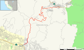
Map of San Bernardino County in southern California with SR 330 highlighted in red | ||||
| Route information | ||||
| Defined by Streets and Highways Code § 603 | ||||
| Maintained by Caltrans | ||||
| Length: | 15.422 mi[1] (24.819 km) | |||
| Existed: | 1972 (from SR 30) – present | |||
| Major junctions | ||||
| South end: |
| |||
| North end: |
| |||
| Location | ||||
| Counties: | San Bernardino | |||
| Highway system | ||||
| ||||

State Route 330 (SR 330) is a state highway in the U.S. state of California. It is also known as City Creek Road in the San Bernardino Mountains.
Route description
This route is part of the California Freeway and Expressway System[2] and is eligible for the State Scenic Highway System.[3]
At its southern terminus, it begins in San Bernardino, California at State Route 210. It is a freeway for approximately a mile, then turns into a conventional two-lane highway. It runs northeasterly from the San Bernardino Valley into the mountains to Running Springs, California, where it ends at State Route 18. The entire routing is in San Bernardino County.
This road consists of approximately 15 miles (24 km) of 6 percent grade road, and is one of three roads from the San Bernardino Valley to the resorts of the San Bernardino National Forest. It alternates between long straight stretches and curved sections. There are three passing lanes, at the 2200 foot (670 m) level, the 4000 foot (1200 m) level, and the 5600 foot (1700 m) level.
History
This highway was originally a part of Legislative Route 207, defined in 1937. It was signed as State Route 30 until 1972, when State Route 30 was redefined to continue south along former State Route 106 rather than continue northeasterly along 330.[4]
Not including Interstate and U.S. highways, State Route 330 was one of only three routes in California which is numbered based on the number of a current or former parent route (the others being State Route 299 and State Route 371). This relationship was lost once the remaining portions of former State Route 30 were signed as Route 210.
In December 2010, a part of State Route 330 was washed out, forcing the closure of the entire route for several months.[5] Access to the route was restricted to local residents only. It was reopened in May 2011. Its closure was cited as a reason for why attendance at ski resorts was down for the year, as Route 330 links to the ski resorts.[6]
Major intersections
Except where prefixed with a letter, postmiles were measured on the road as it was in 1964, based on the alignment of Route 30 as it existed at that time, and do not necessarily reflect current mileage. R reflects a realignment in the route since then, M indicates a second realignment, L refers an overlap due to a correction or change, and T indicates postmiles classified as temporary (for a full list of prefixes, see the list of postmile definitions).[1] Segments that remain unconstructed or have been relinquished to local control may be omitted. The entire route is in San Bernardino County.
| Location | Postmile [1][7][8] | Destinations | Notes | ||
|---|---|---|---|---|---|
| San Bernardino | R28.70 | Southbound exit and northbound entrance; former SR 30 | |||
| R29.60 | Highland Avenue | ||||
| North end of freeway | |||||
| Running Springs | 43.89 | Running Springs | Interchange; no access to SR 330 | ||
| 44.12 | |||||
| 1.000 mi = 1.609 km; 1.000 km = 0.621 mi | |||||
References
- 1 2 3 California Department of Transportation. "State Truck Route List". Sacramento: California Department of Transportation. Archived from the original (XLS file) on June 30, 2015. Retrieved June 30, 2015.
- ↑ CA Codes (shc:250-257)
- ↑ CA Codes (shc:260-284)
- ↑ California Highways: State Route 330
- ↑ "Part of Route 330 shut after road falls away". ABC. 2010-12-28. Retrieved 2011-02-16.
- ↑ Martin, Hugo (2011-05-20). "California ski resorts had an unusual problem this season — too much snow". L.A Times.
- ↑ California Department of Transportation, Log of Bridges on State Highways, July 2007
- ↑ California Department of Transportation, All Traffic Volumes on CSHS, 2005 and 2006
External links
| Wikimedia Commons has media related to California State Route 330. |
- California @ AARoads.com - State Route 330
- Caltrans: Route 330 highway conditions
- California Highways: SR 330