Cagles Mill Lake
| Cagles Mill Lake | |
|---|---|
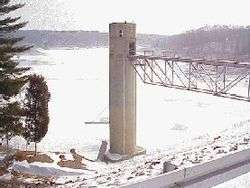 Cagles Mill Lake as seen from dam. U.S. Army Corps of Engineers photo. | |
| Location | Owen / Putnam counties, Indiana, United States |
| Coordinates | 39°29′N 86°55′W / 39.483°N 86.917°WCoordinates: 39°29′N 86°55′W / 39.483°N 86.917°W |
| Type | reservoir |
| Primary inflows | Mill Creek |
| Primary outflows | Mill Creek |
| Basin countries | United States |
| Surface elevation | 636 feet (194 m)[1] |
Cagles Mill Lake, also known as Cataract Lake, is a reservoir located near Cataract, Indiana in Lieber State Recreation Area, in west central Indiana on the borders of Putnam and Owen counties. Mill Creek flows into from the north and drains out through to the Eel River to its south, which then makes its way to the White River. Indiana State Road 42 once went through where Cataract Lake is now and currently has a new, entirely different route on the upper area from its original route.
Located on the lake are the state's largest waterfalls, the Cataract Falls, and a main attraction to tourists on the lake is a bald eagle's nest, where the birds return every season.
Cagles Mill Dam is a flood control project of the United States Army Corps of Engineers, an earthen dam completed in 1953. It impounds a maximum capacity of 228,120 acre-feet, and normal storage of 27,112 acre-feet.[2]
References
External links
- Indiana Department of Natural Resources: Cagles Mill Lake State Reservoir - official site
- National Weather Service hydrographic information
- U.S. Army Corps of Engineers: Cagles Mill Lake