Caballo, New Mexico
| Caballo, New Mexico | |
|---|---|
| Census-designated place | |
 Caballo, New Mexico | |
| Coordinates: 32°58′32″N 107°18′28″W / 32.97556°N 107.30778°WCoordinates: 32°58′32″N 107°18′28″W / 32.97556°N 107.30778°W | |
| Country | United States |
| State | New Mexico |
| County | Sierra |
| Area[1] | |
| • Total | 0.979 sq mi (2.54 km2) |
| • Land | 0.979 sq mi (2.54 km2) |
| • Water | 0 sq mi (0 km2) |
| Elevation | 4,252 ft (1,296 m) |
| Population (2010)[1] | |
| • Total | 112 |
| • Density | 110/sq mi (44/km2) |
| Time zone | Mountain (MST) (UTC-7) |
| • Summer (DST) | MDT (UTC-6) |
| ZIP code | 87931 |
| Area code(s) | 575 |
| GNIS feature ID | 898738[2] |
Caballo is a census-designated place in Sierra County, New Mexico, United States. Its population was 112 as of the 2010 census.[1] Caballo has a post office with ZIP code 87931.[3][4] The community is located along New Mexico State Road 187 north of Exit 63 of Interstate 25.
Geography
Caballo is located at 32°58′50″N 107°18′27″W / 32.980625°N 107.307469°W. According to the U.S. Census Bureau, the community has an area of 0.979 square miles (2.54 km2), all of it land.[1]
References
- 1 2 3 4 "2010 Census Gazetteer Files - Places: New Mexico". U.S. Census Bureau. Retrieved August 21, 2014.
- ↑ "Caballo". Geographic Names Information System. United States Geological Survey.
- ↑ "Postmaster Finder - Post Offices by ZIP Code". United States Postal Service. Retrieved August 21, 2014.
- ↑ United States Postal Service. "USPS - Look Up a ZIP Code". Retrieved August 21, 2014.
Municipalities and communities of Sierra County, New Mexico, United States | ||
|---|---|---|
| Cities | 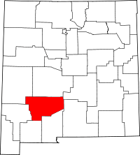 | |
| Villages | ||
| CDPs | ||
| Other communities | ||
| Ghost towns | ||
This article is issued from Wikipedia - version of the 8/22/2014. The text is available under the Creative Commons Attribution/Share Alike but additional terms may apply for the media files.