Bykle
| Bykle kommune | |||
|---|---|---|---|
| Municipality | |||
| |||
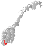
 Bykle within Aust-Agder | |||
| Coordinates: 59°26′35″N 7°15′18″E / 59.44306°N 7.25500°ECoordinates: 59°26′35″N 7°15′18″E / 59.44306°N 7.25500°E | |||
| Country | Norway | ||
| County | Aust-Agder | ||
| District | Setesdal | ||
| Administrative centre | Bykle | ||
| Government | |||
| • Mayor (2011) | Jon Rolf Næss (AP) | ||
| Area | |||
| • Total | 1,467.27 km2 (566.52 sq mi) | ||
| • Land | 1,265.40 km2 (488.57 sq mi) | ||
| • Water | 201.87 km2 (77.94 sq mi) | ||
| Area rank | 55 in Norway | ||
| Population (2010) | |||
| • Total | 970 | ||
| • Rank | 410 in Norway | ||
| • Density | 1.3/km2 (3/sq mi) | ||
| • Change (10 years) | 11.8 % | ||
| Demonym(s) |
Byklar (N) Bykler (B)[1] | ||
| Time zone | CET (UTC+1) | ||
| • Summer (DST) | CEST (UTC+2) | ||
| ISO 3166 code | NO-0941 | ||
| Official language form | Nynorsk | ||
| Website |
www | ||
|
| |||

Bykle is a municipality in Aust-Agder county, Norway. It is located in the traditional region of Setesdal. The administrative center is the village of Bykle in the southern part of the municipality. Another village nearby is Nordbygdi. Bykle was established when it was separated from the municipality of Valle on 1 January 1902.
General information
The municipality of Bykle was created when it was separated from the older municipality of Valle on 1 January 1902 after a dispute over the costs of road building (Bykle was the bigger area, while Valle had more people and more money).[2] At that time, Bykle had a population of 476 residents in the new municipality.[3]
Name
The municipality (originally the parish) is named after the old Bykle farm (Old Norse: Byklar), since the first church was built there. The farm is named after Lake Bykil, but the meaning of that name is unknown.[4]
Coat-of-arms
The coat-of-arms is from modern times. They were granted on 4 April 1986. The arms show 11 silver water droplets as a symbol for the water and rivers in the municipality, as well as for the hydropower plant which was founded in 1915. The plant has brought prosperity to the area since then. The green color of the background symbolizes agriculture.[5]
Geography
Bykle is bordered in the north by Vinje municipality, in the east by Tokke both in Telemark county. It is bordered in the south by Valle in Aust-Agder county and also bordered by Sirdal in Vest-Agder county. It is bordered in the southwest by Forsand and in the west by Hjelmeland and Suldal--all in Rogaland county.
There are many lakes that are located within the municipality, including Blåsjø, Botsvatn, Hartevatnet, Holmavatnet, Holmevatnet, Ormsavatnet, Reinevatn, Skyvatn, Store Urevatn, Svartevatnet, and Vatndalsvatnet.
The Setesdalsheiene mountain range runs through the municipality, including the tallest mountain in that range, Sæbyggjenuten at 1,507 metres (4,944 ft). The Byklestigen pass is a torturous trail up a steep cliff face. Until the 1870s, it was the only route to reach Bykle from the middle Setesdal valley to the south. It runs above the river Otra and was the site of numerous accidents on the hazardous route.
Economy
Bykle has several hydroelectric power generation facilities. The second-largest sector of income for Bykle, is Hovden alpine skiing facility. Due to its vast amount of hydroelectric power, Bykle is the wealthiest of the Setesdal municipalities.
Politics
Bykle is ruled by a labour-dominated local council. It has been controlled by one mayor, Kai Jeiskelid for the last 26 years, yet in September 2011, a new mayor was elected. Due to a law implemented for 50 years ago, by the Labour Party, obligation of residence is required in this municipality.
History
At Storhedder north of the lake Storheddervatnet prehistoric runic inscriptions dating over 1000 years old can be found.
The Hovden area was interconnected more with the districts to the west of the mountains than communities down the Setesdal valley. The main mountain plateau trade route led west to Suldal municipality in Rogaland. The Byklestigen pass was the line of divisions between dialects; in Valle to the south the classic Setesdal tongue was spoken while in Bykle the dialect includes a significant mixture from Telemark.
Falcons were trapped in the heights above Bykle. From as early as 1203 and as late as 1780 there are reports of English and Dutch trapping of falcons at Breivik in Bykle. One byproduct of the numerous Dutch visits in the 1560s was the discovery that the natives had no natural resistance to syphilis; a state physician had to be dispatched there to stem the disease.
Attractions
- Bykle church, built in 1619, is found in Bykle center. It stands on the site of an older stave church
- Open air museums at Huldreheimen and Lislestog.
- Hovden ski resort is found in the north.
- Viking Age bog iron museum, which recognizes the industry in the area over 1000 years ago, located at Hovden
- Prehistoric runic inscriptions at Storhedder
References
- ↑ "Navn på steder og personer: Innbyggjarnamn" (in Norwegian). Språkrådet. Retrieved 2015-12-01.
- ↑ Stagg, Frank Noel (1958). South Norway. George Allen & Unwin, Ltd.
- ↑ Jukvam, Dag (1999). "Historisk oversikt over endringer i kommune- og fylkesinndelingen" (PDF) (in Norwegian). Statistisk sentralbyrå.
- ↑ Rygh, Oluf (1905). Norske gaardnavne: Nedenes amt (in Norwegian) (8 ed.). Kristiania, Norge: W. C. Fabritius & sønners bogtrikkeri. pp. 211 & 213.
- ↑ Norske Kommunevåpen (1990). "Nye kommunevåbener i Norden". Retrieved 3 October 2008.
External links
| Wikimedia Commons has media related to Bykle. |
| Look up Bykle in Wiktionary, the free dictionary. |
- Municipal fact sheet from Statistics Norway
 Aust-Agder travel guide from Wikivoyage
- Municipal website (Norwegian)
- Culture in Bykle on the map (Norwegian)