Butterfield, Texas
| Butterfield, Texas | |
|---|---|
| Census-designated place | |
 | |
| Coordinates: 31°50′3″N 106°5′34″W / 31.83417°N 106.09278°WCoordinates: 31°50′3″N 106°5′34″W / 31.83417°N 106.09278°W | |
| Country | United States |
| State | Texas |
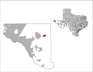
| County | El Paso |
| Area | |
| • Total | 3.2 sq mi (8.2 km2) |
| • Land | 3.2 sq mi (8.2 km2) |
| • Water | 0.0 sq mi (0.0 km2) |
| Elevation | 4,219 ft (1,286 m) |
| Population (2010) | |
| • Total | 114 |
| • Density | 36/sq mi (14/km2) |
| Time zone | Mountain (MST) (UTC-7) |
| • Summer (DST) | MDT (UTC-6) |
| ZIP Code | 79938 |
| FIPS code | 48-11626[1] |
| GNIS feature ID | 1852689[2] |
Butterfield is a census-designated place (CDP) in El Paso County, Texas, United States. The population was 114 at the 2010 census.[3] It is part of the El Paso Metropolitan Statistical Area. The ZIP Code encompassing the CDP area is 79938.[4]
Geography
Butterfield is located at 31°50′3″N 106°5′34″W / 31.83417°N 106.09278°W (31.834236, -106.092697).[5]
According to the United States Census Bureau, the CDP has a total area of 3.2 square miles (8.3 km2), all land.
Demographics
As of the census[1] of 2000, there were 61 people, 18 households, and 14 families residing in the CDP. The population density was 19.3 people per square mile (7.5/km²). There were 21 housing units at an average density of 6.6/sq mi (2.6/km²). The racial makeup of the CDP was 85.25% White, 6.56% from other races, and 8.20% from two or more races. Hispanic or Latino of any race were 81.97% of the population.
There were 18 households out of which 50.0% had children under the age of 18 living with them, 55.6% were married couples living together, 22.2% had a female householder with no husband present, and 16.7% were non-families. 16.7% of all households were made up of individuals and 5.6% had someone living alone who was 65 years of age or older. The average household size was 3.39 and the average family size was 3.73.
In the CDP the population was spread out with 32.8% under the age of 18, 11.5% from 18 to 24, 31.1% from 25 to 44, 21.3% from 45 to 64, and 3.3% who were 65 years of age or older. The median age was 30 years. For every 100 females there were 103.3 males. For every 100 females age 18 and over, there were 78.3 males.
The median income for a household in the CDP was $8,750, and the median income for a family was $8,750. Males had a median income of $0 versus $6,250 for females. The per capita income for the CDP was $4,526. There were 100.0% of families and 100.0% of the population living below the poverty line, including none under 18 and none of those over 64.
Education
Butterfield is served by the Clint Independent School District.
References
- 1 2 "American FactFinder". United States Census Bureau. Archived from the original on 2013-09-11. Retrieved 2008-01-31.
- ↑ "US Board on Geographic Names". United States Geological Survey. 2007-10-25. Retrieved 2008-01-31.
- ↑ "Geographic Identifiers: 2010 Demographic Profile Data (G001): Butterfield CDP, Texas". U.S. Census Bureau, American Factfinder. Retrieved January 11, 2013.
- ↑ Zip Codes for Butterfield, El Paso County, Texas. Retrieved 2013-12-27.
- ↑ "US Gazetteer files: 2010, 2000, and 1990". United States Census Bureau. 2011-02-12. Retrieved 2011-04-23.
Municipalities and communities of El Paso County, Texas, United States | ||
|---|---|---|
| Cities | 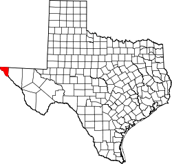 | |
| Towns | ||
| Village | ||
| CDPs | ||
| Unincorporated communities | ||