Burwood East, Victoria
| Burwood East Melbourne, Victoria | |||||||||||||
|---|---|---|---|---|---|---|---|---|---|---|---|---|---|
 Burwood East | |||||||||||||
| Coordinates | 37°51′07″S 145°09′00″E / 37.852°S 145.15°ECoordinates: 37°51′07″S 145°09′00″E / 37.852°S 145.15°E | ||||||||||||
| Population | 10,141 (2011)[1] | ||||||||||||
| • Density | 2,358/km2 (6,110/sq mi) | ||||||||||||
| Postcode(s) | 3151 | ||||||||||||
| Area | 4.3 km2 (1.7 sq mi) | ||||||||||||
| Location | 17 km (11 mi) from Melbourne | ||||||||||||
| LGA(s) | City of Whitehorse | ||||||||||||
| State electorate(s) | Forest Hill | ||||||||||||
| Federal Division(s) | Chisholm | ||||||||||||
| |||||||||||||
Burwood East is a suburb of Melbourne, Victoria, Australia, located 17 km east of Melbourne's Central Business District.[2] Its local government area is the City of Whitehorse. At the 2011 Census, Burwood East had a population of 10,141.
Burwood East is bounded by Springvale Road to the east, Middleborough Road to the west, Eley Road and Hawthorn Road to the north and Highbury Road to the south.
History
The Wurundjeri Aboriginal clan, one of four Koorie clans that inhabited the Port Phillip region, were the original occupants of the area now occupied by East Burwood. To the east of present-day Middleborough Road, much of the land was initially not very attractive to European squatters for settlement and parts were mostly covered with open forests, consisting of Red Stringybark, Red Box, Long Leaf Box, Candlebark and Manna Gum.[3] Highbury Park contains some of the few remaining stands of remnant vegetation, including the locally uncommon Shiny Wallaby-grass (Austrodanthonia induta).[4]
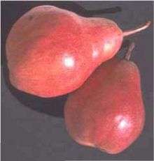
By the mid 19th century, East Burwood and the surrounding districts were under cultivation and local horticulturists were supplying Melbourne's markets, including the Victoria Markets, with cut flowers and produce. Jonquils and Daffodils were harvested in the area well into the 1950s. Apple, cherry and pear groves covered the hill slopes for close to a century. Local orchardist Walter Mock developed the Red Williams’ pear variety in East Burwood during the 1930s.[5] The 'Reds' found favour and the variety was exported to Europe and North America.[6] However little more than thirty years later, the last of the orchards located in East Burwood had been ripped up or relocated in one case, to Bacchus Marsh.[7][8]
Commercial activity
Burwood East is notable as the site of the first Kmart department store in Australia.[9] The Kmart Plaza store[10] opened in 1969, at the intersection of Burwood Road (now Highway) and Blackburn Road. It was the first 24-hour Kmart store and proved very popular with locals, frustrated with the limited shopping hours on offer at the time. Burwood East Kmart is the second largest in Australia, with a gross leasable area of 8,444 m2 (90,890 sq ft).[11]
The Tally Ho Business Park, on the corner of Burwood Highway and Springvale Road, hosts the headquarters of many corporations and organisations, including the Country Fire Authority and a regional headquarters of VicRoads and Yokogawa. The site of the Tally Ho Business Park and its surrounds was previously occupied by the Tally Ho Boys' Home, which was established on land provided at a reduced price to the Methodist Church by Abel Hoadley, the inventor of the Violet Crumble chocolate bar. The Violet Crumble was supposedly manufactured in a Cottage where the ABC now stands.
On the north side of Burwood Highway, there are additional business buildings including a HP building, expanding the business park beyond the boundary of the original Tally Ho Boys' Home.
Vision Drive (located adjacent to the Tally Ho Business Park) is the current location of World Vision Australia's National Office, The GPT Group and the National Archives of Australia (Melbourne Repository).
Transport
Burwood East is serviced by public transport:
- 703 Middle Brighton – Blackburn via Bentleigh Station, Clayton, Monash University, Syndal Station (every day). Operated by Ventura Bus Lines.
- 732 Box Hill – Upper Ferntree Gully via Vermont South, Westfield Knox (every day). Operated by Ventura Bus Lines.
- 735 Box Hill – Nunawading via Forest Hill Chase (every day). Operated by Ventura Bus Lines.
- 736 Mitcham – Blackburn via Vermont South, Glen Waverley Station, Forest Hill Chase (every day). Operated by Ventura Bus Lines.
Burwood Highway is part of Melbourne's Tram Network. Tram Route 75 originally terminated at the intersection of Blackburn Road and Burwood Highway until July 2005, with the completion of the 3 km line extension to Hartland Road in Vermont South. Also, with the introduction of the new myki ticketing system, the tram zone boundaries have also been extended. This is good news for Route 75 passengers travelling across Zone 1+2, as they now only need to pay Zone 1 fares.
Sport
Burwood East is home to the Nunawading Basketball Centre, Nunawading Velodrome, East Burwood/Bennettswood Cricket Club and East Burwood Football Club, on Burwood Highway.
Football has been played in Burwood East since 1915 and local fruit and flower growers produced an abundance of footballers. The club has built a family tradition and families names such as Fankhauser, Tainton and Mullens.[12] Today the club competes in the Eastern Football League.[13]
Education
Schools in the suburb include:
- A part of Burwood East is in the Mount Waverley Secondary College School Zone.
- Forest Hill College
- Burwood East Primary School
- Burwood Heights Primary School
- Blackburn English Language School
- Burwood East Special Developmental School
Local churches
- Burwood Heights Uniting Church
- Anglican Church of the Ascension
- Crossway
Current and future developments
The State Government has declared the Burwood Heights area as a 'Major Activity Centre' because of the easy access to public transport, current uses and the potential for significant development. In March 2008 Whitehorse Council approved a development plan that will see housing for up to 1000 residents at the old brickworks site in East Burwood.[14]
The development will comprise over 25,000sqm of retail floorspace, multiscreen cinemas, up to 700 dwelings, leisure and entertainment and community facilities, all based around "main street" retail/entertainment precinct and urban plaza. The project is scheduled for completion in 2015. Details of the Burwood Heights Activity Center Project are listed . However, the progress of the project is stalled or very slow.
Kmart Plaza has also undergo a facelift, with renovations scheduled to start early 2010. The owners of the Kmart Plaza, also known as the East Burwood Plaza, will double the size of the complex, on the corner of Burwood Highway and Blackburn Road, from 15,000 square meters to 30,000 square metres.[11] The new leasing floor plan can be viewed here.
Pomeroy Pacific development manager Paul Chiodo said the $35 million extension will add about 30 specialty shops, a 5,500 square metre Coles Supermarket, a 333-seat restaurant, gymnasium and a First Choice bottle shop. The extension will be built over an existing car park, on the western side of the 6.3 hectare site.
German discount supermarket chain Aldi has leased the 2,981 square meter supermarket space currently occupied by Coles. Kmart, which occupies about 8,444 square metres of space and trades 24-hours a day, will not relocate. Construction work is currently underway, with stage 1 completed in 2011 and the centre is named to be 'Burwood One' .
RSPCA (Royal Society for the Prevention of Cruelty to Animals) Burwood East is the largest RSPCA animal shelter in Victoria and features an animal adoption centre, animal shelter, veterinary clinic, animal behaviour training, grooming and education centre. Animal ambulance services also operate out of the Burwood East location. The site is undergoing a substantial re-development, scheduled for completion is mid-2013.
See also
- City of Nunawading - the former local government area of which Burwood East was a part
References
- ↑ Australian Bureau of Statistics (31 October 2012). "Burwood East (State Suburb)". 2011 Census QuickStats. Retrieved 23 August 2012.
- ↑ http://www.postcodes-australia.com/areas/vic/hawthorn/burwood+east
- ↑ Presland G, (2007)The Whitehorse Calendar: Celebrating 150 Years of Local Government in Whitehorse, City of Whitehouse
- ↑ Sinclair S, Volume 123 (2) 2006, The Victorian Naturalist, The Field Naturalists Club of Victoria Inc.
- ↑ Campbell Dr J, European Pear Varieties, Agfact H4.1.13, Second Edition, October 2002, NSW Agriculture
- ↑ Information on William (Red) Archived 19 July 2011 at the Wayback Machine.
- ↑ In the 1950s the Payne Family relocated 300 mature apple trees from East Burwood to Bacchus Marsh.Paynes Orchards
- ↑ Wantirna History Archived 12 September 2009 at the Wayback Machine.
- ↑ http://www.fundinguniverse.com/company-histories/Coles-Myer-Ltd-Company-History.html
- ↑ Also known as Burwood Plaza, it is listed as Kmart Plaza in the Melways Street Directory
- 1 2 http://www.realestatesource.com.au/australias-first-k-mart-centre-to-double-in-size.html
- ↑ History of East Burwood Football ClubClub History Archived 22 May 2009 at the Wayback Machine.,
- ↑ Full Point Footy, Eastern Football League, retrieved 21 October 2008
- ↑ According to Melbourne 2030 Activity Centre program, the Burwood Square project "Archived copy". Archived from the original on 20 July 2008. Retrieved 2009-01-30.