Burgess, South Carolina
| Burgess, South Carolina | |
|---|---|
| Unincorporated Community | |
| Nickname(s): Burgess Community | |
| Country | United States |
| State | South Carolina |
| County | Horry |
| Time zone | Eastern |
| Area code(s) | 843 |
Burgess is an unincorporated community in Horry County, South Carolina, United States, along South Carolina Highway 707 at latitude 33.607 and longitude -79.056 and appears on the Brookgreen Gardens U.S. Geological Survey Map. [1] Burgess is located between Socastee and Murrells Inlet and just west of Surfside Beach and Garden City
History
Burgess has a big population jump due to the new subdivisions and neighborhoods such as TPC, Blackmoor and Laurel Woods. Burgess also has a community center called Burgess Community Center located on South Carolina Highway 707 near Mt. Zion Church and St. James Middle School and just down the street from St. James High School. During the late 1890s Burgess was an African American farming community.
Major Roads/Highways
- South Carolina Highway 707
- South Carolina Highway 31 (under construction)
- Holmestown Road
Schools
- St. James High School
- St. James Middle School
- St. James Elementary School
- Burgess Elementary School
References
- ↑ "Burgess Populated Place Profile". SC HomeTownLocator. Retrieved 3 February 2014.
External links
Municipalities and communities of Horry County, South Carolina, United States | ||
|---|---|---|
| Cities | 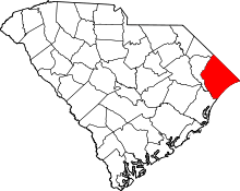 | |
| Towns | ||
| CDPs | ||
| Unincorporated communities | ||
Coordinates: 33°36′24″N 79°03′20″W / 33.60667°N 79.05556°W