Bunnik
| Bunnik | |||
|---|---|---|---|
| Municipality | |||
|
Church in Bunnik | |||
| |||
.svg.png) Location in Utrecht | |||
| Coordinates: 52°3′N 5°14′E / 52.050°N 5.233°ECoordinates: 52°3′N 5°14′E / 52.050°N 5.233°E | |||
| Country | Netherlands | ||
| Province | Utrecht | ||
| Government[1] | |||
| • Body | Municipal council | ||
| • Mayor | Hans Ostendorp (CDA) | ||
| Area[2] | |||
| • Total | 37.57 km2 (14.51 sq mi) | ||
| • Land | 36.95 km2 (14.27 sq mi) | ||
| • Water | 0.62 km2 (0.24 sq mi) | ||
| Elevation[3] | 3 m (10 ft) | ||
| Population (May 2014)[4] | |||
| • Total | 14,591 | ||
| • Density | 395/km2 (1,020/sq mi) | ||
| Demonym(s) | Bunniker | ||
| Time zone | CET (UTC+1) | ||
| • Summer (DST) | CEST (UTC+2) | ||
| Postcode | 3980–3985 | ||
| Area code | 030 | ||
| Website |
www | ||


Bunnik (![]() pronunciation ) is a municipality and a village in the Netherlands, in the province of Utrecht. The recorded history of the village dates back nearly 2000 years, when the Romans constructed a fort at Fectio (now Vechten) with a harbour facing the river Rhine, which marked the border of the Roman Empire. The fort developed into a thriving trading centre, which continued to exist after the Romans abandoned the fort in the fourth century. Subsequently, the area was occupied by the Frisians and the Franks. In the 8th and 9th century the villages of Bunninchem (Bunnik), Lodichem (Odijk) en Wercundia (Werkhoven) developed.
pronunciation ) is a municipality and a village in the Netherlands, in the province of Utrecht. The recorded history of the village dates back nearly 2000 years, when the Romans constructed a fort at Fectio (now Vechten) with a harbour facing the river Rhine, which marked the border of the Roman Empire. The fort developed into a thriving trading centre, which continued to exist after the Romans abandoned the fort in the fourth century. Subsequently, the area was occupied by the Frisians and the Franks. In the 8th and 9th century the villages of Bunninchem (Bunnik), Lodichem (Odijk) en Wercundia (Werkhoven) developed.
Chief interests of Bunnik are its surrounding nature, consisting mainly of forests and farmlands. Additionally, Bunnik, hosts the oldest Youth Hostel in the Netherlands. The major European construction and services company Royal BAM Group has its headquarters in Bunnik.
Population centres
The municipality of Bunnik consists of the following cities, towns, villages and/or districts: Bunnik, Odijk, Werkhoven.
Topography
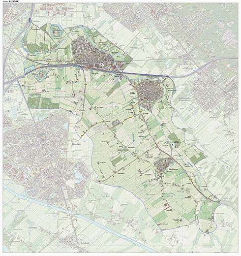
Dutch Topographic map of the municipality of Bunnik, June 2015.
Transportation
References
- ↑ "Burgermeester" [Mayor] (in Dutch). Gemeente Bunnik. Retrieved 4 April 2014.
- ↑ "Kerncijfers wijken en buurten" [Key figures for neighbourhoods]. CBS Statline (in Dutch). CBS. 2 July 2013. Retrieved 12 March 2014.
- ↑ "Postcodetool for 3984NC". Actueel Hoogtebestand Nederland (in Dutch). Het Waterschapshuis. Retrieved 4 April 2014.
- ↑ "Bevolkingsontwikkeling; regio per maand" [Population growth; regions per month]. CBS Statline (in Dutch). CBS. 26 June 2014. Retrieved 24 July 2014.
External links
 Media related to Bunnik at Wikimedia Commons
- Official website
 |
Utrecht | Zeist | | |
| |
Utrechtse Heuvelrug | |||
| ||||
| | ||||
| Houten | |
Wijk bij Duurstede |
Municipalities of Utrecht | ||
|---|---|---|
 | ||
| ||