Buellton, California
| Buellton | |
|---|---|
| City | |
|
Buellton, as seen from near Gaviota Peak in the Santa Ynez Mountains | |
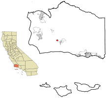 Location in Santa Barbara County and the state of California | |
 Buellton Location in the United States | |
| Coordinates: 34°36′51″N 120°11′38″W / 34.61417°N 120.19389°WCoordinates: 34°36′51″N 120°11′38″W / 34.61417°N 120.19389°W | |
| Country |
|
| State |
|
| County | Santa Barbara |
| Incorporated | February 1, 1992[1] |
| Government | |
| • State senator | Hannah-Beth Jackson (D)[2] |
| • Assemblymember | Monique Limón (D)[2] |
| • U. S. rep. | Lois Capps (D)[3] |
| Area[4] | |
| • Total | 1.583 sq mi (4.099 km2) |
| • Land | 1.582 sq mi (4.098 km2) |
| • Water | 0.001 sq mi (0.002 km2) 0.04% |
| Elevation[5] | 358 ft (109 m) |
| Population (2010) | |
| • Total | 4,828 |
| • Density | 3,000/sq mi (1,200/km2) |
| Time zone | PST (UTC-8) |
| • Summer (DST) | PDT (UTC-7) |
| ZIP code | 93427 |
| Area code(s) | 805 |
| FIPS code | 06-08758 |
| GNIS feature ID | 1667902 |
| Website |
www |


Buellton is a small city in Santa Barbara County, California, United States. The city of Buellton is one of the communities that make up the Santa Ynez Valley. The population was 4,828 at the 2010 census.
Geography
Buellton is located at 34°36′51″N 120°11′38″W / 34.61417°N 120.19389°W (34.614136, -120.193798).[6] at an elevation of 358 ft (109 m).
According to the United States Census Bureau, the city has a total area of 1.6 square miles (4.1 km2), 99.96% of it land and 0.04% of it water.
Buellton is on the Santa Ynez River in the Santa Ynez Valley, and in 2004 was one of the fastest-growing towns in central Santa Barbara County. It is a common stop for travelers on U.S. Highway 101, being the first town north of Santa Barbara after the scenic and undeveloped stretch of about 25 miles (40 km) through the Gaviota coast.
Demographics
| Historical population | |||
|---|---|---|---|
| Census | Pop. | %± | |
| 1970 | 1,402 | — | |
| 1980 | 2,364 | 68.6% | |
| 1990 | 3,506 | 48.3% | |
| 2000 | 3,828 | 9.2% | |
| 2010 | 4,828 | 26.1% | |
| Est. 2015 | 5,082 | [7] | 5.3% |
2010
The 2010 United States Census[9] reported that Buellton had a population of 4,828. The population density was 3,050.3 people per square mile (1,177.7/km²). The racial makeup of Buellton was 3,912 (81.0%) White, 37 (0.8%) African American, 76 (1.6%) Native American, 137 (2.8%) Asian, 5 (0.1%) Pacific Islander, 424 (8.8%) from other races, and 237 (4.9%) from two or more races. Hispanic or Latino of any race were 1,451 persons (30.1%).
The Census reported that 4,828 people (100% of the population) lived in households, 0 (0%) lived in non-institutionalized group quarters, and 0 (0%) were institutionalized.
There were 1,761 households, out of which 667 (37.9%) had children under the age of 18 living in them, 1,008 (57.2%) were opposite-sex married couples living together, 168 (9.5%) had a female householder with no husband present, 81 (4.6%) had a male householder with no wife present. There were 93 (5.3%) unmarried opposite-sex partnerships, and 10 (0.6%) same-sex married couples or partnerships. 385 households (21.9%) were made up of individuals and 189 (10.7%) had someone living alone who was 65 years of age or older. The average household size was 2.74. There were 1,257 families (71.4% of all households); the average family size was 3.23.
The population was spread out with 1,228 people (25.4%) under the age of 18, 391 people (8.1%) aged 18 to 24, 1,229 people (25.5%) aged 25 to 44, 1,343 people (27.8%) aged 45 to 64, and 637 people (13.2%) who were 65 years of age or older. The median age was 39.1 years. For every 100 females there were 95.5 males. For every 100 females age 18 and over, there were 94.2 males.
There were 1,845 housing units at an average density of 1,165.7 per square mile (450.1/km²), of which 1,226 (69.6%) were owner-occupied, and 535 (30.4%) were occupied by renters. The homeowner vacancy rate was 2.5%; the rental vacancy rate was 4.4%. 3,262 people (67.6% of the population) lived in owner-occupied housing units and 1,566 people (32.4%) lived in rental housing units.
2000
As of the census[10] of 2000, there were 3,828 people, 1,433 households, and 1,000 families residing in the city. The population density was 2,450.4 people per square mile (947.4/km²). There were 1,483 housing units at an average density of 949.3 per square mile (367.0/km²). The racial makeup of the city was 81.50% White, 0.55% African American, 1.15% Native American, 1.10% Asian, 0.21% Pacific Islander, 12.23% from other races, and 3.27% from two or more races. Hispanic or Latino of any race were 25.73% of the population.
There were 1,433 households out of which 34.7% had children under the age of 18 living with them, 58.2% were married couples living together, 8.0% had a female householder with no husband present, and 30.2% were non-families. 23.9% of all households were made up of individuals and 10.7% had someone living alone who was 65 years of age or older. The average household size was 2.67 and the average family size was 3.17.
In the city the population was spread out with 27.1% under the age of 18, 6.7% from 18 to 24, 29.6% from 25 to 44, 23.0% from 45 to 64, and 13.6% who were 65 years of age or older. The median age was 38 years. For every 100 females there were 98.5 males. For every 100 females age 18 and over, there were 94.7 males.
The median income for a household in the city was $48,490, and the median income for a family was $54,839. Males had a median income of $46,379 versus $28,542 for females. The per capita income for the city was $20,907. About 6.6% of families and 8.8% of the population were below the poverty line, including 10.2% of those under age 18 and 7.3% of those age 65 or over.
History
Buellton is named for R.T. Buell who owned the Rancho San Carlos de Jonata Mexican land grant. It is the home of Pea Soup Andersen's, a major roadside stop and landmark on Route 101 since 1924.
Public safety
The Santa Barbara County Sheriff's Office provides police services for Buellton, while the Santa Barbara County Fire Department acts as the local fire service.
Activities
Wineries and Tasting Rooms
|
OstrichLand USA
OstrichLand USA is a small, 33 acre Ostrich and Emu farm located in the Santa Ynez Valley.
References
- ↑ "California Cities by Incorporation Date". California Association of Local Agency Formation Commissions. Archived from the original (Word) on November 3, 2014. Retrieved August 25, 2014.
- 1 2 "Statewide Database". UC Regents. Retrieved November 5, 2014.
- ↑ "California's 24th Congressional District - Representatives & District Map". Civic Impulse, LLC. Retrieved September 29, 2014.
- ↑ "2010 Census U.S. Gazetteer Files – Places – California". United States Census Bureau.
- ↑ "Buellton". Geographic Names Information System. United States Geological Survey. Retrieved November 5, 2014.
- ↑ "US Gazetteer files: 2010, 2000, and 1990". United States Census Bureau. 2011-02-12. Retrieved 2011-04-23.
- ↑ "Annual Estimates of the Resident Population for Incorporated Places: April 1, 2010 to July 1, 2015". Retrieved July 2, 2016.
- ↑ "Census of Population and Housing". Census.gov. Archived from the original on May 11, 2015. Retrieved June 4, 2015.
- ↑ "2010 Census Interactive Population Search: CA - Buellton city". U.S. Census Bureau. Retrieved July 12, 2014.
- ↑ "American FactFinder". United States Census Bureau. Archived from the original on 2013-09-11. Retrieved 2008-01-31.
External links
| Wikimedia Commons has media related to Buellton, California. |
| Wikivoyage has a travel guide for Buellton. |
Municipalities and communities of Santa Barbara County, California, United States | ||
|---|---|---|
| Cities | 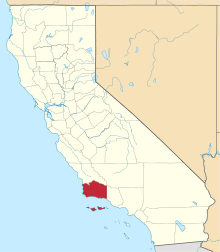 | |
| CDPs | ||
| Unincorporated communities | ||
| Indian reservation | ||
| Ghost towns | ||