Buckley Wells tram stop
| Metrolink | |
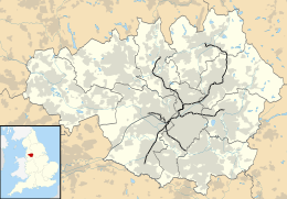 Buckley Wells Location of Buckley Wells in Greater Manchester | |
| Location | |
| Place | Bury |
| Local authority | Bury |
| Coordinates | 53°35′15″N 2°18′05″W / 53.5876°N 2.3015°WCoordinates: 53°35′15″N 2°18′05″W / 53.5876°N 2.3015°W |
| Fare zone information | |
|
| |
Buckley Wells is a proposed tram stop on the Bury Line of Greater Manchester's Metrolink light rail system. It is to be located between Bury Interchange and Radcliffe Metrolink station, in the Buckley Wells area of Bury, north of Fishpool and south of Bury town centre.
The proposed site of Buckley Wells stop, by the A56 road, is owned by Transport for Greater Manchester, was proposed in 2003,[1] offering (in addition to the Metrolink stop and services for southern Bury) a park and ride facility, and opportunity to provide an interchange with the East Lancashire Railway.[2]
References
- ↑ "Metolink Network" (PDF). Archived from the original (PDF) on 16 July 2011.
- ↑ "Disruptions to Metrolink this weekend". Ask Bury. 3 February 2010. Archived from the original on 11 September 2011.
| Preceding station | Following station | |||
|---|---|---|---|---|
| Proposed | ||||
| Radcliffe | Bury Line | Bury | ||
| Bury Lines |
|---|
Legend |
| Tram stops |  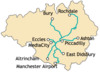 | |||||||||||||||||||||||||||||||
|---|---|---|---|---|---|---|---|---|---|---|---|---|---|---|---|---|---|---|---|---|---|---|---|---|---|---|---|---|---|---|---|---|
| Operations |
| |||||||||||||||||||||||||||||||
| History (Timeline) |
| |||||||||||||||||||||||||||||||
| Proposed stops |
| |||||||||||||||||||||||||||||||
This article is issued from Wikipedia - version of the 9/13/2016. The text is available under the Creative Commons Attribution/Share Alike but additional terms may apply for the media files.