Buchtel, Ohio
| Buchtel, Ohio | |
|---|---|
| Village | |
|
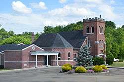
St. Mary of the Hills Church | |
 Location of Buchtel, Ohio | |
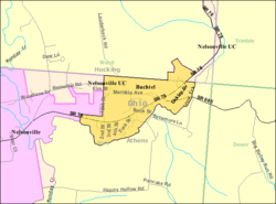 Detailed map of Buchtel | |
| Coordinates: 39°27′41″N 82°10′55″W / 39.46139°N 82.18194°WCoordinates: 39°27′41″N 82°10′55″W / 39.46139°N 82.18194°W | |
| Country | United States |
| State | Ohio |
| Counties | Athens, Hocking |
| Area[1] | |
| • Total | 0.49 sq mi (1.27 km2) |
| • Land | 0.49 sq mi (1.27 km2) |
| • Water | 0 sq mi (0 km2) |
| Elevation[2] | 676 ft (206 m) |
| Population (2010)[3] | |
| • Total | 558 |
| • Estimate (2012[4]) | 552 |
| • Density | 1,138.8/sq mi (439.7/km2) |
| Time zone | Eastern (EST) (UTC-5) |
| • Summer (DST) | EDT (UTC-4) |
| ZIP code | 45716 |
| Area code(s) | 740 |
| FIPS code | 39-09834[5] |
| GNIS feature ID | 1075462[2] |
Buchtel is a village in Athens and Hocking counties in the U.S. state of Ohio, just northeast of Nelsonville. The population was 558 at the 2010 census. A former name for the village is Bessemer.
History
Buchtel was laid out in 1876, and named for John R. Buchtel, a representative of the Akron Iron Company, which owned a large amount of land in the vicinity.[6] A post office called Buchtel has been in operation since 1879.[7]
Geography
Buchtel is located at 39°27′41″N 82°10′55″W / 39.46139°N 82.18194°W (39.461269, -82.182017),[8] along Snow Fork, a tributary of Monday Creek.[9]
According to the United States Census Bureau, the village has a total area of 0.49 square miles (1.27 km2), all land.[1]
Demographics
| Historical population | |||
|---|---|---|---|
| Census | Pop. | %± | |
| 1880 | 417 | — | |
| 1910 | 1,180 | — | |
| 1920 | 1,178 | −0.2% | |
| 1930 | 799 | −32.2% | |
| 1940 | 775 | −3.0% | |
| 1950 | 569 | −26.6% | |
| 1960 | 499 | −12.3% | |
| 1970 | 592 | 18.6% | |
| 1980 | 585 | −1.2% | |
| 1990 | 640 | 9.4% | |
| 2000 | 574 | −10.3% | |
| 2010 | 558 | −2.8% | |
| Est. 2015 | 557 | [10] | −0.2% |
2010 census
As of the census[3] of 2010, there were 558 people, 235 households, and 152 families residing in the village. The population density was 1,138.8 inhabitants per square mile (439.7/km2). There were 266 housing units at an average density of 542.9 per square mile (209.6/km2). The racial makeup of the village was 97.8% White, 1.1% African American, and 1.1% from two or more races. Hispanic or Latino of any race were 1.1% of the population.
There were 235 households of which 28.9% had children under the age of 18 living with them, 47.7% were married couples living together, 12.3% had a female householder with no husband present, 4.7% had a male householder with no wife present, and 35.3% were non-families. 28.5% of all households were made up of individuals and 12.3% had someone living alone who was 65 years of age or older. The average household size was 2.37 and the average family size was 2.84.
The median age in the village was 38 years. 21.9% of residents were under the age of 18; 10.5% were between the ages of 18 and 24; 26.1% were from 25 to 44; 26.7% were from 45 to 64; and 14.7% were 65 years of age or older. The gender makeup of the village was 48.6% male and 51.4% female.
2000 census
As of the census[5] of 2000, there were 574 people, 232 households, and 164 families residing in the village. The population density was 1,194.2 people per square mile (461.7/km²). There were 247 housing units at an average density of 513.9 per square mile (198.7/km²). The racial makeup of the village was 96.86% White, 0.52% African American, 1.22% Native American, 0.17% Asian, 0.35% from other races, and 0.87% from two or more races. Hispanic or Latino of any race were 1.39% of the population.
There were 232 households out of which 31.9% had children under the age of 18 living with them, 54.7% were married couples living together, 11.2% had a female householder with no husband present, and 28.9% were non-families. 25.0% of all households were made up of individuals and 12.5% had someone living alone who was 65 years of age or older. The average household size was 2.47 and the average family size was 2.95.
In the village the population was spread out with 24.7% under the age of 18, 8.0% from 18 to 24, 30.5% from 25 to 44, 24.7% from 45 to 64, and 12.0% who were 65 years of age or older. The median age was 36 years. For every 100 females there were 92.6 males. For every 100 females age 18 and over, there were 94.6 males.
The median income for a household in the village was $27,632, and the median income for a family was $31,607. Males had a median income of $27,159 versus $18,333 for females. The per capita income for the village was $13,324. About 15.5% of families and 20.5% of the population were below the poverty line, including 21.3% of those under age 18 and 13.0% of those age 65 or over.
Public services
The residents of Buchtel are served by the Nelsonville-York City School District and Nelsonville-York High School. Buchtel borders the site of the Nelsonville-York City School District campus, but the school property is located within the Nelsonville City limits.
They are also served by the Athens County Public Library with branches in Albany, Athens, Chauncey, Coolville, Glouster, Nelsonville, and The Plains.
References
- 1 2 "US Gazetteer files 2010". United States Census Bureau. Archived from the original on 2012-07-14. Retrieved 2013-01-06.
- 1 2 "US Board on Geographic Names". United States Geological Survey. 2007-10-25. Retrieved 2008-01-31.
- 1 2 "American FactFinder". United States Census Bureau. Retrieved 2013-01-06.
- ↑ "Population Estimates". United States Census Bureau. Archived from the original on 2013-06-17. Retrieved 2013-06-17.
- 1 2 "American FactFinder". United States Census Bureau. Archived from the original on 2013-09-11. Retrieved 2008-01-31.
- ↑ History of Hocking Valley, Ohio. Inter-State Publishing Co. 1883. p. 407.
- ↑ "Athens County". Jim Forte Postal History. Archived from the original on 14 January 2016. Retrieved 31 December 2015.
- ↑ "US Gazetteer files: 2010, 2000, and 1990". United States Census Bureau. 2011-02-12. Retrieved 2011-04-23.
- ↑ DeLorme (1991). Ohio Atlas & Gazetteer. Yarmouth, Maine: DeLorme. ISBN 0-89933-233-1.
- ↑ "Annual Estimates of the Resident Population for Incorporated Places: April 1, 2010 to July 1, 2015". Retrieved July 2, 2016.
- ↑ "Census of Population and Housing". Census.gov. Archived from the original on May 11, 2015. Retrieved June 4, 2015.
External links
Municipalities and communities of Athens County, Ohio, United States | ||
|---|---|---|
| Cities | 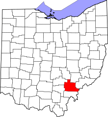 | |
| Villages | ||
| Townships | ||
| CDPs | ||
| Unincorporated communities | ||
| Footnotes | ‡This populated place also has portions in an adjacent county or counties | |
Municipalities and communities of Hocking County, Ohio, United States | ||
|---|---|---|
| City | 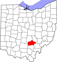 | |
| Villages | ||
| Townships | ||
| CDPs | ||
| Unincorporated communities | ||
| Footnotes | ‡This populated place also has portions in an adjacent county or counties | |