Bridgeport, Utah
| Bridgeport, Utah | |
|---|---|
| Ghost town | |
 Bridge- port  Bridge- port Location of Bridgeport in Utah | |
| Coordinates: 40°54′10″N 109°08′55″W / 40.90278°N 109.14861°WCoordinates: 40°54′10″N 109°08′55″W / 40.90278°N 109.14861°W | |
| Country | United States |
| State | Utah |
| County | Daggett |
| Founded | 1902 |
| Abandoned | 1940 |
| Elevation[1] | 8,779 ft (2,676 m) |
| GNIS feature ID | 1455194[1] |
Bridgeport was the community name given to a small ranching area in far eastern Daggett County, Utah, USA, near the Colorado border. The Bridgeport store, saloon and post office were located on the north side of the Green River near the mouth of Jesse Ewing Canyon, near the western end of Browns Park.
Bridgeport was developed and operated by Charley Crouse, an early Browns Park pioneer; a second store about two miles upstream was operated by John Jarvie. No trace of the Crouse buildings remains today, but the Jarvie store and farmstead is now listed on the National Register of Historic Places, and is maintained as an interpretive site by the Bureau of Land Management.[2]
The United States post office at Bridgeport operated from 1902 to 1940.[3]
References
- 1 2 U.S. Geological Survey Geographic Names Information System: Bridgeport
- ↑ Johnson, Michael W. (1998). A History of Daggett County: A Modern Frontier. Salt Lake City, Utah: Utah State Historical Society. p. 143. ISBN 0-913738-18-2.
- ↑ http://www.postalhistory.com/postoffices.asp?task=display&state=UT&county=Daggett
Municipalities and communities of Daggett County, Utah, United States | ||
|---|---|---|
| Town | 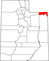 | |
| CDPs | ||
| Ghost towns | ||