Brandon, Minnesota
| Brandon, Minnesota | |
|---|---|
| City | |
| Motto: "Great Today, Greater Tomorrow!"[1] | |
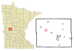 Location of Brandon, Minnesota | |
| Coordinates: 45°57′57″N 95°35′43″W / 45.96583°N 95.59528°W | |
| Country | United States |
| State | Minnesota |
| County | Douglas |
| Area[2] | |
| • Total | 0.48 sq mi (1.24 km2) |
| • Land | 0.47 sq mi (1.22 km2) |
| • Water | 0.01 sq mi (0.03 km2) |
| Elevation | 1,398 ft (426 m) |
| Population (2010)[3] | |
| • Total | 489 |
| • Estimate (2012[4]) | 479 |
| • Density | 1,040.4/sq mi (401.7/km2) |
| Time zone | Central (CST) (UTC-6) |
| • Summer (DST) | CDT (UTC-5) |
| ZIP code | 56315 |
| Area code(s) | 320 |
| FIPS code | 27-07336[5] |
| GNIS feature ID | 0640435[6] |
| Website | http://www.brandonmn.com/ |
Brandon is a city in Douglas County, Minnesota, United States. The population was 489 at the 2010 census.[7]
History
The village of Brandon was incorporated on November 22, 1881.[8] The current town site was laid out when the railroad was being built in August 1879.[8] The town was called Chippewa when at its previous location which was two miles north of the present day site.[8] Brandon was named in honor of Brandon, Vermont, the birthplace of Stephen A. Douglas.[9][10]
Geography
According to the United States Census Bureau, the city has a total area of 0.48 square miles (1.24 km2), of which 0.47 square miles (1.22 km2) is land and 0.01 square miles (0.03 km2) is water.[2]
Demographics
| Historical population | |||
|---|---|---|---|
| Census | Pop. | %± | |
| 1890 | 225 | — | |
| 1900 | 272 | 20.9% | |
| 1910 | 276 | 1.5% | |
| 1920 | 292 | 5.8% | |
| 1930 | 311 | 6.5% | |
| 1940 | 345 | 10.9% | |
| 1950 | 319 | −7.5% | |
| 1960 | 353 | 10.7% | |
| 1970 | 414 | 17.3% | |
| 1980 | 473 | 14.3% | |
| 1990 | 441 | −6.8% | |
| 2000 | 450 | 2.0% | |
| 2010 | 489 | 8.7% | |
| Est. 2015 | 476 | [11] | −2.7% |
2010 census
As of the census[3] of 2010, there were 489 people, 207 households, and 139 families residing in the city. The population density was 1,040.4 inhabitants per square mile (401.7/km2). There were 220 housing units at an average density of 468.1 per square mile (180.7/km2). The racial makeup of the city was 99.2% White, 0.2% African American, and 0.6% Native American. Hispanic or Latino of any race were 2.2% of the population.
There were 207 households of which 29.0% had children under the age of 18 living with them, 54.6% were married couples living together, 10.1% had a female householder with no husband present, 2.4% had a male householder with no wife present, and 32.9% were non-families. 28.5% of all households were made up of individuals and 6.8% had someone living alone who was 65 years of age or older. The average household size was 2.36 and the average family size was 2.90.
The median age in the city was 34.5 years. 26.4% of residents were under the age of 18; 7.3% were between the ages of 18 and 24; 24.8% were from 25 to 44; 26.3% were from 45 to 64; and 15.3% were 65 years of age or older. The gender makeup of the city was 53.0% male and 47.0% female.
2000 census
As of the census[5] of 2000, there were 450 people, 187 households, and 123 families residing in the city. The population density was 1,120.2 people per square mile (434.4/km²). There were 199 housing units at an average density of 495.4 per square mile (192.1/km²). The racial makeup of the city was 99.56% White, 0.22% Asian, and 0.22% from two or more races. Hispanic or Latino of any race were 0.89% of the population.
There were 187 households out of which 32.6% had children under the age of 18 living with them, 56.1% were married couples living together, 7.5% had a female householder with no husband present, and 33.7% were non-families. 31.0% of all households were made up of individuals and 11.8% had someone living alone who was 65 years of age or older. The average household size was 2.41 and the average family size was 2.99.
In the city the population was spread out with 27.3% under the age of 18, 8.7% from 18 to 24, 23.8% from 25 to 44, 24.4% from 45 to 64, and 15.8% who were 65 years of age or older. The median age was 38 years. For every 100 females there were 97.4 males. For every 100 females age 18 and over, there were 97.0 males.
The median income for a household in the city was $28,750, and the median income for a family was $38,500. Males had a median income of $26,000 versus $23,750 for females. The per capita income for the city was $15,088. About 6.8% of families and 11.7% of the population were below the poverty line, including 15.4% of those under age 18 and 12.5% of those age 65 or over.
References
- ↑ "City of Brandon Minnesota". City of Brandon Minnesota. Retrieved October 14, 2012.
- 1 2 "US Gazetteer files 2010". United States Census Bureau. Archived from the original on 2012-01-24. Retrieved 2012-11-13.
- 1 2 "American FactFinder". United States Census Bureau. Retrieved 2012-11-13.
- ↑ "Population Estimates". United States Census Bureau. Archived from the original on 2013-06-17. Retrieved 2013-05-28.
- 1 2 "American FactFinder". United States Census Bureau. Archived from the original on 2013-09-11. Retrieved 2008-01-31.
- ↑ "US Board on Geographic Names". United States Geological Survey. 2007-10-25. Retrieved 2008-01-31.
- ↑ "2010 Census Redistricting Data (Public Law 94-171) Summary File". American FactFinder. U.S. Census Bureau, 2010 Census. Archived from the original on 21 July 2011. Retrieved 23 April 2011.
- 1 2 3 Larson, Constant, ed. (1916). History of Douglas and Grant Counties Minnesota. 1. Indianapolis, IN: B.F. Bowen & Company, Inc. pp. 323–324. Retrieved 2010-01-18.
- ↑ Larson, Constant, ed. (1916). History of Douglas and Grant Counties Minnesota. 1. Indianapolis, IN: B.F. Bowen & Company, Inc. p. 130. Retrieved 2010-01-18.
- ↑ "Profile for Brandon, Minnesota, MN". ePodunk. Retrieved October 14, 2012.
- ↑ "Annual Estimates of the Resident Population for Incorporated Places: April 1, 2010 to July 1, 2015". Retrieved July 2, 2016.
- ↑ "Census of Population and Housing". Census.gov. Archived from the original on May 11, 2015. Retrieved June 4, 2015.
External links
- City of Brandon Minnesota
- Brandon Community Club
- City-Data.com
- ePodunk: Profile for Brandon, Minnesota
Municipalities and communities of Douglas County, Minnesota, United States | ||
|---|---|---|
| Cities | 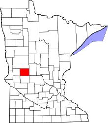 | |
| Townships | ||
| Unincorporated communities | ||
| Footnotes | ‡This populated place also has portions in an adjacent county or counties | |
Coordinates: 45°57′55″N 95°35′55″W / 45.96528°N 95.59861°W