Brandon, Colorado
| Brandon, Colorado | |
|---|---|
| CDP | |
|
Brandon in 2015. | |
 Brandon, Colorado Location within the state of Colorado | |
| Coordinates: 38°26′49″N 102°26′23″W / 38.44694°N 102.43972°WCoordinates: 38°26′49″N 102°26′23″W / 38.44694°N 102.43972°W | |
| Country |
|
| State |
|
| County | Kiowa |
| Established | late 1887[1][2] |
| Government | |
| • Type | unincorporated community |
| Time zone | MST (UTC-7) |
| • Summer (DST) | MDT (UTC-6) |
| ZIP Code | Sheridan Lake CO 81071[3] |

Brandon is a census-designated place in Kiowa County, Colorado, United States. The population as of the 2010 Census was 21.[4] The U.S. Post Office at Sheridan Lake (ZIP Code 81071) now serves Brandon postal addresses.[3]
History
The town of Brandon was established in late 1887.[1][2] The Brandon Post Office opened on May 19, 1888, and closed on February 28, 1963.[5]
Geography
Brandon is located at 38°26′49″N 102°26′23″W / 38.44694°N 102.43972°W (38.446867,-102.439613).
See also
References
- 1 2 Eichler, Geo. R. (1977). Colorado Place Names. 77-089726: Johnson Publishing Company.
- 1 2 "KIOWA COUNTY: THE HIGH PLAINS OF SOUTHEAST COLORADO". Archived from the original (MS Word) on 2006-10-23. Retrieved 2007-09-30.
- 1 2 "ZIP Code Lookup". United States Postal Service. January 3, 2007. Archived from the original (JavaScript/HTML) on September 3, 2007. Retrieved January 3, 2007.
- ↑ Colorado Trend Report 2: State and Complete Places (Sub-state 2010 Census Data). Missouri Census Data Center. Accessed 2011-02-25.
- ↑ Bauer, William H.; James L. Ozment; John H. Willard (1990). Colorado Post Offices 1859-1989. 90-34759: The Colorado Railroad Museum. ISBN 0-918654-42-4.
External links
| Wikimedia Commons has media related to Brandon, Colorado. |
Municipalities and communities of Kiowa County, Colorado, United States | ||
|---|---|---|
| Towns | 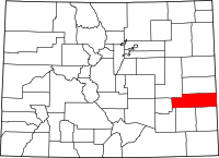 | |
| CDPs | ||
| Unincorporated communities | ||
This article is issued from Wikipedia - version of the 11/7/2016. The text is available under the Creative Commons Attribution/Share Alike but additional terms may apply for the media files.