Braman, Oklahoma
| Braman, Oklahoma | |
|---|---|
| Town | |
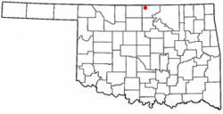 Location of Braman, Oklahoma | |
| Coordinates: 36°55′27″N 97°20′6″W / 36.92417°N 97.33500°WCoordinates: 36°55′27″N 97°20′6″W / 36.92417°N 97.33500°W | |
| Country | United States |
| State | Oklahoma |
| County | Kay |
| Area | |
| • Total | 0.2 sq mi (0.4 km2) |
| • Land | 0.2 sq mi (0.4 km2) |
| • Water | 0.0 sq mi (0.0 km2) |
| Elevation | 1,053 ft (321 m) |
| Population (2010) | |
| • Total | 217 |
| Time zone | Central (CST) (UTC-6) |
| • Summer (DST) | CDT (UTC-5) |
| ZIP code | 74632 |
| Area code(s) | 580 |
| FIPS code | 40-08450[1] |
| GNIS feature ID | 1090451[2] |
Braman is a town in Kay County, Oklahoma, United States. The population was 217 at the 2010 census, a decline of 11.1 percent from 244 at the 2000 census.[3]
Dale DeWitt, the majority leader of the Oklahoma House of Representatives, resides in Braman.
History
Braman was named for railroad developer Dwight Braman, when its post office was first established on April 22,1898. In that year, the Kansas and Southeastern Railroad (which was bought by the Atchison, Topeka and Santa Fe Railroad in 1899, built a track from Hunnewell, Kansas to Braman. The town, located 5 miles (8.0 km) inside the Kansas-Oklahoma state line, incorporated on January 9, 1899. There were 249 residents in 1900, growing to 300 by statehood in 1907.[4]
In 1920, the population was 396 and the local economy was largely based on wheat farming. Oil was discovered nearby during the following decade, attracting a peak population of nearly five thousand, but the number dropped sharply to 507. This was the highest number ever recorded in the census for Braman. It has remained an agricultural center since then.[4]
Geography
According to the United States Census Bureau, Braman has a total area of 0.2 square miles (0.52 km2), all of it land.
Demographics
| Historical population | |||
|---|---|---|---|
| Census | Pop. | %± | |
| 1900 | 249 | — | |
| 1910 | 339 | 36.1% | |
| 1920 | 396 | 16.8% | |
| 1930 | 507 | 28.0% | |
| 1940 | 427 | −15.8% | |
| 1950 | 392 | −8.2% | |
| 1960 | 336 | −14.3% | |
| 1970 | 295 | −12.2% | |
| 1980 | 355 | 20.3% | |
| 1990 | 251 | −29.3% | |
| 2000 | 244 | −2.8% | |
| 2010 | 217 | −11.1% | |
| Est. 2015 | 212 | [5] | −2.3% |
As of the census[1] of 2000, there were 244 people, 103 households, and 66 families residing in the town. The population density was 1,558.2 people per square mile (588.8/km²). There were 117 housing units at an average density of 747.2 per square mile (282.3/km²). The racial makeup of the town was 85.66% White, 0.41% African American, 6.56% Native American, and 7.38% from two or more races. Hispanic or Latino of any race were 3.28% of the population.
There were 103 households out of which 31.1% had children under the age of 18 living with them, 49.5% were married couples living together, 11.7% had a female householder with no husband present, and 35.0% were non-families. 31.1% of all households were made up of individuals and 7.8% had someone living alone who was 65 years of age or older. The average household size was 2.37 and the average family size was 2.99.
In the town the population was spread out with 25.4% under the age of 18, 6.1% from 18 to 24, 26.6% from 25 to 44, 29.5% from 45 to 64, and 12.3% who were 65 years of age or older. The median age was 39 years. For every 100 females there were 92.1 males. For every 100 females age 18 and over, there were 93.6 males.
The median income for a household in the town was $27,841, and the median income for a family was $33,750. Males had a median income of $23,750 versus $21,667 for females. The per capita income for the town was $17,721. About 3.0% of families and 10.0% of the population were below the poverty line, including 5.0% of those under the age of eighteen and 24.0% of those sixty five or over.
References
- 1 2 "American FactFinder". United States Census Bureau. Archived from the original on 2013-09-11. Retrieved 2008-01-31.
- ↑ "US Board on Geographic Names". United States Geological Survey. 2007-10-25. Retrieved 2008-01-31.
- ↑ CensusViewer:Braman, Oklahoma Population.]
- 1 2 Johnston, Jerry. Encyclopedia of Oklahoma History and Culture. "Braman" Retrieved September 22, 2012."Archived copy". Archived from the original on 2009-01-05. Retrieved 2009-08-31.
- ↑ "Annual Estimates of the Resident Population for Incorporated Places: April 1, 2010 to July 1, 2015". Retrieved July 2, 2016.
- ↑ "Census of Population and Housing". Census.gov. Archived from the original on May 11, 2015. Retrieved June 4, 2015.
External links
- Encyclopedia of Oklahoma History and Culture - Braman
- Oklahoma Digital Maps: Digital Collections of Oklahoma and Indian Territory
Municipalities and communities of Kay County, Oklahoma, United States | ||
|---|---|---|
| Cities | 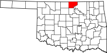 | |
| Towns | ||
| CDP | ||
| Unincorporated communities |
| |
| Ghost towns | ||
| Footnotes | ‡This populated place also has portions in an adjacent county or counties | |