Bradley, Arkansas
| Bradley, Arkansas | |
|---|---|
| Town | |
|
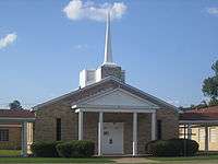
Bradley City Hall | |
 Location in Lafayette County and the state of Arkansas | |
| Coordinates: 33°5′55″N 93°39′27″W / 33.09861°N 93.65750°WCoordinates: 33°5′55″N 93°39′27″W / 33.09861°N 93.65750°W | |
| Country | United States |
| State | Arkansas |
| County | Lafayette |
| Government | |
| • Mayor | Renea Ikegulu[1] |
| Area | |
| • Total | 0.9 sq mi (2.4 km2) |
| • Land | 0.9 sq mi (2.4 km2) |
| • Water | 0 sq mi (0 km2) |
| Elevation | 253 ft (77 m) |
| Population (2000) | |
| • Total | 563 |
| • Density | 625.6/sq mi (234.6/km2) |
| Time zone | Central (CST) (UTC-6) |
| • Summer (DST) | CDT (UTC-5) |
| ZIP code | 71826 |
| Area code(s) | 870 |
| FIPS code | 05-08290 |
| GNIS feature ID | 0076408 |
| Website | http://bradleyark.com |


Bradley is a town in Lafayette County, Arkansas, United States. The population was 563 at the 2000 census.
Geography
Bradley is located at 33°5′55″N 93°39′27″W / 33.09861°N 93.65750°W (33.098580, -93.657434).[2]
According to the United States Census Bureau, the city has a total area of 0.9 square miles (2.3 km2), all of it land.
Demographics
| Historical population | |||
|---|---|---|---|
| Census | Pop. | %± | |
| 1910 | 123 | — | |
| 1920 | 290 | 135.8% | |
| 1930 | 363 | 25.2% | |
| 1940 | 409 | 12.7% | |
| 1950 | 444 | 8.6% | |
| 1960 | 712 | 60.4% | |
| 1970 | 706 | −0.8% | |
| 1980 | 790 | 11.9% | |
| 1990 | 585 | −25.9% | |
| 2000 | 563 | −3.8% | |
| 2010 | 628 | 11.5% | |
| Est. 2015 | 566 | [3] | −9.9% |
2014 Estimate[5] | |||
As of the census[6] of 2000, there were 563 people, 223 households, and 134 families residing in the city. The population density was 614.8 people per square mile (236.3/km²). There were 285 housing units at an average density of 311.2 per square mile (119.6/km²). The racial makeup of the city was 46.36% White, 52.40% Black or African American, 0.36% Asian, and 0.89% from two or more races. 0.71% of the population were Hispanic or Latino of any race.
There were 223 households out of which 30.0% had children under the age of 18 living with them, 32.7% were married couples living together, 22.4% had a female householder with no husband present, and 39.9% were non-families. 37.2% of all households were made up of individuals and 20.6% had someone living alone who was 65 years of age or older. The average household size was 2.52 and the average family size was 3.38.
In the city the population was spread out with 33.6% under the age of 18, 9.6% from 18 to 24, 23.1% from 25 to 44, 17.9% from 45 to 64, and 15.8% who were 65 years of age or older. The median age was 31 years. For every 100 females there were 80.4 males. For every 100 females age 18 and over, there were 70.8 males.
The median income for a household in the city was $14,375, and the median income for a family was $19,306. Males had a median income of $21,719 versus $14,688 for females. The per capita income for the city was $2,455. About 43.9% of families and 49.6% of the population were below the poverty line, including 66.5% of those under age 18 and 42.2% of those age 65 or over.
Education
Public education for elementary and secondary students is provided by the Emerson-Taylor-Bradley School District, which includes Bradley Elementary School and Bradley High School. The school's mascot and athletic emblem is the Bear with purple and gold serving as the school colors.
Infrastructure
Highways
References
- ↑ KSLA Staff. "Bradley, Ark. appoints new mayor". Raycom Media. Retrieved 12 September 2016.
- ↑ "US Gazetteer files: 2010, 2000, and 1990". United States Census Bureau. 2011-02-12. Retrieved 2011-04-23.
- ↑ "Annual Estimates of the Resident Population for Incorporated Places: April 1, 2010 to July 1, 2015". Retrieved July 2, 2016.
- ↑ "Census of Population and Housing". Census.gov. Archived from the original on May 11, 2015. Retrieved June 4, 2015.
- ↑ "Annual Estimates of the Resident Population for Incorporated Places: April 1, 2010 to July 1, 2014". Retrieved June 4, 2015.
- ↑ "American FactFinder". United States Census Bureau. Archived from the original on 2013-09-11. Retrieved 2008-01-31.
Encyclopedia of Arkansas History & Culture
Municipalities and communities of Lafayette County, Arkansas, United States | ||
|---|---|---|
| Cities | 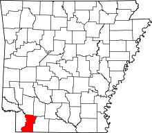 | |
| Town | ||
| Unincorporated communities | ||