Boyle River (Ireland)
| Boyle River | |
|---|---|
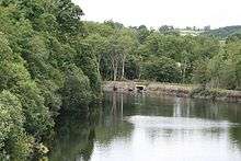 Boyle River at Knockvicar. | |
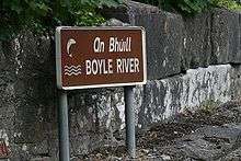
| Native name | An Bhúill |
| Basin | |
| Main source | Lough Gara, County Mayo. |
| River mouth | Atlantic Ocean via the River Shannon |
The Boyle River is a river in Ireland. It forms part of the Shannon River Basin. It flows from Lough Gara on the Sligo/Roscommon border and flows through the town of Boyle to Lough Key. From there is flows eastwards through the village of Knockvicar to the River Shannon at Lough Drumharlow, near Carrick-on-Shannon.
The length of the Boyle River (from its source in Mayo to the Shannon) is 64.4 km (40ml).[1] The area of the Boyle river basin is 725 km2[2]

Boyle River Basin
The Upper Shannon catchment, above Carrick-on-Shannon (area: 1,301 km2[3]) has two distinct reaches: The River Shannon (basin area: 576 km2) which rises in Cavan and the Boyle River (basin area: 725 km2), with its source in Mayo which have their confluence at Lough Eidin/Drumharlow approximately 4.7 km upstream of Carrick-On-Shannon.
The Boyle River has its origins in the rivers Lung and Breedoge which flow into Lough Gara. The 29 km (18 mi) Lung River is fed by Urlaur Lough and Errit Lough on the Mayo/Roscommon border.[4][5]
The river flow from the furthest reaches of the Boyle catchment to Limerick city has a measurement of 290 km (180ml).[6] When added to the Shannon's 102.1 km (63.5ml) estuary this gives a total river flow of 392.1 km (243.5ml), which makes it the longest river within the River Shannon basin (from source to mouth), 31.6 km (19.5ml) longer than the Shannon Pot source.[7]

See also
- Rivers of Ireland
- River Shannon
- Shannon River Basin
- List of loughs in Ireland
- List of rivers in Ireland
References
- ↑ Notes on River Basins: Page 64
- ↑ Dublin Marine Institute 1998: Studies of Irish Rivers and Lakes: Moriarty, Christopher - Table 10.1.
- ↑ Leitrim County Council Table 16.8
- ↑ Urlaur Lough
- ↑ Errit Lough Archived September 10, 2014, at the Wayback Machine.
- ↑ River Habitat Survey, Fig. 2
- ↑ European Commission Rivers Map
| Wikimedia Commons has media related to River Boyle. |
Coordinates: 53°57′30″N 08°24′21″W / 53.95833°N 8.40583°W