Bovey, Minnesota
| Bovey, Minnesota | |
|---|---|
| City | |
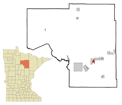 Location of the city of Bovey within Itasca County, Minnesota | |
| Coordinates: 47°17′46″N 93°24′48″W / 47.29611°N 93.41333°W | |
| Country | United States |
| State | Minnesota |
| County | Itasca |
| Area[1] | |
| • Total | 2.30 sq mi (5.96 km2) |
| • Land | 2.29 sq mi (5.93 km2) |
| • Water | 0.01 sq mi (0.03 km2) |
| Elevation | 1,316 ft (401 m) |
| Population (2010)[2] | |
| • Total | 804 |
| • Estimate (2012[3]) | 802 |
| • Density | 351.1/sq mi (135.6/km2) |
| Time zone | Central (CST) (UTC-6) |
| • Summer (DST) | CDT (UTC-5) |
| ZIP code | 55709 |
| Area code(s) | 218 |
| FIPS code | 27-07048[4] |
| GNIS feature ID | 0655489[5] |
Bovey is a city in Itasca County, Minnesota, United States. It is part of Minnesota's Iron Range. The population was 804 at the 2010 census.[6]
U.S. Highway 169 serves as a main route in the area.
Geography
According to the United States Census Bureau, the city has a total area of 2.30 square miles (5.96 km2), of which 2.29 square miles (5.93 km2) is land and 0.01 square miles (0.03 km2) is water.[1]
In recent years the city, along with its neighbors Coleraine and Taconite, has been under a serious threat of flooding from the nearby Canisteo Mine Pit.[7] The pit, which comprises a series of 19 mines that ceased to be worked in 1985, has now become a lake some 4.8 miles long and up to 300 ft deep. In June 2011 the water level was recorded as having reached 1316.1 feet above sea level, higher than low-lying areas of the town. A project to drain some of the lake to prevent it overflowing and swamping the town was due to commence in mid-2011. The most recent pit water level is 1316.60 MSL.[8]
Community
Bovey hosts an annual harvest festival known as Farmer's Day, which festivities typically occur during Labor Day weekend. The holiday culminates with a parade on Labor Day, which is officially Farmer's Day.
Notable people from Bovey
- Adam Hauser – NHL goaltender born and raised in Bovey.
- Richard Hongisto – San Francisco politician born in Bovey.
- Eric Enstrom – photographer of the famous 1918 photograph Grace
Demographics
| Historical population | |||
|---|---|---|---|
| Census | Pop. | %± | |
| 1910 | 1,377 | — | |
| 1920 | 1,324 | −3.8% | |
| 1930 | 1,248 | −5.7% | |
| 1940 | 1,355 | 8.6% | |
| 1950 | 1,320 | −2.6% | |
| 1960 | 1,086 | −17.7% | |
| 1970 | 858 | −21.0% | |
| 1980 | 813 | −5.2% | |
| 1990 | 662 | −18.6% | |
| 2000 | 662 | 0.0% | |
| 2010 | 804 | 21.5% | |
| Est. 2015 | 811 | [9] | 0.9% |
2010 census
As of the census[2] of 2010, there were 804 people, 334 households, and 200 families residing in the city. The population density was 351.1 inhabitants per square mile (135.6/km2). There were 380 housing units at an average density of 165.9 per square mile (64.1/km2). The racial makeup of the city was 93.8% White, 0.2% African American, 2.4% Native American, 0.4% Asian, and 3.2% from two or more races. Hispanic or Latino of any race were 2.4% of the population.
There were 334 households of which 32.0% had children under the age of 18 living with them, 39.8% were married couples living together, 12.0% had a female householder with no husband present, 8.1% had a male householder with no wife present, and 40.1% were non-families. 29.9% of all households were made up of individuals and 12.9% had someone living alone who was 65 years of age or older. The average household size was 2.39 and the average family size was 2.87.
The median age in the city was 33.5 years. 25.5% of residents were under the age of 18; 11.5% were between the ages of 18 and 24; 27.9% were from 25 to 44; 21% were from 45 to 64; and 14.2% were 65 years of age or older. The gender makeup of the city was 52.2% male and 47.8% female.
2000 census
As of the census[4] of 2000, there were 662 people, 302 households, and 169 families residing in the city. The population density was 290.0 people per square mile (112.1/km²). There were 326 housing units at an average density of 142.8 per square mile (55.2/km²). The racial makeup of the city was 96.98% White, 2.11% Native American, 0.15% Asian, and 0.76% from two or more races. Hispanic or Latino of any race were 1.21% of the population.
There were 302 households out of which 23.2% had children under the age of 18 living with them, 43.4% were married couples living together, 10.3% had a female householder with no husband present, and 44.0% were non-families. 36.1% of all households were made up of individuals and 20.5% had someone living alone who was 65 years of age or older. The average household size was 2.19 and the average family size was 2.83.
In the city the population was spread out with 23.0% under the age of 18, 11.2% from 18 to 24, 24.9% from 25 to 44, 22.4% from 45 to 64, and 18.6% who were 65 years of age or older. The median age was 38 years. For every 100 females there were 92.4 males. For every 100 females age 18 and over, there were 90.3 males.
The median income for a household in the city was $25,662, and the median income for a family was $33,750. Males had a median income of $28,571 versus $19,500 for females. The per capita income for the city was $16,127. About 19.5% of families and 22.3% of the population were below the poverty line, including 46.6% of those under age 18 and 3.4% of those age 65 or over.
References
- 1 2 "US Gazetteer files 2010". United States Census Bureau. Archived from the original on 2012-01-24. Retrieved 2012-11-13.
- 1 2 "American FactFinder". United States Census Bureau. Retrieved 2012-11-13.
- ↑ "Population Estimates". United States Census Bureau. Archived from the original on 2013-06-17. Retrieved 2013-05-28.
- 1 2 "American FactFinder". United States Census Bureau. Archived from the original on 2013-09-11. Retrieved 2008-01-31.
- ↑ "US Board on Geographic Names". United States Geological Survey. 2007-10-25. Retrieved 2008-01-31.
- ↑ "2010 Census Redistricting Data (Public Law 94-171) Summary File". American FactFinder. U.S. Census Bureau, 2010 Census. Archived from the original on 21 July 2011. Retrieved 23 April 2011.
- ↑ http://minnesota.publicradio.org/display/web/2010/04/23/canisteo-mine-pit/
- ↑ http://www.dnr.state.mn.us/waters/mine_pit/canisteo.html
- ↑ "Annual Estimates of the Resident Population for Incorporated Places: April 1, 2010 to July 1, 2015". Retrieved July 2, 2016.
- ↑ "Census of Population and Housing". Census.gov. Archived from the original on May 11, 2015. Retrieved June 4, 2015.
Municipalities and communities of Itasca County, Minnesota, United States | ||
|---|---|---|
| Cities | 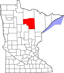 | |
| Townships |
| |
| Unorganized territories | ||
| CDPs | ||
| Unincorporated communities | ||
| Indian reservations | ||
| Footnotes | ‡This populated place also has portions in an adjacent county or counties | |
Coordinates: 47°17′44″N 93°25′08″W / 47.29556°N 93.41889°W