Boulder, Wyoming
| Boulder, Wyoming | |
|---|---|
| CDP | |
|
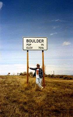
Sign at the edge of the community | |
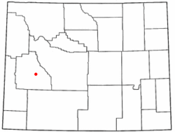 Location of Boulder, Wyoming | |
 Boulder, Wyoming Location in the United States | |
| Coordinates: 42°44′53″N 109°42′46″W / 42.74806°N 109.71278°WCoordinates: 42°44′53″N 109°42′46″W / 42.74806°N 109.71278°W | |
| Country | United States |
| State | Wyoming |
| County | Sublette |
| Area | |
| • Total | 1.9 sq mi (5 km2) |
| • Land | 1.9 sq mi (5 km2) |
| • Water | 0.0 sq mi (0 km2) |
| Elevation | 7,018 ft (2,139 m) |
| Population (2010)[1] | |
| • Total | 170 |
| • Density | 89/sq mi (35/km2) |
| Time zone | Mountain (MST) (UTC-7) |
| • Summer (DST) | MDT (UTC-6) |
| ZIP code | 82923 |
| Area code(s) | 307 |
| FIPS code | 56-09235[2] |
| GNIS feature ID | 1585799[3] |
Boulder is a census-designated place (CDP) in Sublette County, Wyoming, United States. The population was 170 at the 2010 census.
Geography
Boulder is located at 42°44′53″N 109°42′46″W / 42.74806°N 109.71278°W (42.748164, −109.712828).[4]
According to the United States Census Bureau, the CDP has a total area of 1.9 square miles (4.8 km²), all of it land.[5]
Demographics
As of the census[2] of 2000, there were 30 people, 15 households, and 7 families residing in the CDP. The population density was 23.1 people per square mile (8.9/km²). There were 28 housing units at an average density of 21.5/sq mi (8.3/km²). The racial makeup of the CDP was 100.00% White.
There were 15 households out of which 13.3% had children under the age of 18 living with them, 40.0% were married couples living together, 6.7% had a female householder with no husband present, and 53.3% were non-families. 46.7% of all households were made up of individuals and 13.3% had someone living alone who was 65 years of age or older. The average household size was 2.00 and the average family size was 2.71.
In the CDP the population was spread out with 10.0% under the age of 18, 6.7% from 18 to 24, 30.0% from 25 to 44, 36.7% from 45 to 64, and 16.7% who were 65 years of age or older. The median age was 46 years. For every 100 females there were 130.8 males. For every 100 females age 18 and over, there were 145.5 males.
The median income for a household in the CDP was $12,500, and the median income for a family was $23,750. Males had a median income of $0 versus $0 for females. The per capita income for the CDP was $7,908. There were no families and 33.3% of the population living below the poverty line, including no under eighteens and none of those over 64.
Air pollution
Since January 2008, ground-level ozone in Boulder and the surrounding area has exceeded healthy levels 11 times. Natural gas drilling in nearby Jonah Field and the Pinedale Anticline is blamed for the reduced air quality.[6]
Education
Public education in the community of Boulder is provided by Sublette County School District #1.
Climate
Boulder experiences a semi-arid climate (Köppen BSk) with long, cold, dry winters and short, warm summers.[7]
| Climate data for Boulder, Wyoming | |||||||||||||
|---|---|---|---|---|---|---|---|---|---|---|---|---|---|
| Month | Jan | Feb | Mar | Apr | May | Jun | Jul | Aug | Sep | Oct | Nov | Dec | Year |
| Record high °F (°C) | 49 (9) |
50 (10) |
64 (18) |
75 (24) |
87 (31) |
90 (32) |
94 (34) |
93 (34) |
86 (30) |
79 (26) |
65 (18) |
56 (13) |
94 (34) |
| Average high °F (°C) | 25.1 (−3.8) |
30.8 (−0.7) |
39.3 (4.1) |
51.5 (10.8) |
62.3 (16.8) |
72.0 (22.2) |
79.4 (26.3) |
78.4 (25.8) |
68.5 (20.3) |
58.1 (14.5) |
39.4 (4.1) |
28.2 (−2.1) |
52.75 (11.53) |
| Daily mean °F (°C) | 8.7 (−12.9) |
13.2 (−10.4) |
24.8 (−4) |
36.2 (2.3) |
45.6 (7.6) |
54.4 (12.4) |
60.1 (15.6) |
58.7 (14.8) |
49.4 (9.7) |
39.1 (3.9) |
23.7 (−4.6) |
11.5 (−11.4) |
35.45 (1.92) |
| Average low °F (°C) | −7.7 (−22.1) |
−4.4 (−20.2) |
10.2 (−12.1) |
20.8 (−6.2) |
28.8 (−1.8) |
36.7 (2.6) |
40.7 (4.8) |
39.0 (3.9) |
30.3 (−0.9) |
20.1 (−6.6) |
8.0 (−13.3) |
−5.2 (−20.7) |
18.11 (−7.72) |
| Record low °F (°C) | −36 (−38) |
−37 (−38) |
−29 (−34) |
4 (−16) |
10 (−12) |
18 (−8) |
25 (−4) |
23 (−5) |
12 (−11) |
−6 (−21) |
−27 (−33) |
−52 (−47) |
−52 (−47) |
| Average precipitation inches (mm) | 0.41 (10.4) |
0.44 (11.2) |
0.77 (19.6) |
0.91 (23.1) |
1.32 (33.5) |
1.21 (30.7) |
1.04 (26.4) |
1.32 (33.5) |
1.47 (37.3) |
0.71 (18) |
0.44 (11.2) |
0.32 (8.1) |
10.36 (263) |
| Source #1: NOAA (normals, 1971–2000)[8] | |||||||||||||
| Source #2: The Weather Channel (Records)[9] | |||||||||||||
References
- ↑ "2010 City Population and Housing Occupancy Status". U.S. Census Bureau. Archived from the original on July 21, 2011. Retrieved July 13, 2012.
- 1 2 "American FactFinder". United States Census Bureau. Archived from the original on September 11, 2013. Retrieved 2008-01-31.
- ↑ "US Board on Geographic Names". United States Geological Survey. 2007-10-25. Retrieved 2008-01-31.
- ↑ "US Gazetteer files: 2010, 2000, and 1990". United States Census Bureau. 2011-02-12. Retrieved 2011-04-23.
- ↑ "2010 Wyoming Place Names". U.S. Census Bureau. Archived from the original on July 4, 2012. Retrieved July 13, 2012.
- ↑ Moen, Bob (May 8, 2008). "Air pollution in Wyo. community rivals that of big cities". Archived from the original on May 15, 2008. Retrieved May 13, 2008.
- ↑ Climate Summary
- ↑ "Climatography of the United States NO.81" (PDF). National Oceanic and Atmospheric Administration. Retrieved January 13, 2011.
- ↑ "Monthly Averages for Boulder, WY". The Weather Channel. Retrieved January 13, 2011.
Municipalities and communities of Sublette County, Wyoming, United States | ||
|---|---|---|
| Towns | 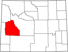 | |
| CDPs | ||
| Unincorporated communities | ||
| Ghost towns | ||