Boothstown
| Boothstown | |
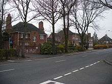
 Methodist Chapel, Boothstown |
|
 Boothstown |
|
| Population | 9,599 (2011.Ward. Boothstown and Ellenbrook) |
|---|---|
| OS grid reference | SD7200 |
| Metropolitan borough | Salford |
| Wigan | |
| Metropolitan county | Greater Manchester |
| Region | North West |
| Country | England |
| Sovereign state | United Kingdom |
| Post town | MANCHESTER |
| Postcode district | M28, M29 |
| Dialling code | 0161 |
| Police | Greater Manchester |
| Fire | Greater Manchester |
| Ambulance | North West |
| EU Parliament | North West England |
| UK Parliament | Worsley and Eccles South |
| Leigh | |
|
|
Coordinates: 53°30′09″N 2°25′31″W / 53.5024°N 2.4252°W
Boothstown is a residential village in the City of Salford, Greater Manchester, England. There is also a ward of the City of Salford called Boothstown and Ellenbrook. The population of this ward at the 2011 Census was 9,599.[1] It is situated to the west of the City of Salford, bordered to the north by the East Lancashire Road A580 and to the south by the Bridgewater Canal. Historically Boothstown or Booth Town was a hamlet partly in Worsley township in the parish of Eccles, and partly in Tyldesley in the parish of Leigh. The boundary was the Stirrup Brook.[2]
It lies 6.8 miles (10.9 km) northwest of Salford, 9.8 miles (15.8 km) northwest of Manchester and 10 miles (16.1 km) southeast of Wigan. Astley is to the west, to the north is Walkden and to the east is Worsley where there is a transport interchange between the M60, M62 & M602 motorways.
Once known for its mining community, Boothstown is now a mainly residential area.
History
Evidence of the Romans in this area is that in 1947, workmen digging in Boothstown at grid reference SD72160108 discovered a hoard of over 550 bronze Roman coins dating between 259 AD and 278 AD.[3] A second hoard of coins dated 289 - 296 A.D. was found at Boothsbank in 1989.[4]
Manor
In 1323 the estate or manor of Booths was held by the de Worsley family and remained with that family, held of the king by a rent of 2s, until the reign of Elizabeth I. In the 17th century the manor was held by Charnock and then by Sherington. Booths Old Hall was built about 1343 and New Booths Hall was built in the early-17th century.[4] The hearth-tax returns of 1666 show nearby Wardley Hall was the largest residence with 19 hearths, Worsley Hall and Booths had 17 each. There were 276 hearths in the township, Worsley proper had 191. The house, in the latter part of the 18th century, was owned by the Clowes family who owned Garrett Hall in neighbouring Tyldesley.[5][6] Lord Francis Egerton bought the estate from Robert Haldane Bradshaw in 1836 and Booths and became part of the Manor of Worsley.[4]
Industrial Revolution
In 1795 the Bridgewater Canal was extended from Worsley, through Boothstown to Leigh. The growth of Boothstown was based on coal and cotton. Cookes Meadow Pit at Ellenbrook dated from 1760-70 but deep mining came with the sinking of Mosley Common Colliery in the 1860s. An early colliery tramway moved coal from the pits down to the canal at Boothstown Basin by using the slope of the land and gravity.[4]
Boothstown had an underground canal, the Chaddock Level which was used to transport coal during the 19th century. It connected the Bridgewater Canal at Boothstown Basin to the Chaddock Colliery, the Queen Anne Pit (1810 to 1820) and the Henfold Pit in Tyldesley. The keystone on the entrance the Chaddock Level is dated 1816. These pits on the Tyldesley side of Boothstown had closed by 1870.[7] In 1931 Boothstown Mines Rescue Station was built along with housing for the rescue team members and other staff, it is a Grade II Listed building.[8][9]
A Mr Smith built a small cotton mill in Boothstown Delph by the Stirrup Brook in 1812.[4] In 1891 Edward Makin of Garden Mill had 260 looms weaving "regattas, stripes, ginghams etc." and William Yates' Boothstown Mill had 9,000 spindles as well as 242 looms producing fine quality cotton from 1875 until the mill closed in 1968.[10][11]
Geography
 |
Tyldesley | Ellenbrook | Walkden | |
| Astley | |
Worsley | ||
| ||||
| | ||||
| Glazebury | Chat Moss | Eccles |
The A572 crosses Boothstown west to east connecting it to Worsley and Wigan. the A580 East Lancashire Road is now the boundary between Tyldesley and Boothstown and crosses west to east at the northern edge of the village. The Bridgewater Canal crosses east to west in the south of the village.
There is agricultural and open land in the south of the Boothstown area that forms part of the Green Belt.[12] To the south of the Bridgewater Canal the Geological Formation consists mainly of the pebble beds of the new red sandstone, north of Boothstown are coal measures.[5]
Transport
Boothstown is served by bus routes to/from Salford, Manchester city centre, Walkden, Wigan and Leigh.
Notable people
Elizabeth Wolstenholme, the suffragist ran a private boarding school in Boothstown in the early 1860s.[13]
References
Notes
- ↑ "City of Salford Ward population 2011". Retrieved 7 January 2016.
- ↑ Boothstown, Genuki, retrieved 2010-01-17
- ↑ Monument no. 44272, Pastscape.org.uk, retrieved 2008-03-19
- 1 2 3 4 5 Boothstown, visitsalford, retrieved 2008-12-14
- 1 2 Farrer, William; Brownbill, J, eds. (1911), "Townships: Worsley", A History of the County of Lancaster: Volume 4, British History Online, pp. 376–392, retrieved 2009-12-11
- ↑ Boothstown, genuki.org.uk, retrieved 2009-12-11
- ↑ Boothstown:Chaddock Canal, Tony Smith, retrieved 2009-12-11
- ↑ Boothstown Mines Rescue, colsal.org.uk, retrieved 2008-12-14
- ↑ Mines Rescue Station, imagesofengland, retrieved 2008-12-14
- ↑ Cotton Mills in Boothstown, gracesguide.co.uk, retrieved 2008-12-14
- ↑ Boothstown, spinningtheweb.org.uk, retrieved 2008-12-14
- ↑ Boothstown_ Ellenbrook (PDF), salford.gov.uk, retrieved 2009-12-11
- ↑ Crawford (2003), p. 188
Bibliography
- Crawford, Elizabeth (2003), The Women's Suffrage Movement: A Reference Guide 1866-1928, Routledge, ISBN 1-135-43402-6
External links
- Ellenbrook and Boothstown Brass Band
- A site dedicated to sites and information about Boothstown
- Boothstown Scouts and Guides Website
- local on line newspaper containing local news, events, services, and local advertisements.