Bongkolong
| Bongkolong | |
|---|---|
| village | |
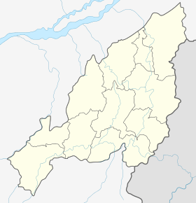 Bongkolong  Bongkolong Location in Nagaland, India | |
| Coordinates: 25°29′25″N 93°31′33″E / 25.490326°N 93.525729°ECoordinates: 25°29′25″N 93°31′33″E / 25.490326°N 93.525729°E | |
| Country | India |
| State | Nagaland |
| District | Peren |
| Circle | Athibung |
| Population (2011) | |
| • Total | 746 |
| Time zone | IST (UTC+5:30) |
| Census code | 268345 |
Bongkolong is a village in the Peren district of Nagaland, India. It is located in the Athibung Circle.[1]
Demographics
According to the 2011 census of India, Bongkolong has 162 households. The effective literacy rate (i.e. the literacy rate of population excluding children aged 6 and below) is 94.91%.[2]
| Total | Male | Female | |
|---|---|---|---|
| Population | 746 | 403 | 343 |
| Children aged below 6 years | 157 | 82 | 75 |
| Scheduled caste | 0 | 0 | 0 |
| Scheduled tribe | 742 | 400 | 342 |
| Literates | 559 | 303 | 256 |
| Workers (all) | 491 | 270 | 221 |
| Main workers (total) | 328 | 198 | 130 |
| Main workers: Cultivators | 263 | 162 | 101 |
| Main workers: Agricultural labourers | 25 | 13 | 12 |
| Main workers: Household industry workers | 1 | 0 | 1 |
| Main workers: Other | 39 | 23 | 16 |
| Marginal workers (total) | 163 | 72 | 91 |
| Marginal workers: Cultivators | 71 | 30 | 41 |
| Marginal workers: Agricultural labourers | 75 | 36 | 39 |
| Marginal workers: Household industry workers | 1 | 1 | 0 |
| Marginal workers: Others | 16 | 5 | 11 |
| Non-workers | 255 | 133 | 122 |
References
- ↑ Nagaland revenue village directory
- 1 2 "District Census Handbook - Peren" (PDF). 2011 Census of India. Directorate of Census Operations, Nagaland. Retrieved 2015-07-22.
This article is issued from Wikipedia - version of the 8/26/2016. The text is available under the Creative Commons Attribution/Share Alike but additional terms may apply for the media files.