Bokeelia, Florida
| Bokeelia, Florida | |
|---|---|
| CDP | |
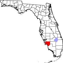
 Location in Lee County and the state of Florida | |
| Coordinates: 26°41′17″N 82°8′43″W / 26.68806°N 82.14528°WCoordinates: 26°41′17″N 82°8′43″W / 26.68806°N 82.14528°W | |
| Country | United States |
| State |
|
| County | Lee |
| Area | |
| • Total | 8.8 sq mi (22.9 km2) |
| • Land | 8.8 sq mi (22.9 km2) |
| • Water | 0 sq mi (0 km2) |
| Elevation | 0 ft (0 m) |
| Population (2000) | |
| • Total | 1,997 |
| • Density | 226.9/sq mi (87.2/km2) |
| Time zone | Eastern (EST) (UTC-5) |
| • Summer (DST) | EDT (UTC-4) |
| ZIP code | 33922 |
| Area code(s) | 239 |
| FIPS code | 12-07375[1] |
| GNIS feature ID | 0279189[2] |
Bokeelia is a census-designated place (CDP) located on Pine Island in Lee County, Florida, United States. As of the 2000 census, the CDP had a total population of 1,997. It is part of the Cape Coral-Fort Myers, Florida Metropolitan Statistical Area. Bokeelia is still home to one of Lee County's first pioneer families, the Padillas, who came by way of Cayo Costa.
Geography
Bokeelia is located at 26°41′17″N 82°8′43″W / 26.68806°N 82.14528°W (26.687960, -82.145249).[3]
According to the United States Census Bureau, the CDP has a total area of 8.9 square miles (23 km2), of which 8.9 square miles (23 km2) is land and 0.04 square miles (0.10 km2) (0.23%) is water.
Little Bokeelia Island, formerly owned by Charles Burgess, is a private island off Bokeelia.[4]
Demographics
As of the census[1] of 2000, there were 1,997 people, 907 households, and 631 families residing in the CDP. The population density was 225.7 people per square mile (87.1/km²). There were 1,436 housing units at an average density of 162.3/sq mi (62.6/km²). The racial makeup of the CDP was 98.05% White, 0.25% African American, 0.05% Native American, 0.30% Asian, 0.85% from other races, and 0.50% from two or more races. Hispanic or Latino of any race were 12.47% of the population.
There were 907 households out of which 16.1% had children under the age of 18 living with them, 60.5% were married couples living together, 5.1% had a female householder with no husband present, and 30.4% were non-families. 24.5% of all households were made up of individuals and 12.0% had someone living alone who was 65 years of age or older. The average household size was 2.20 and the average family size was 2.55.
In the CDP the population was spread out with 15.0% under the age of 18, 6.7% from 18 to 24, 18.2% from 25 to 44, 31.9% from 45 to 64, and 28.2% who were 65 years of age or older. The median age was 52 years. For every 100 females there were 110.2 males. For every 100 females age 18 and over, there were 112.0 males.
The median income for a household in the CDP was $36,319, and the median income for a family was $42,250. Males had a median income of $24,271 versus $28,854 for females. The per capita income for the CDP was $27,613. About 12.4% of families and 17.6% of the population were below the poverty line, including 25.6% of those under age 18 and 3.2% of those age 65 or over.
References
- 1 2 "American FactFinder". United States Census Bureau. Archived from the original on 2013-09-11. Retrieved 2008-01-31.
- ↑ "US Board on Geographic Names". United States Geological Survey. 2007-10-25. Retrieved 2008-01-31.
- ↑ "US Gazetteer files: 2010, 2000, and 1990". United States Census Bureau. 2011-02-12. Retrieved 2011-04-23.
- ↑ "Ten unusual islands for sale". Daily Telegraph.