Bohmte
| Bohmte | ||
|---|---|---|
| ||
 Bohmte | ||
Location of Bohmte within Osnabrück district 
 | ||
| Coordinates: 52°22′N 8°19′E / 52.367°N 8.317°ECoordinates: 52°22′N 8°19′E / 52.367°N 8.317°E | ||
| Country | Germany | |
| State | Lower Saxony | |
| District | Osnabrück | |
| Government | ||
| • Mayor | Klaus Goedejohann (CDU) | |
| Area | ||
| • Total | 110.75 km2 (42.76 sq mi) | |
| Population (2015-12-31)[1] | ||
| • Total | 12,637 | |
| • Density | 110/km2 (300/sq mi) | |
| Time zone | CET/CEST (UTC+1/+2) | |
| Postal codes | 49163 | |
| Dialling codes | 05471 (Bohmte) 05475 (Hunteburg) | |
| Vehicle registration | OS | |
| Website | www.bohmte.de | |

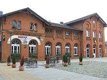
Bohmte railway station
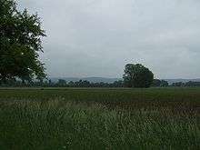
The Stirper Bruch grazing area
Bohmte is a municipality in the district of Osnabrück, in Lower Saxony, Germany. It is situated on the river Hunte, approx. 20 km northeast of Osnabrück. The foundation of today's Bohmte is a result of the regional reorganization of 1972, when the towns of Bohmte, Herringhausen-Stirpe-Oelingen and Hunteburg were consolidated.
Bohmte introduced a new road system in September 2007, designed to reduce the dominance of the motor vehicle. It is hoped that the scheme, which is based on the shared space philosophy, will improve road safety in the town.[2]
Politics
Parish council
Apportionment at the parish council as of 10 September 2006:
- CDU 15 seats
- SPD 11 seats
- FDP 2 seats
- Alliance '90/The Greens 2 seats
Town twinnings
- Gützkow, Vorpommern-Greifswald, Mecklenburg-Vorpommern (since 1991)
- Bolbec, Seine-Maritime, France
Education and culture
- Erich Kästner-Schule (Primary education for all religions)
- Christophorus-Schule (Primary education for the Roman Catholic)
- Grundschule Herringhausen (Primary education in Herringhausen)
- Oberschule Bohmte
- Wilhelm-Busch-Schule (Primary education and Hauptschule)
- Astrid-Lindgren-Schule (for the disabled)
Famous persons
- Karl Janisch (born 1870 in Berlin; died 1946 in Schwegermoor) Architect
- Reinhold Tiling (born 13. Juni 1893 in Absberg/Franken; died 11. Oktober 1933 in Osnabruck) Engineer, pilot and pioneer in rockets
- Rudolf Seiters (born 13. Oktober 1937 in Osnabrück) German politician (CDU)
Regular festivals and meetings
Festivals
- "Spass auf der Straß" (Fun on the street) - last weekend in April
- Marksmen's festival in the Bohmterheide - Whitsuntide
- Marksmen's festival in Bohmte - first weekend in July
- Marksmen's festival in Stirpe-Oelingen - second weekend in July
- Marksmen's festival in Hunteburg - fourth weekend in July
Markets
- "Tag der offenen Tür" (Open doors day) at Bohmte/Bad Essen aerodrome - May Day
- Harvest festival in Herringhausen-Stirpe-Oelingen with harvest market - first weekend in September
- Bohmter Markt (Bohmte market) - fourth weekend in September
- North-German pony market in Hunteburg - second weekend in October
Christmas markets
- Sankt Nikolaus market in Bohmte - second Sunday of Advent
- Christmas market in Hunteburg - third Sunday of Advent
Famous buildings
- Bohmte railway station
- Church of St John the Baptist
- Church of St Thomas
References
| Wikimedia Commons has media related to Bohmte. |
- ↑ Landesbetrieb für Statistik und Kommunikationstechnologie Niedersachsen, 102 Bevölkerung - Basis Zensus 2011, Stand 31. Dezember 2015 (Tabelle K1020014)
- ↑ Catherine Bosley (2007-09-11). "Town ditches traffic lights to cut accidents". Reuters. Retrieved 2007-09-14.
This article is issued from Wikipedia - version of the 11/3/2016. The text is available under the Creative Commons Attribution/Share Alike but additional terms may apply for the media files.