Seine-Maritime
| Seine-Maritime | |||
|---|---|---|---|
| Department | |||
|
Prefecture building of the Seine-Maritime department, in Rouen | |||
| |||
 Location of Seine-Maritime in France | |||
| Coordinates: 49°40′N 0°50′E / 49.667°N 0.833°ECoordinates: 49°40′N 0°50′E / 49.667°N 0.833°E | |||
| Country | France | ||
| Region | Normandy | ||
| Prefecture | Rouen | ||
| Subprefectures |
Dieppe Le Havre | ||
| Government | |||
| • President of the General Council | Pascal Martin | ||
| Area1 | |||
| • Total | 6,278 km2 (2,424 sq mi) | ||
| Population (2013) | |||
| • Total | 1,254,609 | ||
| • Rank | 14th | ||
| • Density | 200/km2 (520/sq mi) | ||
| Time zone | CET (UTC+1) | ||
| • Summer (DST) | CEST (UTC+2) | ||
| Department number | 76 | ||
| Arrondissements | 3 | ||
| Cantons | 35 | ||
| Communes | 718 | ||
| ^1 French Land Register data, which exclude estuaries, and lakes, ponds, and glaciers larger than 1 km2 | |||

Seine-Maritime (French pronunciation: [sɛn.ma.ʁi.tim]) is a department of France in the Normandy region of northern France. It is situated on the northern coast of France, at the mouth of the Seine, and includes the cities of Rouen and Le Havre. Until 1955 it was named Seine-Inférieure.
History
- 1790 - Creation of the Seine-Inférieure department
- The department was created from part of the old province of Normandy during the French revolution, on 4 March 1790, through the application of a law of 22 December 1789.
- 1815 - Occupation
- After the victory at Waterloo of the coalition armies, the department was occupied by British forces from June 1815 till November 1818.
- 1843 – Railways and industry
- In Rouen, Elbeuf, and Bolbec, the number of textile factories is increasing. Metallurgy and naval construction as well.
- 1851 - A republican department
- Following the then president, Louis-Napoléon Bonaparte's 1851 Coup d'état, Seine-Inférieure was one of several departments placed under a state of emergency (literally, in French, state of siege) [1] following fears of significant resistance to the new government.
- World War II
- Occupied by the Wehrmacht, Seine-Inférieure is the witness of two Allied military raids in 1942, the Bruneval raid and Dieppe raid.
- 2005 - Inhabitants renamed
- Previously lacking a demonym, the inhabitants of Seine-Maritime (as the department had been renamed in 1955) determined, following a public consultation, that they should be known in official documents as "Seinomarins" [2] (males) and "Seinomarines" (females).
Heraldry
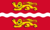
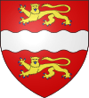 |
The arms of the departement Seine-Maritime are blazoned : Gules a fess wavy argent between two lions passant gardant or armed and langued azure. |
Geography
The department can be split into three main areas:[3]
- The Seine valley. The Seine flows through the provincial capital Rouen.
- The northern coastline, including the towns of Dieppe and Le Havre.
- The Norman Pays de Bray, with its hills and bocage landscape.
Administration
The département was created in 1790 as Seine-Inférieure, one of five departements that replaced the former province of Normandy. In 1800 five arrondissements were created within the département, namely Rouen, Le Havre, Dieppe, Neufchatel and Yvetot, although the latter two were disbanded in 1926. On 18 January 1955 the name of the département was changed to Seine-Maritime, in order to provide a more positive-sounding name and in-keeping with changes made in a number of other French departements.
Transport
In 1843 the railway from Paris reached the region. The département is connected to the adjacent Eure department via the Tancarville and Pont de Normandie bridge crossings of the Seine.
Culture
Madame Bovary by Gustave Flaubert is set in Seine Maritime.
The novel La Place by Annie Ernaux largely takes place in Seine-Maritime and describes events and changes that take place in relation to French society in the 20th century especially in relation to the rural population.
Cauchois is the dialect of the Pays de Caux, and is one of the most vibrant forms of Norman language beyond Cotentinais
Tourism
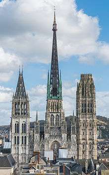 Notre-Dame of Rouen
_0018.JPG) Element of the Atlantic Wall near Fécamp
Element of the Atlantic Wall near Fécamp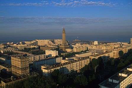
 Limestone cliffs of Étretat
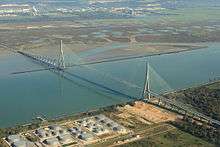 Pont de Normandie above the Seine estuary
See also
- Cantons of the Seine-Maritime department
- Communes of the Seine-Maritime department
- Arrondissements of the Seine-Maritime department
References
- ↑ Jacques Olivier Boudon, Les Bonaparte : regards sur la France impériale. La Documentation photographique, dossier 8073, janvier-février 2010, p. 11 (carte de Gilles Pécout)
- ↑ "Seinomarins, un beau nom !". Commune76.
- ↑ "Seine Maritime". France-For-Visitors.com. Rough Guides. Retrieved 22 October 2011.
External links
- (French) General Council website
- (French) Communes 76
- (French) Prefecture website