Bloomingdale, Michigan
| Bloomingdale, Michigan | |
|---|---|
| Village | |
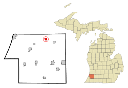 Location of Bloomingdale within Van Buren County, Michigan | |
| Coordinates: 42°23′0″N 85°57′33″W / 42.38333°N 85.95917°WCoordinates: 42°23′0″N 85°57′33″W / 42.38333°N 85.95917°W | |
| Country | United States |
| State | Michigan |
| County | Van Buren |
| Area[1] | |
| • Total | 1.17 sq mi (3.03 km2) |
| • Land | 1.14 sq mi (2.95 km2) |
| • Water | 0.03 sq mi (0.08 km2) |
| Elevation | 732 ft (223 m) |
| Population (2010)[2] | |
| • Total | 454 |
| • Estimate (2012[3]) | 446 |
| • Density | 398.2/sq mi (153.7/km2) |
| Time zone | Eastern (EST) (UTC-5) |
| • Summer (DST) | EDT (UTC-4) |
| ZIP code | 49026 |
| Area code(s) | 269 |
| FIPS code | 26-09220[4] |
| GNIS feature ID | 2398139[5] |
Bloomingdale is a village in Van Buren County in the U.S. state of Michigan. The population was 454 at the 2010 census. The village is located within Bloomingdale Township and is the township seat.
In the 1930s oil was discovered within the village limits, but pumping has now ceased due to lack of oil. Bloomingdale was thought to be a rising city but when the oil ceased so did the attraction.
Bloomingdale is considered the midpoint on the popular Kal-Haven Trail, which runs directly through the main four corners and business district. The downtown Augustus Haven Park with its Depot Museum is a popular picnic stop for trail users.
History
Bloomingdale was founded in 1855. A post office was established in 1856. The town was platted in 1870 and incorporated as a village in 1881.[6]
Geography
According to the United States Census Bureau, the village has a total area of 1.17 square miles (3.03 km2), of which 1.14 square miles (2.95 km2) is land and 0.03 square miles (0.08 km2) is water.[1]
Demographics
| Historical population | |||
|---|---|---|---|
| Census | Pop. | %± | |
| 1880 | 292 | — | |
| 1890 | 380 | 30.1% | |
| 1900 | 379 | −0.3% | |
| 1910 | 501 | 32.2% | |
| 1920 | 486 | −3.0% | |
| 1930 | 386 | −20.6% | |
| 1940 | 553 | 43.3% | |
| 1950 | 465 | −15.9% | |
| 1960 | 471 | 1.3% | |
| 1970 | 496 | 5.3% | |
| 1980 | 537 | 8.3% | |
| 1990 | 503 | −6.3% | |
| 2000 | 528 | 5.0% | |
| 2010 | 454 | −14.0% | |
| Est. 2015 | 442 | [7] | −2.6% |
2010 census
As of the census[2] of 2010, there were 454 people, 172 households, and 124 families residing in the village. The population density was 398.2 inhabitants per square mile (153.7/km2). There were 208 housing units at an average density of 182.5 per square mile (70.5/km2). The racial makeup of the village was 93.4% White, 0.2% African American, 0.9% Native American, 0.2% Asian, 2.4% from other races, and 2.9% from two or more races. Hispanic or Latino of any race were 5.1% of the population.
There were 172 households of which 36.6% had children under the age of 18 living with them, 46.5% were married couples living together, 16.9% had a female householder with no husband present, 8.7% had a male householder with no wife present, and 27.9% were non-families. 24.4% of all households were made up of individuals and 7.5% had someone living alone who was 65 years of age or older. The average household size was 2.64 and the average family size was 3.03.
The median age in the village was 38.4 years. 24.4% of residents were under the age of 18; 9.7% were between the ages of 18 and 24; 23.9% were from 25 to 44; 29.3% were from 45 to 64; and 12.6% were 65 years of age or older. The gender makeup of the village was 46.0% male and 54.0% female.
2000 census
As of the census[4] of 2000, there were 528 people, 181 households, and 140 families residing in the village. The population density was 469.5 per square mile (182.0/km²). There were 206 housing units at an average density of 183.2 per square mile (71.0/km²). The racial makeup of the village was 90.72% White, 2.65% African American, 1.89% Native American, 2.08% from other races, and 2.65% from two or more races. Hispanic or Latino of any race were 3.60% of the population.
There were 181 households out of which 46.4% had children under the age of 18 living with them, 54.7% were married couples living together, 14.4% had a female householder with no husband present, and 22.1% were non-families. 17.1% of all households were made up of individuals and 7.2% had someone living alone who was 65 years of age or older. The average household size was 2.92 and the average family size was 3.23.
In the village the population was spread out with 31.8% under the age of 18, 10.4% from 18 to 24, 29.9% from 25 to 44, 17.2% from 45 to 64, and 10.6% who were 65 years of age or older. The median age was 32 years. For every 100 females there were 103.1 males. For every 100 females age 18 and over, there were 96.7 males.
The median income for a household in the village was $35,714, and the median income for a family was $40,000. Males had a median income of $35,500 versus $21,500 for females. The per capita income for the village was $15,705. About 7.8% of families and 13.2% of the population were below the poverty line, including 12.9% of those under age 18 and 23.1% of those age 65 or over. The highest income reported was $350,000.
Notable people
- Bill Killefer, catcher for three Major League Baseball teams
- Red Killefer, MLB player for Detroit Tigers, member of Pacific Coast League Hall of Fame
- David Wayne, actor; grew up in Bloomingdale
References
Notes
- 1 2 "US Gazetteer files 2010". United States Census Bureau. Archived from the original on 2012-01-24. Retrieved 2012-11-25.
- 1 2 "American FactFinder". United States Census Bureau. Retrieved 2012-11-25.
- ↑ "Population Estimates". United States Census Bureau. Archived from the original on 2013-06-17. Retrieved 2013-06-03.
- 1 2 "American FactFinder". United States Census Bureau. Archived from the original on 2013-09-11. Retrieved 2008-01-31.
- ↑ U.S. Geological Survey Geographic Names Information System: Bloomingdale, Michigan
- ↑ Romig 1986, p. 67.
- ↑ "Annual Estimates of the Resident Population for Incorporated Places: April 1, 2010 to July 1, 2015". Retrieved July 2, 2016.
- ↑ "Census of Population and Housing". Census.gov. Archived from the original on May 11, 2015. Retrieved June 4, 2015.
Sources
- Romig, Walter (October 1, 1986) [1973]. Michigan Place Names: The History of the Founding and the Naming of More Than Five Thousand Past and Present Michigan Communities. Great Lakes Books Series (Paperback). Detroit, Michigan: Wayne State University Press. ISBN 0-8143-1838-X. ISBN 978-0814318386.
Municipalities and communities of Van Buren County, Michigan, United States | ||
|---|---|---|
| Cities | 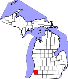 | |
| Villages | ||
| Charter township | ||
| General law townships | ||
| Unincorporated community | ||
| Footnotes | ‡This populated place also has portions in an adjacent county or counties | |