Biwabik, Minnesota
| Biwabik, Minnesota | |
|---|---|
| City | |
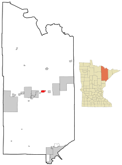 Location of the city of Biwabik within Saint Louis County, Minnesota | |
| Coordinates: 47°32′0″N 92°20′32″W / 47.53333°N 92.34222°W | |
| Country | United States |
| State | Minnesota |
| County | Saint Louis |
| Area[1] | |
| • Total | 10.15 sq mi (26.29 km2) |
| • Land | 8.97 sq mi (23.23 km2) |
| • Water | 1.18 sq mi (3.06 km2) |
| Elevation | 1,450 ft (442 m) |
| Population (2010)[2] | |
| • Total | 969 |
| • Estimate (2012[3]) | 990 |
| • Density | 108.0/sq mi (41.7/km2) |
| Time zone | Central (CST) (UTC-6) |
| • Summer (DST) | CDT (UTC-5) |
| ZIP codes | 55708 |
| Area code(s) | 218 |
| FIPS code | 27-06148[4] |
| GNIS feature ID | 0660819[5] |
| Website | www.cityofbiwabik.com |
Biwabik is a city in Saint Louis County, Minnesota, United States. The population was 969 at the 2010 census.[6]
State Highway 135 (MN 135) and Vermilion Trail (County 4) are two of the main routes in Biwabik.
Its name is derived from the Ojibwe word for Iron: Biwabiko-nabik-wan.
Geography
According to the United States Census Bureau, the city has a total area of 10.15 square miles (26.29 km2); 8.97 square miles (23.23 km2) is land and 1.18 square miles (3.06 km2) is water.[1]
Biwabik is the home of Giants Ridge Golf and Ski Resort.
Demographics
| Historical population | |||
|---|---|---|---|
| Census | Pop. | %± | |
| 1900 | 1,299 | — | |
| 1910 | 1,690 | 30.1% | |
| 1920 | 2,024 | 19.8% | |
| 1930 | 1,383 | −31.7% | |
| 1940 | 1,304 | −5.7% | |
| 1950 | 1,245 | −4.5% | |
| 1960 | 1,836 | 47.5% | |
| 1970 | 1,483 | −19.2% | |
| 1980 | 1,428 | −3.7% | |
| 1990 | 1,097 | −23.2% | |
| 2000 | 954 | −13.0% | |
| 2010 | 969 | 1.6% | |
| Est. 2015 | 992 | [7] | 2.4% |
2010 census
As of the census[2] of 2010, there were 969 people, 469 households, and 250 families residing in the city. The population density was 108.0 inhabitants per square mile (41.7/km2). There were 543 housing units at an average density of 60.5 per square mile (23.4/km2). The racial makeup of the city was 97.8% White, 0.1% African American, 0.7% Native American, 0.3% Asian, 0.3% from other races, and 0.7% from two or more races. Hispanic or Latino of any race were 0.9% of the population.
There were 469 households of which 22.4% had children under the age of 18 living with them, 38.2% were married couples living together, 10.7% had a female householder with no husband present, 4.5% had a male householder with no wife present, and 46.7% were non-families. 42.2% of all households were made up of individuals and 19.2% had someone living alone who was 65 years of age or older. The average household size was 2.03 and the average family size was 2.72.
The median age in the city was 46.8 years. 20% of residents were under the age of 18; 6.2% were between the ages of 18 and 24; 20.5% were from 25 to 44; 31.2% were from 45 to 64; and 22.1% were 65 years of age or older. The gender makeup of the city was 49.3% male and 50.7% female.
2000 census
At the 2000 census,[4] there were 954 people, 454 household, and 266 families residing in the city. The population density was 199.9 per square mile (77.2/km²). There were 492 housing units at an average density of 103.1 per square mile (39.8/km²). The racial makeup of the city was 97.59% White, 2.10% Native American, 0.10% Asian, 0.10% Pacific Islander, and 0.10% from two or more races. 20.5% were of Finnish, 14.1% German, 12.7% Norwegian, 8.0% Irish, 7.6% Slovene and 6.9% Swedish ancestry according to Census 2000.
There were 454 households of which 25.1% had children under the age of 18 living with them, 44.1% were married couples living together, 9.5% had a female householder with no husband present, and 41.4% were non-families. 37.0% of all households were made up of individuals and 17.6% had someone living alone who was 65 years of age or older. The average household size was 2.09 and the average family size was 2.69.
20.8% of the population were under the age of 18, 7.1% from 18 to 24, 26.6% from 25 to 44, 25.4% from 45 to 64, and 20.1% who were 65 years of age or older. The median age was 42 years. For every 100 females there were 92.7 males. For every 100 females age 18 and over, there were 90.9 males.
The median household income was $28,359 and the median family income was $37,386. Males had a median income of $41,250 compared with $21,136 for females. The per capita income for the city was $16,182. About 11.7% of families and 17.0% of the population were below the poverty line, including 29.9% of those under age 18 and 11.1% of those age 65 or over.
History
Daniel R. Curtin, Wisconsin State Assemblyman and businessman, at one time owned the town site of Biwabik, Minnesota. For 10 years, Curtin was in the lumber and mining business.[9]
See also
- Honk, the Moose, a children's novel based on a story taking place in Biwabik.
References
- 1 2 "US Gazetteer files 2010". United States Census Bureau. Archived from the original on 2012-01-24. Retrieved 2012-11-13.
- 1 2 "American FactFinder". United States Census Bureau. Retrieved 2012-11-13.
- ↑ "Population Estimates". United States Census Bureau. Archived from the original on 2013-06-17. Retrieved 2013-05-28.
- 1 2 "American FactFinder". United States Census Bureau. Archived from the original on 2013-09-11. Retrieved 2008-01-31.
- ↑ "US Board on Geographic Names". United States Geological Survey. 2007-10-25. Retrieved 2008-01-31.
- ↑ "2010 Census Redistricting Data (Public Law 94-171) Summary File". American FactFinder. U.S. Census Bureau, 2010 Census. Archived from the original on 21 July 2011. Retrieved 23 April 2011.
- ↑ "Annual Estimates of the Resident Population for Incorporated Places: April 1, 2010 to July 1, 2015". Retrieved July 2, 2016.
- ↑ "Census of Population and Housing". Census.gov. Archived from the original on May 11, 2015. Retrieved June 4, 2015.
- ↑ 'The History of Door County, Wisconsin, the Country Beautiful,' volume II, Hjalmar Rued Holand, S. J. Clarke Printing Company, Chicago, Illinois: 1917, Biographical Sketch of Joseph Justin Curtin, M. D., pg. 96-97, (Information about his father Daniel R. Curtin)
External links

Coordinates: 47°31′59″N 92°20′25″W / 47.53306°N 92.34028°W