Bison, South Dakota
| Bison, South Dakota | |
|---|---|
| Town | |
|
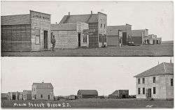
Postcard view of Main Street in Bison in 1915. | |
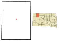 Location in Perkins County and the state of South Dakota | |
| Coordinates: 45°31′26″N 102°27′53″W / 45.52389°N 102.46472°WCoordinates: 45°31′26″N 102°27′53″W / 45.52389°N 102.46472°W | |
| Country | United States |
| State | South Dakota |
| County | Perkins |
| Area[1] | |
| • Total | 0.99 sq mi (2.56 km2) |
| • Land | 0.99 sq mi (2.56 km2) |
| • Water | 0 sq mi (0 km2) |
| Elevation | 2,782 ft (848 m) |
| Population (2010)[2] | |
| • Total | 333 |
| • Estimate (2013)[3] | 338 |
| • Density | 340/sq mi (130/km2) |
| Time zone | Mountain (MST) (UTC-7) |
| • Summer (DST) | MDT (UTC-6) |
| ZIP code | 57620 |
| Area code(s) | 605 |
| FIPS code | 46-05620[4] |
| GNIS feature ID | 1253935[5] |
| Website | Town of Bison |
Bison is a town in and the county seat of Perkins County, South Dakota, United States.[6] The population was 333 at the 2010 census.
History
Bison was platted in 1907, and named after the American bison which were once numerous in the area.[7] A post office has been in operation at Bison since 1907.[8] Bison was declared county seat in 1908.[9]
Geography
Bison is located at 45°31′26″N 102°27′53″W / 45.52389°N 102.46472°W (45.523911, -102.464634).[10]
According to the United States Census Bureau, the town has a total area of 0.99 square miles (2.56 km2), all of it land.[1]
Bison has been assigned the ZIP code 57620, and the FIPS place code 05620.
Demographics
| Historical population | |||
|---|---|---|---|
| Census | Pop. | %± | |
| 1950 | 457 | — | |
| 1960 | 457 | 0.0% | |
| 1970 | 406 | −11.2% | |
| 1980 | 457 | 12.6% | |
| 1990 | 451 | −1.3% | |
| 2000 | 373 | −17.3% | |
| 2010 | 333 | −10.7% | |
| Est. 2015 | 339 | [11] | 1.8% |
| U.S. Decennial Census[12] 2013 Estimate[3] | |||
2010 census
As of the census[2] of 2010, there were 333 people, 158 households, and 100 families residing in the town. The population density was 336.4 inhabitants per square mile (129.9/km2). There were 180 housing units at an average density of 181.8 per square mile (70.2/km2). The racial makeup of the town was 97.9% White and 2.1% from two or more races. Hispanic or Latino of any race were 0.3% of the population.
There were 158 households of which 23.4% had children under the age of 18 living with them, 57.0% were married couples living together, 3.8% had a female householder with no husband present, 2.5% had a male householder with no wife present, and 36.7% were non-families. 35.4% of all households were made up of individuals and 21.5% had someone living alone who was 65 years of age or older. The average household size was 2.11 and the average family size was 2.72.
The median age in the town was 48.6 years. 21.9% of residents were under the age of 18; 3.6% were between the ages of 18 and 24; 19.5% were from 25 to 44; 29.4% were from 45 to 64; and 25.5% were 65 years of age or older. The gender makeup of the town was 50.8% male and 49.2% female.
2000 census
At the 2000 census,[4] there were 373 people, 177 households and 109 families residing in the town. The population density was 372.5 per square mile (144.0/km²). There were 227 housing units at an average density of 226.7 per square mile (87.6/km²). The racial makeup of the town was 99.73% White and 0.27% Native American. Hispanic or Latino of any race were 0.27% of the population.
There were 177 households of which 24.9% had children under the age of 18 living with them, 52.5% were married couples living together, 5.6% had a female householder with no husband present, and 38.4% were non-families. 38.4% of all households were made up of individuals and 18.6% had someone living alone who was 65 years of age or older. The average household size was 2.11 and the average family size was 2.78.
Age distribution was 22.3% under the age of 18, 5.9% from 18 to 24, 20.6% from 25 to 44, 26.3% from 45 to 64, and 24.9% who were 65 years of age or older. The median age was 45 years. For every 100 females there were 99.5 males. For every 100 females age 18 and over, there were 95.9 males.
The median household income was $30,000, and the median family income was $41,250. Males had a median income of $28,594 versus $17,386 for females. The per capita income for the town was $19,856. About 4.5% of families and 12.6% of the population were below the poverty line, including 12.3% of those under age 18 and 16.3% of those age 65 or over.
References
- 1 2 "US Gazetteer files 2010". United States Census Bureau. Archived from the original on 2012-01-24. Retrieved 2012-06-21.
- 1 2 "American FactFinder". United States Census Bureau. Retrieved 2012-06-21.
- 1 2 "Population Estimates". United States Census Bureau. Retrieved 2014-11-08.
- 1 2 "American FactFinder". United States Census Bureau. Archived from the original on 2013-09-11. Retrieved 2008-01-31.
- ↑ "US Board on Geographic Names". United States Geological Survey. 2007-10-25. Retrieved 2008-01-31.
- ↑ "Find a County". National Association of Counties. Archived from the original on 2011-05-31. Retrieved 2011-06-07.
- ↑ Federal Writers' Project (1940). South Dakota place-names, v.1-3. University of South Dakota. p. 26.
- ↑ "Perkins County". Jim Forte Postal History. Retrieved 26 January 2015.
- ↑ Hellmann, Paul T. (May 13, 2013). Historical Gazetteer of the United States. Routledge. p. 983. Retrieved 30 November 2013.
- ↑ "US Gazetteer files: 2010, 2000, and 1990". United States Census Bureau. 2011-02-12. Retrieved 2011-04-23.
- ↑ "Annual Estimates of the Resident Population for Incorporated Places: April 1, 2010 to July 1, 2015". Retrieved July 2, 2016.
- ↑ United States Census Bureau. "Census of Population and Housing". Archived from the original on May 11, 2015. Retrieved November 8, 2014.
External links
| Wikimedia Commons has media related to Bison, South Dakota. |
Municipalities and communities of Perkins County, South Dakota, United States | ||
|---|---|---|
| City | 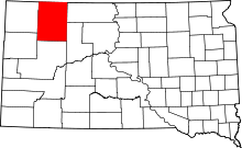 | |
| Town | ||
| Townships |
| |
| CDP | ||
| Other unincorporated communities | ||
| Ghost towns | ||