Binford, North Dakota
| Binford, North Dakota | |
|---|---|
| City | |
 Location of Binford, North Dakota | |
| Coordinates: 47°33′39″N 98°20′48″W / 47.56083°N 98.34667°WCoordinates: 47°33′39″N 98°20′48″W / 47.56083°N 98.34667°W | |
| Country | United States |
| State | North Dakota |
| County | Griggs |
| Area[1] | |
| • Total | 0.35 sq mi (0.91 km2) |
| • Land | 0.35 sq mi (0.91 km2) |
| • Water | 0 sq mi (0 km2) |
| Elevation | 1,526 ft (465 m) |
| Population (2010)[2] | |
| • Total | 183 |
| • Estimate (2015)[3] | 174 |
| • Density | 522.9/sq mi (201.9/km2) |
| Time zone | Central (CST) (UTC-6) |
| • Summer (DST) | CDT (UTC-5) |
| ZIP code | 58416 |
| Area code(s) | 701 |
| FIPS code | 38-07020 |
| GNIS feature ID | 1028008[4] |
| Website | www.gobinford.com |
Binford is a city in Griggs County, North Dakota, United States. The population was 183 at the 2010 census.[5] Binford was founded in 1899.
History
The Johnson Land Company of Iowa purchased a flax field owned by Gabriel Gabrielson when the Northern Pacific Railway laid its tracks in 1899. The town of "Blooming Prairie" was renamed Binford after attorney Ray Binford of Charles City, Iowa who handled the Land Company's purchase.
In the fall of 1899, a lumberyard and general store opened. A hotel was built in 1900. In 1905, Binford had its own newspaper, a bank, grain elevator, a hardware store, two groceries, a couple of pool hall-bowling alleys, two churches, and various other establishments.
Geography
Binford is located at 47°33′39″N 98°20′48″W / 47.56083°N 98.34667°W (47.560954, -98.346733).[6]
According to the United States Census Bureau, the city has a total area of 0.35 square miles (0.91 km2), all of it land.[1]
Demographics
| Historical population | |||
|---|---|---|---|
| Census | Pop. | %± | |
| 1910 | 275 | — | |
| 1920 | 393 | 42.9% | |
| 1930 | 317 | −19.3% | |
| 1940 | 311 | −1.9% | |
| 1950 | 309 | −0.6% | |
| 1960 | 261 | −15.5% | |
| 1970 | 242 | −7.3% | |
| 1980 | 293 | 21.1% | |
| 1990 | 233 | −20.5% | |
| 2000 | 201 | −13.7% | |
| 2010 | 183 | −9.0% | |
| Est. 2015 | 174 | [7] | −4.9% |
| U.S. Decennial Census[8] 2015 Estimate[3] | |||
2010 census
As of the census[2] of 2010, there were 183 people, 99 households, and 51 families residing in the city. The population density was 522.9 inhabitants per square mile (201.9/km2). There were 125 housing units at an average density of 357.1 per square mile (137.9/km2). The racial makeup of the city was 100.0% White. Hispanic or Latino of any race were 0.5% of the population.
There were 99 households of which 15.2% had children under the age of 18 living with them, 42.4% were married couples living together, 7.1% had a female householder with no husband present, 2.0% had a male householder with no wife present, and 48.5% were non-families. 48.5% of all households were made up of individuals and 27.3% had someone living alone who was 65 years of age or older. The average household size was 1.85 and the average family size was 2.59.
The median age in the city was 54.5 years. 14.8% of residents were under the age of 18; 6% were between the ages of 18 and 24; 15.9% were from 25 to 44; 33.9% were from 45 to 64; and 29.5% were 65 years of age or older. The gender makeup of the city was 50.3% male and 49.7% female.
2000 census
As of the census of 2000, there were 201 people, 94 households, and 57 families residing in the city. The population density was 573.4 people per square mile (221.7/km²). There were 120 housing units at an average density of 342.3/sq mi (132.4/km²). The racial makeup of the city was 100.00% White.
There were 94 households out of which 25.5% had children under the age of 18 living with them, 5.2% were married couples living together, 66.4% had a householder with no husband present, and 38.3% were non-families. 35.1% of all households were made up of individuals and 27.7% had someone living in town alone who was 65 years of age or older. The average household size was 2.14 and the average family size was 2.79.
In the city the population was spread out with 20.9% under the age of 18, 6.0% from 18 to 24, 19.4% from 25 to 44, 20.9% from 45 to 64, and 32.8% who were 65 years of age or older. The median age was 47 years. For every 100 females age 18 and over, there were 78.7 males.
The median income for a household in the city was $25,375, and the median income for a family was $30,000. Males had a median income of $25,938 versus $18,125 for females. Plus support income from the military. The per capita income for the city was $14,459. About 3.3% of families and 5.0% of the population were below the poverty line, including none of those under the age of eighteen and 5.3% of those sixty five or over.
Notable people
- Thomas Ryum Amlie, U.S. Congressman from Wisconsin[9]
External links
References
- 1 2 "US Gazetteer files 2010". United States Census Bureau. Archived from the original on 2012-01-24. Retrieved 2012-06-14.
- 1 2 "American FactFinder". United States Census Bureau. Retrieved 2012-06-14.
- 1 2 "Population Estimates". United States Census Bureau. Retrieved July 16, 2016.
- ↑ "US Board on Geographic Names". United States Geological Survey. 2007-10-25. Retrieved 2008-01-31.
- ↑ "2010 Census Redistricting Data (Public Law 94-171) Summary File". American FactFinder. United States Census Bureau. Archived from the original on 21 July 2011. Retrieved 2 May 2011.
- ↑ "US Gazetteer files: 2010, 2000, and 1990". United States Census Bureau. 2011-02-12. Retrieved 2011-04-23.
- ↑ "Annual Estimates of the Resident Population for Incorporated Places: April 1, 2010 to July 1, 2015". Retrieved July 2, 2016.
- ↑ United States Census Bureau. "Census of Population and Housing". Archived from the original on May 11, 2015. Retrieved January 19, 2014.
- ↑ 'Wisconsin Blue Book 1937,' Biographical Sketch of Thomas Ryum Amlie, pg. 19
Municipalities and communities of Griggs County, North Dakota, United States | ||
|---|---|---|
| Cities | 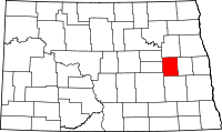 | |
| Townships |
| |
| CDPs | ||
| Unincorporated communities | ||