Bergen (village), New York
| Bergen | |
| Village | |
 Looking north along Lake Street (NY 19) to railroad crossing | |
| Country | United States |
|---|---|
| State | New York |
| Region | Western New York |
| County | Genesee |
| Town | Bergen |
| Elevation | 606 ft (185 m) |
| Coordinates | 43°5′0″N 77°56′30″W / 43.08333°N 77.94167°WCoordinates: 43°5′0″N 77°56′30″W / 43.08333°N 77.94167°W |
| Highest point | In S corner of village |
| - elevation | 665 ft (203 m) |
| - coordinates | 43°4′27″N 77°56′43″W / 43.07417°N 77.94528°W |
| Lowest point | NE corner of village along tributary of Black Creek |
| - coordinates | 43°5′18″N 77°56′9″W / 43.08833°N 77.93583°W |
| Area | 0.6 sq mi (2 km2) |
| Population | 1,240 (2000) |
| Density | 2,002.3/sq mi (773/km2) |
| Settled | 1801 |
| - Incorporated | 1877 |
| Government | Village Hall |
| - location | 11 North Lake Avenue |
| Mayor | AnnaMarie Barclay |
| Timezone | EST (UTC-5) |
| - summer (DST) | EDT (UTC-4) |
| ZIP Code | 14416 |
| Area code | 585 |
| Exchange | 494 |
| FIPS code | 36-06046 |
| GNIS feature ID | 0943720 |
_highlighted.svg.png) Location in Genesee County and the state of New York.
| |
| Website: Village of Bergen | |
Bergen (/ˈbɜːrdʒən/ BUR-jən) is a village in Genesee County, New York, United States. The population was 1,240 at the 2000 census.
The village lies on the eastern edge of the Town of Bergen. The village is north of the junction of Routes 19 and 33.
History
See also Town of Bergen
The Bergen area was opened up in 1801 when a road was hacked through the thick "Northwoods" from LeRoy to Lake Ontario. (In its early days of settlement, Bergen was called Northwoods.) Bergen was first settled in 1801 by Samuel Lincoln. In the same year George Letson, William Letson, Benajah Worden, Richard Abbey, Solomon Levi, Jesse Leach, James Letson, Gideon Elliott, and David Scott settled in town.
A colony of 60 families from Connecticut settled the area along Route 19 from Fort Hill (near Parmalee Rd) to Black Creek from 1805 to 1810. The first store was a mile south of Route 33 on Route 19 on the east side of the road. The first group of stores was located from the intersection of Lake Rd. (Rte. 19) and Route 262 to the intersection of Rte. 19 and the Scottsville Road (Rt. 33A). This area was called Buell's Corner, later Bergen Corners or High Bergen. The first church organization was established in December 1807. The Congregational church was founded January 25, 1808. Harry Kelsey, a graduate of Yale college, taught the first school. The first frame house in the town was erected by Levi Ward, a pioneer physician. Jared Merritt built the first saw mill. Dr. Ward was proprietor of the first store, in 1808. The first inn was opened in 1809 by Samuel Butler. Colonel W.H. Ward was the first postmaster.
After the railroad came through in 1836, an area was laid out around the intersection of Lake Road (Route 19) and the railroad for businesses and houses. It was called Wardville after the Levi Ward family who laid it out. It was also called Cork, after the Irish who settled there while and after the building of the railroad, and Lower Bergen. The two areas were soon connected by residences and churches.

Fire initially destroyed the business area around the railroad tracks in 1866.
This area, along with the surrounding residences was incorporated in on March 5, 1877 as the Village of Bergen. The village of Bergen is near the center of the eastern boundary line, on the New York Central and Hudson River Railroad.
Fire destroyed the business area around the railroad tracks again in 1880. The Village Board passed an ordinance requiring that all structures in this area should be built of brick, stone, or wrought iron.
The west side of the district south of the railroad is on the National Register as the Lake Street Historic District due to its 1880 wrought iron store fronts, transom windows and probably, also, because of the famous family who founded "Wardville". Some of the family went on from Bergen to the Rochester area and were primary developers of that area.
Due to better building material and firefighting equipment, another fire in 1906 destroyed only some of the buildings on the west side of the street. A fire in 1932 leveled some of the buildings on the east side of the street. Since then, fires in individual buildings have caused some alteration of their facades.
Geography
Bergen is located at 43°05′00″N 77°56′30″W / 43.083388°N 77.941754°W (43.083388, -77.941754).[1]
According to the United States Census Bureau, the village has a total area of 0.6 square miles (1.6 km2).None of the area is covered with water.
Demographics
| Historical population | |||
|---|---|---|---|
| Census | Pop. | %± | |
| 1850 | 250 | — | |
| 1860 | 150 | −40.0% | |
| 1880 | 675 | — | |
| 1890 | 623 | −7.7% | |
| 1900 | 624 | 0.2% | |
| 1910 | 637 | 2.1% | |
| 1920 | 576 | −9.6% | |
| 1930 | 724 | 25.7% | |
| 1940 | 658 | −9.1% | |
| 1950 | 786 | 19.5% | |
| 1960 | 964 | 22.6% | |
| 1970 | 1,018 | 5.6% | |
| 1980 | 976 | −4.1% | |
| 1990 | 1,103 | 13.0% | |
| 2000 | 1,240 | 12.4% | |
| 2010 | 1,176 | −5.2% | |
| Est. 2015 | 1,133 | [2] | −3.7% |
As of the census[4] of 2000, there were 1,240 people, 466 households, and 317 families residing in the village. The population density was 2,002.3 people per square mile (772.2/km2). There were 477 housing units at an average density of 770.2 per square mile (297.0/km2). The racial makeup of the village was 95.32% White, 0.56% Black or African American, 0.40% Native American, 0.81% Asian, 0.97% from other races, and 1.94% from two or more races. Hispanic or Latino of any race were 1.45% of the population.
There were 466 households out of which 35.2% had children under the age of 18 living with them, 57.5% were married couples living together, 6.4% had a female householder with no husband present, and 31.8% were non-families. 24.2% of all households were made up of individuals and 8.2% had someone living alone who was 65 years of age or older. The average household size was 2.66 and the average family size was 3.23.
In the village the population was spread out with 28.8% under the age of 18, 7.9% from 18 to 24, 32.8% from 25 to 44, 21.2% from 45 to 64, and 9.3% who were 65 years of age or older. The median age was 35 years. For every 100 females there were 103.9 males. For every 100 females age 18 and over, there were 102.1 males.
The median income for a household in the village was $51,016, and the median income for a family was $54,327. Males had a median income of $35,909 versus $26,364 for females. The per capita income for the village was $19,689. About 2.2% of families and 3.6% of the population were below the poverty line, including 4.8% of those under age 18 and 7.1% of those age 65 or over.
Business
Ralph and Rosie's is a popular pizzeria and deli on Lake Street in Bergen that has been owned and operated by the Marsocci family since March 1978.
See also
References
- ↑ "US Gazetteer files: 2010, 2000, and 1990". United States Census Bureau. 2011-02-12. Retrieved 2011-04-23.
- ↑ "Annual Estimates of the Resident Population for Incorporated Places: April 1, 2010 to July 1, 2015". Retrieved July 2, 2016.
- ↑ "Census of Population and Housing". Census.gov. Archived from the original on May 11, 2015. Retrieved June 4, 2015.
- ↑ "American FactFinder". United States Census Bureau. Archived from the original on 2013-09-11. Retrieved 2008-01-31.
External links
| Wikimedia Commons has media related to Bergen, New York. |
- Village of Bergen website
- Information on the Levi Ward Family
- Encyclopedia of Biography - Dr. Levi Ward Family
- Sameuel Lincoln Reference 1
- Sameuel Lincoln Reference 2
- Sameuel Lincoln Reference 3
- Levi Ward Bergen Reference
- Buell Family of Bergen
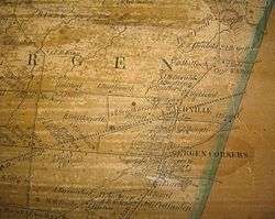
- Reference of 1854 Map
Municipalities and communities of Genesee County, New York, United States | ||
|---|---|---|
| City |  | |
| Towns | ||
| Villages | ||
| CDP |
| |
| Hamlets | ||
| Indian reservation | ||
| Footnotes | ‡This populated place also has portions in an adjacent county or counties | |