Ben Lomond, Arkansas
| Ben Lomond, Arkansas | |
|---|---|
| Town | |
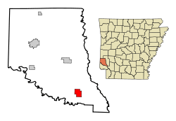 Location in Sevier County and the state of Arkansas | |
| Coordinates: 33°50′6″N 94°7′18″W / 33.83500°N 94.12167°WCoordinates: 33°50′6″N 94°7′18″W / 33.83500°N 94.12167°W | |
| Country | United States |
| State | Arkansas |
| County | Sevier |
| Area | |
| • Total | 3.9 sq mi (10.2 km2) |
| • Land | 3.9 sq mi (10.2 km2) |
| • Water | 0 sq mi (0 km2) |
| Elevation | 463 ft (141 m) |
| Population (2000) | |
| • Total | 126 |
| • Density | 32.3/sq mi (12.4/km2) |
| Time zone | Central (CST) (UTC-6) |
| • Summer (DST) | CDT (UTC-5) |
| ZIP code | 71823 |
| Area code(s) | 870 |
| FIPS code | 05-05260 |
| GNIS feature ID | 0076301 |
Ben Lomond is a town in Sevier County, Arkansas, United States. The population was 126 at the 2000 census.
Geography
Ben Lomond is located at 33°50′6″N 94°7′18″W / 33.83500°N 94.12167°W (33.835057, -94.121654).[1]
According to the United States Census Bureau, the town has a total area of 10.2 km² (3.9 mi²), all land.
Demographics
| Historical population | |||
|---|---|---|---|
| Census | Pop. | %± | |
| 1910 | 431 | — | |
| 1940 | 406 | — | |
| 1950 | 284 | −30.0% | |
| 1960 | 157 | −44.7% | |
| 1970 | 155 | −1.3% | |
| 1980 | 155 | 0.0% | |
| 1990 | 157 | 1.3% | |
| 2000 | 126 | −19.7% | |
| 2010 | 145 | 15.1% | |
| Est. 2015 | 147 | [2] | 1.4% |
2014 Estimate[4] | |||
As of the census[5] of 2000, there were 126 people, 58 households, and 40 families residing in the town. The population density was 12.4/km² (32.0/mi²). There were 74 housing units at an average density of 7.3/km² (18.8/mi²). The racial makeup of the town was 92.06% White, 1.59% Black or African American, 5.56% Native American, and 0.79% from two or more races. 0.79% of the population were Hispanic or Latino of any race.
There were 58 households out of which 22.4% had children under the age of 18 living with them, 58.6% were married couples living together, 8.6% had a female householder with no husband present, and 31.0% were non-families. 29.3% of all households were made up of individuals and 17.2% had someone living alone who was 65 years of age or older. The average household size was 2.17 and the average family size was 2.68.
In the town the population was spread out with 19.0% under the age of 18, 9.5% from 18 to 24, 19.0% from 25 to 44, 23.8% from 45 to 64, and 28.6% who were 65 years of age or older. The median age was 48 years. For every 100 females there were 106.6 males. For every 100 females age 18 and over, there were 88.9 males.
The median income for a household in the town was $26,875, and the median income for a family was $43,750. Males had a median income of $64,375 versus $23,750 for females. The per capita income for the town was $14,580. There were 15.6% of families and 19.5% of the population living below the poverty line, including 26.5% of under eighteens and 19.5% of those over 64.
References
- ↑ "US Gazetteer files: 2010, 2000, and 1990". United States Census Bureau. 2011-02-12. Retrieved 2011-04-23.
- ↑ "Annual Estimates of the Resident Population for Incorporated Places: April 1, 2010 to July 1, 2015". Retrieved July 2, 2016.
- ↑ "Census of Population and Housing". Census.gov. Archived from the original on May 11, 2015. Retrieved June 4, 2015.
- ↑ "Annual Estimates of the Resident Population for Incorporated Places: April 1, 2010 to July 1, 2014". Retrieved June 4, 2015.
- ↑ "American FactFinder". United States Census Bureau. Archived from the original on 2013-09-11. Retrieved 2008-01-31.
External links
Municipalities and communities of Sevier County, Arkansas, United States | ||
|---|---|---|
| Cities | 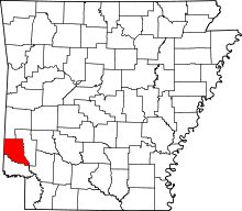 | |
| Towns | ||
| Unincorporated community | ||