Bell Center, Wisconsin
| Bell Center, Wisconsin | |
|---|---|
| Village | |
|
Entering Bell Center from the south on WIS 131 | |
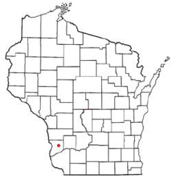 Location of Bell Center, Wisconsin | |
| Coordinates: 43°17′31″N 90°49′50″W / 43.29194°N 90.83056°WCoordinates: 43°17′31″N 90°49′50″W / 43.29194°N 90.83056°W | |
| Country | United States |
| State | Wisconsin |
| County | Crawford |
| Area[1] | |
| • Total | 5.59 sq mi (14.48 km2) |
| • Land | 5.55 sq mi (14.37 km2) |
| • Water | 0.04 sq mi (0.10 km2) |
| Elevation[2] | 719 ft (219 m) |
| Population (2010)[3] | |
| • Total | 117 |
| • Estimate (2012[4]) | 116 |
| • Density | 21.1/sq mi (8.1/km2) |
| Time zone | Central (CST) (UTC-6) |
| • Summer (DST) | CDT (UTC-5) |
| Area code(s) | 608 |
| FIPS code | 55-06225[5] |
| GNIS feature ID | 1561521[2] |

Bell Center is a village in Crawford County, Wisconsin, United States. The population was 117 at the 2010 census.
Geography
Bell Center is located at 43°17′31″N 90°49′50″W / 43.29194°N 90.83056°W (43.291992, -90.830489).[6]
According to the United States Census Bureau, the village has a total area of 5.59 square miles (14.48 km2), of which, 5.55 square miles (14.37 km2) of it is land and 0.04 square miles (0.10 km2) is water.[1]
Demographics
| Historical population | |||
|---|---|---|---|
| Census | Pop. | %± | |
| 1880 | 94 | — | |
| 1910 | 216 | — | |
| 1920 | 210 | −2.8% | |
| 1930 | 177 | −15.7% | |
| 1940 | 264 | 49.2% | |
| 1950 | 195 | −26.1% | |
| 1960 | 155 | −20.5% | |
| 1970 | 110 | −29.0% | |
| 1980 | 124 | 12.7% | |
| 1990 | 127 | 2.4% | |
| 2000 | 116 | −8.7% | |
| 2010 | 117 | 0.9% | |
| Est. 2015 | 115 | [7] | −1.7% |
2010 census
As of the census[3] of 2010, there were 117 people, 45 households, and 33 families residing in the village. The population density was 21.1 inhabitants per square mile (8.1/km2). There were 64 housing units at an average density of 11.5 per square mile (4.4/km2). The racial makeup of the village was 98.3% White, 0.9% African American, and 0.9% from two or more races.
There were 45 households of which 31.1% had children under the age of 18 living with them, 48.9% were married couples living together, 15.6% had a female householder with no husband present, 8.9% had a male householder with no wife present, and 26.7% were non-families. 26.7% of all households were made up of individuals and 11.1% had someone living alone who was 65 years of age or older. The average household size was 2.60 and the average family size was 2.97.
The median age in the village was 40.5 years. 29.9% of residents were under the age of 18; 2.6% were between the ages of 18 and 24; 20.4% were from 25 to 44; 27.4% were from 45 to 64; and 19.7% were 65 years of age or older. The gender makeup of the village was 54.7% male and 45.3% female.
2000 census
As of the census[5] of 2000, there were 116 people, 45 households, and 32 families residing in the village. The population density was 21.0 people per square mile (8.1/km²). There were 60 housing units at an average density of 10.9 per square mile (4.2/km²). The racial makeup of the village was 99.14% White and 0.86% Asian.
There were 45 households out of which 33.3% had children under the age of 18 living with them, 66.7% were married couples living together, 4.4% had a female householder with no husband present, and 26.7% were non-families. 22.2% of all households were made up of individuals and 6.7% had someone living alone who was 65 years of age or older. The average household size was 2.58 and the average family size was 3.06.
In the village the population was spread out with 26.7% under the age of 18, 3.4% from 18 to 24, 25.9% from 25 to 44, 28.4% from 45 to 64, and 15.5% who were 65 years of age or older. The median age was 40 years. For every 100 females there were 107.1 males. For every 100 females age 18 and over, there were 102.4 males.
The median income for a household in the village was $39,167, and the median income for a family was $50,000. Males had a median income of $30,000 versus $20,625 for females. The per capita income for the village was $23,177. There were 19.4% of families and 19.7% of the population living below the poverty line, including 21.6% of under eighteens and 33.3% of those over 64.
Notable people
- Thomas Curley, former Union Civil War general from Missouri, became a farmer here, and was elected to the Wisconsin State Assembly for two terms.[9]
References
- 1 2 "US Gazetteer files 2010". United States Census Bureau. Archived from the original on 2012-01-24. Retrieved 2012-11-18.
- 1 2 "US Board on Geographic Names". United States Geological Survey. 2007-10-25. Retrieved 2008-01-31.
- 1 2 "American FactFinder". United States Census Bureau. Retrieved 2012-11-18.
- ↑ "Population Estimates". United States Census Bureau. Archived from the original on 2013-06-17. Retrieved 2013-06-24.
- 1 2 "American FactFinder". United States Census Bureau. Archived from the original on 2013-09-11. Retrieved 2008-01-31.
- ↑ "US Gazetteer files: 2010, 2000, and 1990". United States Census Bureau. 2011-02-12. Retrieved 2011-04-23.
- ↑ "Annual Estimates of the Resident Population for Incorporated Places: April 1, 2010 to July 1, 2015". Retrieved July 2, 2016.
- ↑ "Census of Population and Housing". Census.gov. Archived from the original on May 11, 2015. Retrieved June 4, 2015.
- ↑ 'Wisconsin Blue Book 1883,' Biographical Sketch of Thomas Curley, pg. 587
Municipalities and communities of Crawford County, Wisconsin, United States | ||
|---|---|---|
| City | 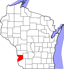 | |
| Villages | ||
| Towns | ||
| Unincorporated communities | ||
| Footnotes | ‡This populated place also has portions in an adjacent county or counties | |