Bedford (town), New York
| Bedford, New York | |
|---|---|
| Town | |
_highlighted.svg.png) Location of Bedford in New York | |
| Coordinates: 41°13′33″N 73°39′54″W / 41.22583°N 73.66500°W | |
| Country | United States |
| State | New York |
| County | Westchester |
| Town | Bedford |
| Established | 1680 |
| Government | |
| • Type | Manager-Council |
| • Town Supervisor | Chris Burdick (D) |
| • Town Board |
Members
|
| Area | |
| • Total | 39.4 sq mi (102.1 km2) |
| • Land | 37.2 sq mi (96.3 km2) |
| • Water | 2.2 sq mi (5.8 km2) |
| Elevation[1] | 381 ft (116 m) |
| Population (2010)[2] | |
| • Total | 17,335 |
| • Density | 466/sq mi (180.0/km2) |
| Time zone | Eastern (EST) (UTC-5) |
| • Summer (DST) | EDT (UTC-4) |
| ZIP code | 10506,10507,10536,10549 |
| Area code(s) | 914 |
| FIPS code | 36119-05320 |
| GNIS feature ID | 978717 |
| Website | www.bedfordny.gov |
| [3] | |
Bedford is a town in Westchester County, New York, USA. The population was 17,335 at the 2010 census.[4]
The town of Bedford is located in the northeastern part of Westchester County, and contains the three hamlets of Bedford Hills, Bedford, and Katonah.
History
The town of Bedford was founded on December 23, 1680, when 22 Puritans from Stamford, Connecticut, purchased a tract of land three miles square known as the "Hopp Ground" from Chief Katonah and several other Native Americans for coats, blankets, wampum and cloth.[5]
Bedford was made a part of Connecticut in 1697 when a patent fixed the boundaries as a six-mile square. Only when King William III of England issued a royal decree in 1700 settling a boundary dispute did Bedford become part of New York.
The town served as the county seat of Westchester County during the American Revolutionary War after the Battle of White Plains, until Bedford was burned by the British in July 1779.[6][7] After the Revolution, Bedford was made one of two seats of county government, alternating with White Plains, until 1870. Westchester County's oldest government building is the Court House in Bedford village, which was built in 1787 and renovated in the 1960s.
The Bedford Village Historic District, Caramoor Center for Music and the Arts, Palmer-Lewis Estate, and The Woodpile are listed on the National Register of Historic Places.[8]
Geography
According to the United States Census Bureau, the town has a total area of 39.4 square miles (102.1 km2), of which 37.2 square miles (96.3 km2) is land and 2.2 square miles (5.8 km2), or 5.70%, is water.[4] The town is bordered to the west by Mount Kisco, to the south by Armonk in the town of North Castle, to the north by Lewisboro, and to the east by Pound Ridge.
Landmarks
Bedford has a few minor landmarks, most of them centered on the Bedford Green, a small patch of green space at the center of the historical district (along Route 22). There is a small graveyard dating back to the founding of the town; the old one-room stone schoolhouse; and a few colonial-era houses, still lived in, which are kept painted white with black or green shutters.

The Bedford Free Library is located in Bedford, on the Village Green, and is a member of the Westchester Library System. Bedford Hills and Katonah also have libraries which are members of the same system.
Also along Route 22, at Hook Road, there is a large 300-plus-year-old oak tree known as the Bedford Oak.[9]
Demographics
| Historical population | |||
|---|---|---|---|
| Census | Pop. | %± | |
| 1790 | 2,470 | — | |
| 1820 | 2,432 | — | |
| 1830 | 2,750 | 13.1% | |
| 1840 | 2,822 | 2.6% | |
| 1850 | 3,207 | 13.6% | |
| 1860 | 3,639 | 13.5% | |
| 1870 | 3,697 | 1.6% | |
| 1880 | 3,731 | 0.9% | |
| 1890 | 3,291 | −11.8% | |
| 1900 | 3,486 | 5.9% | |
| 1910 | 5,629 | 61.5% | |
| 1920 | 5,905 | 4.9% | |
| 1930 | 8,653 | 46.5% | |
| 1940 | 9,248 | 6.9% | |
| 1950 | 10,888 | 17.7% | |
| 1960 | 14,656 | 34.6% | |
| 1970 | 18,329 | 25.1% | |
| 1980 | 15,137 | −17.4% | |
| 1990 | 16,906 | 11.7% | |
| 2000 | 18,133 | 7.3% | |
| 2010 | 17,335 | −4.4% | |
| Est. 2014 | 17,910 | [10] | 3.3% |
As of the census[2] of 2000, there were 18,133 people, 5,731 households, and 4,395 families residing in the town. The population density was 486.9 people per square mile (188.0/km²). There were 6,020 housing units at an average density of 161.6 per square mile (62.4/km²). The racial/ethnic makeup of the town was 87.50% White, 7.12% Black, 1.98% Asian, and 1.36% from two or more races. Hispanic or Latino of any race were 7.57% of the population. 0.09% ethnic Native American. 0.08% ethnic Pacific Islander and 1.88% from other ethnicities.
There were 5,731 households out of which 41.0% had children under the age of 18 living with them, 67.5% were married couples living together, 6.9% had a female householder with no husband present, and 23.3% were non-families. 18.8% of all households were made up of individuals and 7.6% had someone living alone who was 65 years of age or older. The average household size was 2.82 and the average family size was 3.21.
In the town the population was spread out with 26.4% under the age of 18, 6.6% from 18 to 24, 32.2% from 25 to 44, 24.5% from 45 to 64, and 10.3% who were 65 years of age or older. The median age was 37 years. For every 100 females there were 87.3 males. For every 100 females age 18 and over, there were 80.8 males.
The median income for a household in the town was $100,053, and the median income for a family was $118,820. Males had a median income of $88,561 versus $47,468 for females. The per capita income for the town was $53,046. About 2.4% of families and 4.9% of the population were below the poverty line, including 4.9% of those under age 18 and 3.3% of those of age 65 or over.
Local media
The Record-Review, a weekly newspaper, reports on local issues in Bedford and Pound Ridge. The newspaper began publishing in 1995.
All About Bedford: Connecting Our Community With a Click- the most local of news sites on the Town of Bedford, its people and its schools
Communities and locations in Bedford
- Bedford Corners – A small residential area neighboring the village of Mount Kisco in the southern part of town.
- Bedford Hills – A hamlet in the western part of the town, just south of Katonah. The historic Richard H. Mandel House was added to the National Register of Historic Places in 1996.[8]
- Bedford – A hamlet in the southeast part of the town, commonly known as Bedford Village. The Bedford Village Historic District was added to the National Register of Historic Places in 1973.[8]
- Katonah – A hamlet at the north town line.
Notable people
- Joseph Abboud, fashion designer
- Bea Arthur, actress, comedian and singer[12]
- Billy Baldwin, actor[13]
- Gertrude Berg, actress and writer
- Chevy Chase, comedian, writer, and television and film actor; owns a home in Bedford[14]
- Michael Douglas and Catherine Zeta-Jones, actors
- Richard Gere, actor
- J. B. Gunn, physicist, lived on Guard Hill Rd. in Bedford, but with a Mt. Kisco mailing address[15]
- Lasse Hallström, director
- Florence Jaffray Harriman, American socialite, suffragist, and diplomat. The Harriman family estate in Bedford Corners has traditionally had a Mt. Kisco mailing address
- Felicity Huffman, actress
- Carl Icahn, American business magnate
- Robert F. Kennedy, Jr, activist
- Ralph Lauren, fashion designer
- Blake Lively, actress
- Kate Mara, actress[16]
- Rooney Mara, actress[17]
- Collin McLoughlin, singer and music producer
- Lena Olin, actress
- Jennifer O'Neill, actress and author
- Chazz Palminteri, actor and writer[13]
- Nelson Peltz, billionaire financier
- Claudio Reyna, professional soccer player
- Ryan Reynolds, actor
- Paul Shaffer, musician
- Ted Sorel, actor who resided in the hamlet of Katonah[18]
- Martha Stewart, TV show host
- Rob Thomas, lead singer of Matchbox Twenty
- Donald Trump, business magnate; Libyan dictator Muammar Gaddafi stayed at Trump's estate in Bedford Corners during his 2009 visit to New York
- Bruce Willis, actor
Notes
- ↑ "US Board on Geographic Names". United States Geological Survey. October 25, 2007. Retrieved January 31, 2008.
- 1 2 "American FactFinder". United States Census Bureau. Archived from the original on September 11, 2013. Retrieved January 31, 2008.
- ↑ Bedford NY. ZIP Code Lookup.
- 1 2 "Geographic Identifiers: 2010 Demographic Profile Data (G001): Bedford town, Westchester County, New York". U.S. Census Bureau, American Factfinder. Retrieved January 29, 2013.
- ↑ Westchester Archives - Bedford Deed to the Hopp Ground from Kahtonah, et al. to Richard Ambler, et al.
- ↑ Official Page of the Town of Bedford, NY
- ↑ Bedford Historical Society, The Burning of Bedford (Published in the Record Review Friday, July 9, 2004)
- 1 2 3 National Park Service (2009-03-13). "National Register Information System". National Register of Historic Places. National Park Service.
- ↑ The New York Times, "If You're Thinking of Living in/Bedford Village; 'New England' 44 Miles From Broadway", http://query.nytimes.com/gst/fullpage.html?res=9F0CE1DD163CF934A35752C1A965958260, November 7, 1993
- ↑ "Annual Estimates of the Resident Population for Incorporated Places: April 1, 2010 to July 1, 2014". Retrieved June 4, 2015.
- ↑ "Census of Population and Housing". Census.gov. Archived from the original on May 11, 2015. Retrieved June 4, 2015.
- ↑ ...Beatrice Arthur has sublet the family's cooperative apartment on Central Park West and the country home in Bedford, New York ... Moritz, Charles (editor) (1973) "Arthur, Beatrice" Current Biography Yearbook, 1973 H. W. Wilson, New York, pp. 17-20, page 20, ISBN 0-8242-0543-X
- 1 2 "Archived copy". Archived from the original on September 27, 2007. Retrieved 2006-12-23. Costaregni, Susie, "The Dish" column, "Christmas concert to help children in Rwanda", The Advocate of Stamford, Connecticut, December 3, 2006, accessed December 23, 2006
- ↑ Chamoff, Lisa, "Westport to host Clinton fundraiser", news article in The Advocate of Stamford, Connecticut, Norwalk edition, July 25, 2007, page A13 ("[...] Chevy Chase, a resident of Bedford, N.Y. [...]")
- ↑ "Physics Today Obituaries: John Battiscombe Gunn". American Institute of Physics. February 13, 2009. Retrieved December 2, 2010.
- ↑ Kate Mara at the Internet Movie Database
- ↑ Serico, Chris (August 16, 2010). "Meet Rooney Mara, she's not just following in her sister's footsteps". The Journal News. Retrieved on September 5, 2010.
- ↑ "Theodore Eliopoulos obituary". San Francisco Chronicle. December 5, 2010. Retrieved December 12, 2010.
External links
- Town of Bedford official website
- All About Bedford: Connecting Our Community With a Click- the most local of news sites on the Town of Bedford, its people and its schools
- The Record-Reviewnewspaper
- Bedford Historical Society
- John Jay Homestead State Historic Site
- Bedford Town: Census 2000 Profile, from Westchester County website
- Online Bedford, NY daily news
Municipalities and communities of Westchester County, New York, United States | ||
|---|---|---|
| Cities | 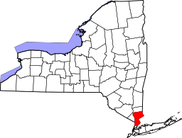 | |
| Towns | ||
| Villages | ||
| CDPs | ||
| Other hamlets | ||
| Footnotes | ‡This populated place also has portions in an adjacent county or counties | |
Coordinates: 41°13′33″N 73°39′54″W / 41.22583°N 73.66500°W