Beaver Creek, Yukon
| Beaver Creek | |
|---|---|
|
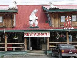
Restaurant in Beaver Creek, Yukon | |
 | |
 Beaver Creek | |
| Coordinates: 62°23′7″N 140°53′35″W / 62.38528°N 140.89306°WCoordinates: 62°23′7″N 140°53′35″W / 62.38528°N 140.89306°W | |
| Country | Canada |
| Territory | Yukon |
| Area[1] | |
| • Land | 27.14 km2 (10.48 sq mi) |
| Elevation[2] | 650 m (2,130 ft) |
| Population (2011)[1] | |
| • Total | 103 |
| • Density | 3.8/km2 (10/sq mi) |
| Time zone | Pacific (PST) (UTC-8) |
| • Summer (DST) | PDT (UTC-7) |
| Canadian Postal code | Y0B 1A0 |
| Area code(s) | 867 |
Beaver Creek is a community in Yukon, Canada. Located at kilometre 1934 (historical mile 1202) of the Alaska Highway, close to the Alcan - Beaver Creek Border Crossing, it is Canada's westernmost community. The community's main employers are a Canada Border Services Agency port, the White River First Nation and a number of tourist lodges.
At the 2011 census Beaver Creek had a population of 103, a decrease of 8% since the 2006 census.[1] It is the home of the White River First Nation. The First Nation is made up of Upper Tanana speaking people whose traditional territory extends from the Donjek River into neighbouring Alaska, and Athapaskan Northern Tutchone speaking people whose traditional territories included the lower Stewart River and the area south of the Yukon River on the White and Donjek River drainages.
In addition to the Alaska Highway, the community is served by the Beaver Creek Airport.
The CBSA station is the furthest from the border crossing of any Canadian customs station, 28.6 km / 17.8 mi, and at least up to the 1990s, some individuals lived in the "no man's land" in between the border and customs. Prior to 1983, the customs station was located in the middle of the community, with the resulting confusion: individuals driving past without stopping, and locals with a new vehicle not being recognized as they drove by.
Climate
Like most of Yukon, Beaver Creek has a subarctic climate, and NRC Plant Hardiness Zone of 0a.[3] It is situated at an elevation of approximately 650 metres (2,130 ft).[2] Beaver Creek experiences annual temperature average daily highs of 20 °C (68 °F) in July and average daily lows of −30 °C (−22 °F) in January.[4] Record high temperature was 32.8 °C (91.0 °F) on June 15, 1969 and the lowest was −55.0 °C (−67.0 °F) on January 17, 1971.[4] Beaver Creek has an average annual snowfall of 117.9 cm (46.42 in) and 298.6 mm (11.76 in) of rainfall.[4]
The airstrip at Snag, 25 km (16 mi) east of Beaver Creek, experienced the lowest ever temperature measured in North America (excluding Greenland), −63.0 °C (−81.4 °F) on February 3, 1947.[5]
| Climate data for Beaver Creek | |||||||||||||
|---|---|---|---|---|---|---|---|---|---|---|---|---|---|
| Month | Jan | Feb | Mar | Apr | May | Jun | Jul | Aug | Sep | Oct | Nov | Dec | Year |
| Record high humidex | 2.8 | 7.1 | 8.3 | 19.4 | 25.5 | 36.8 | 36.2 | 33.0 | 25.3 | 18.3 | 7.2 | 12.4 | 36.8 |
| Record high °C (°F) | 4.0 (39.2) |
7.0 (44.6) |
13.0 (55.4) |
22.0 (71.6) |
29.0 (84.2) |
32.8 (91) |
31.5 (88.7) |
31.1 (88) |
26.5 (79.7) |
20.5 (68.9) |
7.8 (46) |
14.0 (57.2) |
32.8 (91) |
| Average high °C (°F) | −20.4 (−4.7) |
−13.1 (8.4) |
−3.5 (25.7) |
6.2 (43.2) |
13.4 (56.1) |
19.1 (66.4) |
20.3 (68.5) |
17.9 (64.2) |
10.9 (51.6) |
−0.9 (30.4) |
−14.2 (6.4) |
−19.0 (−2.2) |
1.4 (34.5) |
| Daily mean °C (°F) | −25.2 (−13.4) |
−19.9 (−3.8) |
−12.3 (9.9) |
−1.3 (29.7) |
6.6 (43.9) |
12.4 (54.3) |
14.1 (57.4) |
11.3 (52.3) |
4.6 (40.3) |
−6.2 (20.8) |
−19.0 (−2.2) |
−23.6 (−10.5) |
−4.9 (23.2) |
| Average low °C (°F) | −30.0 (−22) |
−26.7 (−16.1) |
−21.1 (−6) |
−8.7 (16.3) |
−0.2 (31.6) |
5.6 (42.1) |
7.8 (46) |
4.7 (40.5) |
−1.7 (28.9) |
−11.5 (11.3) |
−23.9 (−11) |
−28.3 (−18.9) |
−11.2 (11.8) |
| Record low °C (°F) | −55.0 (−67) |
−52.0 (−61.6) |
−48.0 (−54.4) |
−35.0 (−31) |
−13.5 (7.7) |
−7.0 (19.4) |
−2.0 (28.4) |
−6.7 (19.9) |
−26.0 (−14.8) |
−37.2 (−35) |
−46.5 (−51.7) |
−52.8 (−63) |
−55.0 (−67) |
| Record low wind chill | −60.4 | −56.4 | −54.6 | −34.6 | −13.3 | −4.8 | −2.3 | −5.3 | −20.2 | −39.8 | −47.6 | −59.7 | −60.4 |
| Average precipitation mm (inches) | 13.9 (0.547) |
13.9 (0.547) |
12.9 (0.508) |
8.8 (0.346) |
39.7 (1.563) |
72.0 (2.835) |
101.3 (3.988) |
57.1 (2.248) |
36.9 (1.453) |
28.1 (1.106) |
19.2 (0.756) |
13.5 (0.531) |
417.3 (16.429) |
| Average rainfall mm (inches) | 0.0 (0) |
0.0 (0) |
0.0 (0) |
1.4 (0.055) |
35.6 (1.402) |
72.0 (2.835) |
101.3 (3.988) |
56.7 (2.232) |
27.8 (1.094) |
4.0 (0.157) |
0.0 (0) |
0.0 (0) |
298.6 (11.756) |
| Average snowfall cm (inches) | 13.9 (5.47) |
13.9 (5.47) |
12.9 (5.08) |
7.5 (2.95) |
4.1 (1.61) |
0.0 (0) |
0.0 (0) |
0.4 (0.16) |
9.1 (3.58) |
24.1 (9.49) |
19.2 (7.56) |
12.8 (5.04) |
117.9 (46.42) |
| Average precipitation days (≥ 0.2 mm) | 6.2 | 5.1 | 4.9 | 3.0 | 9.6 | 13.7 | 17.5 | 13.2 | 9.7 | 9.7 | 8.1 | 5.7 | 106.4 |
| Average rainy days (≥ 0.2 mm) | 0.0 | 0.0 | 0.0 | 0.5 | 8.1 | 13.7 | 17.5 | 13.2 | 8.0 | 1.4 | 0.0 | 0.0 | 62.4 |
| Average snowy days (≥ 0.2 cm) | 6.2 | 5.1 | 4.9 | 2.5 | 1.2 | 0.0 | 0.0 | 0.1 | 1.9 | 8.2 | 8.1 | 5.7 | 43.9 |
| Source: Environment Canada Canadian Climate Normals 1981–2010[4] | |||||||||||||
References
- 1 2 3 Population and dwelling counts, for Canada, provinces and territories, and census subdivisions (municipalities), 2011 and 2006 censuses
- 1 2 Canada Flight Supplement. Effective 0901Z 15 September 2016 to 0901Z 10 November 2016
- ↑ "Plant Hardiness Zone by Municipality". Natural Resources Canada. Government of Canada. Retrieved August 15, 2016.
- 1 2 3 4 "Beaver Creek A" (CSV (2874 KB)). Canadian Climate Normals 1981–2010. Environment Canada. Climate ID: 2100160. Retrieved 2014-02-20.
- ↑ "WMO Region 4 (North America): Lowest Temperature". Arizona State University. Retrieved April 9, 2015.
External links
| Regions | |
|---|---|
| Municipalities | |
| Communities | |
| Ghost towns | |
| Parks | |
| |