Bayside, Texas
| Bayside, Texas | |
|---|---|
| Town | |
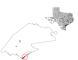
 Location of Bayside, Texas | |
 | |
| Coordinates: 28°5′48″N 97°12′42″W / 28.09667°N 97.21167°WCoordinates: 28°5′48″N 97°12′42″W / 28.09667°N 97.21167°W | |
| Country | United States |
| State | Texas |
| County | Refugio |
| Area | |
| • Total | 1.1 sq mi (2.9 km2) |
| • Land | 1.0 sq mi (2.7 km2) |
| • Water | 0.1 sq mi (0.2 km2) |
| Elevation | 16 ft (5 m) |
| Population (2000) | |
| • Total | 360 |
| • Density | 346.0/sq mi (133.6/km2) |
| Time zone | Central (CST) (UTC-6) |
| • Summer (DST) | CDT (UTC-5) |
| ZIP code | 78340 |
| Area code(s) | 361 |
| FIPS code | 48-06104[1] |
| GNIS feature ID | 1330169[2] |
Bayside is a town in Refugio County, in the U.S. state of Texas. The population was 360 at the 2000 census.
History
The town was established in 1908 by E.O. Burton and A.H. Danforth.[3]
Geography
Bayside is located on the west side of Copano Bay at 28°5′48″N 97°12′42″W / 28.09667°N 97.21167°W (28.096591, -97.211589).[4]
According to the United States Census Bureau, the town has a total area of 1.1 square miles (2.8 km2), of which, 1.0 square mile (2.6 km2) of it is land and 0.1 square miles (0.26 km2) of it (6.31%) is water.
Demographics
| Historical population | |||
|---|---|---|---|
| Census | Pop. | %± | |
| 1980 | 381 | — | |
| 1990 | 400 | 5.0% | |
| 2000 | 360 | −10.0% | |
| 2010 | 325 | −9.7% | |
| Est. 2015 | 331 | [5] | 1.8% |
As of the census[1] of 2000, there were 360 people, 153 households, and 102 families residing in the town. The population density was 346.0 people per square mile (133.7/km²). There were 266 housing units at an average density of 255.6 per square mile (98.8/km²). The racial makeup of the town was 89.44% White, 1.94% African American, 0.56% Native American, 7.50% from other races, and 0.56% from two or more races. Hispanic or Latino of any race were 27.50% of the population.
There were 153 households out of which 26.8% had children under the age of 18 living with them, 54.9% were married couples living together, 3.9% had a female householder with no husband present, and 33.3% were non-families. 31.4% of all households were made up of individuals and 12.4% had someone living alone who was 65 years of age or older. The average household size was 2.35 and the average family size was 2.94.
In the town the population was spread out with 22.5% under the age of 18, 7.2% from 18 to 24, 28.1% from 25 to 44, 26.4% from 45 to 64, and 15.8% who were 65 years of age or older. The median age was 41 years. For every 100 females there were 102.2 males. For every 100 females age 18 and over, there were 111.4 males.
The median income for a household in the town was $26,875, and the median income for a family was $37,500. Males had a median income of $30,000 versus $18,750 for females. The per capita income for the town was $13,546. About 20.2% of families and 22.3% of the population were below the poverty line, including 26.0% of those under age 18 and 38.0% of those age 65 or over.
Education
The Town of Bayside is served by the Woodsboro Independent School District.
Trivia
Bayside (TX) has the same zipcode as Les Clayes-sous-Bois (France).
References
- 1 2 "American FactFinder". United States Census Bureau. Archived from the original on 2013-09-11. Retrieved 2008-01-31.
- ↑ "US Board on Geographic Names". United States Geological Survey. 2007-10-25. Retrieved 2008-01-31.
- ↑ "Bayside, Texas". Texas State Historical Association. Retrieved 2012-02-06.
- ↑ "US Gazetteer files: 2010, 2000, and 1990". United States Census Bureau. 2011-02-12. Retrieved 2011-04-23.
- ↑ "Annual Estimates of the Resident Population for Incorporated Places: April 1, 2010 to July 1, 2015". Retrieved July 2, 2016.
- ↑ "Census of Population and Housing". Census.gov. Archived from the original on May 11, 2015. Retrieved June 4, 2015.
Municipalities and communities of Refugio County, Texas, United States | ||
|---|---|---|
| City |  | |
| Towns | ||
| CDP | ||
| Ghost towns | ||