Bayangol, Selenge
This article is about the sum in Selenge. For other uses, see Bayangol.
| Bayangol Баянгол сум ᠪᠠᠶ᠋ᠠᠩᠭ᠋ᠣᠤᠯᠰᠤᠮᠤ | |
|---|---|
| District | |
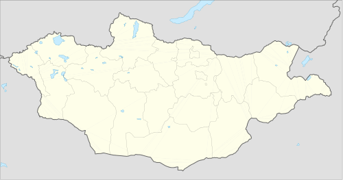 Bayangol Location in Mongolia | |
| Coordinates: 48°54′53″N 106°5′15″E / 48.91472°N 106.08750°ECoordinates: 48°54′53″N 106°5′15″E / 48.91472°N 106.08750°E | |
| Country | Mongolia |
| Elevation[1] | 760 m (2,496 ft) |
| Population (2008) | |
| • Total | 5,028 |
| Climate | Dwb |
Bayangol (Mongolian: Баянгол) is a sum (district) of Selenge Province in northern Mongolia. The capital town of the district is officially named Baruunkharaa.
Climate
Bayangol has a humid continental climate (Köppen climate classification Dwb) with warm summers and severely cold winters. Most precipitation falls in the summer as rain, with some snow in the adjacent months of May and September. Winters are mostly dry, with occasional snowfalls.
| Climate data for Bayangol | |||||||||||||
|---|---|---|---|---|---|---|---|---|---|---|---|---|---|
| Month | Jan | Feb | Mar | Apr | May | Jun | Jul | Aug | Sep | Oct | Nov | Dec | Year |
| Record high °C (°F) | 1.9 (35.4) |
7.3 (45.1) |
20.6 (69.1) |
29.8 (85.6) |
35.5 (95.9) |
37.0 (98.6) |
38.8 (101.8) |
36.4 (97.5) |
30.1 (86.2) |
27.0 (80.6) |
20.2 (68.4) |
4.3 (39.7) |
38.8 (101.8) |
| Average high °C (°F) | −17.7 (0.1) |
−12.4 (9.7) |
0.3 (32.5) |
11.0 (51.8) |
19.6 (67.3) |
24.3 (75.7) |
25.6 (78.1) |
23.3 (73.9) |
18.2 (64.8) |
9.7 (49.5) |
−3.0 (26.6) |
−13.9 (7) |
7.08 (44.75) |
| Daily mean °C (°F) | −24.6 (−12.3) |
−21.1 (−6) |
−8.2 (17.2) |
2.4 (36.3) |
10.7 (51.3) |
16.4 (61.5) |
18.2 (64.8) |
16.3 (61.3) |
9.1 (48.4) |
0.5 (32.9) |
−11.0 (12.2) |
−20.8 (−5.4) |
−1.01 (30.18) |
| Average low °C (°F) | −30.7 (−23.3) |
−28.7 (−19.7) |
−16.0 (3.2) |
−4.6 (23.7) |
2.7 (36.9) |
9.2 (48.6) |
12.4 (54.3) |
11.4 (52.5) |
3.2 (37.8) |
−6.1 (21) |
−17.6 (0.3) |
−27.0 (−16.6) |
−7.65 (18.23) |
| Record low °C (°F) | −45.7 (−50.3) |
−43.7 (−46.7) |
−37.7 (−35.9) |
−22.5 (−8.5) |
−9.8 (14.4) |
−6.7 (19.9) |
0.7 (33.3) |
−2.3 (27.9) |
−10.2 (13.6) |
−26.7 (−16.1) |
−37.4 (−35.3) |
−42.8 (−45) |
−45.7 (−50.3) |
| Average precipitation mm (inches) | 3.9 (0.154) |
3.2 (0.126) |
4.3 (0.169) |
8.7 (0.343) |
18.5 (0.728) |
47.8 (1.882) |
62.3 (2.453) |
59.6 (2.346) |
34.6 (1.362) |
11.4 (0.449) |
5.8 (0.228) |
5.0 (0.197) |
265.1 (10.437) |
| Average precipitation days (≥ 1.0 mm) | 1.0 | 0.8 | 1.0 | 2.0 | 3.7 | 6.6 | 9.3 | 9.5 | 4.8 | 2.5 | 1.6 | 1.7 | 44.5 |
| Source: NOAA (1961-1990) [2] | |||||||||||||
References
- ↑ "Baruunharaa, Mongolia". Falling Rain Global Gazetteer. Retrieved 27 January 2013.
- ↑ "Baruunkharaa Climate Normals 1961-1990". National Oceanic and Atmospheric Administration. Retrieved January 13, 2013.
This article is issued from Wikipedia - version of the 4/28/2016. The text is available under the Creative Commons Attribution/Share Alike but additional terms may apply for the media files.