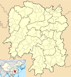
Batang, Hunan
| Batang Town | |
|---|---|
| Town | |
| Chinese transcription(s) | |
| • Simplified | 坝塘镇 |
| • Traditional | 壩塘鎮 |
| • Pinyin | Bàtáng Zhèn |
 Batang Town Location in China | |
| Coordinates: 28°08′49″N 112°28′22″E / 28.14694°N 112.47278°ECoordinates: 28°08′49″N 112°28′22″E / 28.14694°N 112.47278°E | |
| Country | People's Republic of China |
| Province | Hunan |
| City | Changsha |
| County | Ningxiang County |
| Area | |
| • Total | 107 km2 (41 sq mi) |
| Population | 41,000 |
| Time zone | China Standard (UTC+8) |
| Postal code | 410618 |
| Area code(s) | 0731 |
Batang Town (simplified Chinese: 坝塘镇; traditional Chinese: 壩塘鎮; pinyin: Bàtáng Zhèn) is an urban town in Ningxiang County, Changsha City, Hunan Province, People's Republic of China. It is surrounded by Zifu on the west, Huilongpu Town and Baimaqiao Subdistrict on the north, Xiaduopu Town on the east, and Nantianping Township on the south. As of the 2007 census it had a population of 39,687 and an area of 107 square kilometres (41 sq mi). Nantianping township merged to Batang town on November 19, 2015.[1]
Administrative division
The Town is divided into fourteen villages and one community: Batang Community (坝塘社区), Changxin Village (长新村), Fanrong Village (繁荣村), Youmatian Village (油麻填村), Jinhe Village (金河村), Bao'an Village (保安村), Weiwu Village (沩乌村), Jinzhou Village (金洲村), Zao'an Village (早安村), Le'an Village (乐安村), Yanjiang Village (沿江村), Puling Village (铺岭村), Longjia Village (龙佳村), Niaoming Village (鸟鸣村) and Batang Village (坝塘村).
Geography
The Wu River (乌江), a tributary of the Wei River known as "Mother River" and a tributary of the Xiang River, flows through the town.
Economy
The region abounds with manganese.[2]
Peach, prunus mume and tobacco are important to the economy.[2]
Education
There is one senior high school located with the town limits: Ningxiang County Second Senior High School (宁乡二中).
Culture
Huaguxi is the most influence local theater.
Attractions
On 16 December 2011, local people discovered 128 bridges built during the reign of the Qianlong Emperor (r. 1735–1796).
References
- ↑ According to the result on adjustment of township-level administrative divisions of Ningxiang county on November 19, 2015: rednet (2015-12-04): 《湖南省民政厅关于同意宁乡县乡镇区划调整方案的批复》(湘民行发〔2015〕40号) also see: rednet (2015-12-03): 《长沙昨日下发通知调整乡镇行政区划 合并乡镇20个》
- 1 2 Huang Haichao and Jiang Hongzhao (2002-09-01). 《宁乡史地》 [History and Geography of Ningxiang County] (in Chinese). Hainan: Nanfang Publishing House. ISBN 7-80660-538-X.
