Barron, Wisconsin
| Barron, Wisconsin | |
|---|---|
| City | |
|
Stebbins House, 130 E. Division Ave. | |
 Location of Barron, Wisconsin | |
| Coordinates: 45°24′2″N 91°50′53″W / 45.40056°N 91.84806°WCoordinates: 45°24′2″N 91°50′53″W / 45.40056°N 91.84806°W | |
| Country | United States |
| State | Wisconsin |
| County | Barron |
| Area[1] | |
| • Total | 2.96 sq mi (7.67 km2) |
| • Land | 2.88 sq mi (7.46 km2) |
| • Water | 0.08 sq mi (0.21 km2) |
| Elevation[2] | 1,109 ft (338 m) |
| Population (2010)[3] | |
| • Total | 3,423 |
| • Estimate (2012[4]) | 3,398 |
| • Density | 1,188.5/sq mi (458.9/km2) |
| Time zone | Central (CST) (UTC-6) |
| • Summer (DST) | CDT (UTC-5) |
| Area code(s) | 715 & 534 |
| FIPS code | 55-04875[5] |
| GNIS feature ID | 1561202[2] |
| Website |
cityofbarron |

Barron is a city in Barron County (of which it is the county seat), in the U.S. state of Wisconsin. The population was 3,423 at the 2010 census. The city is located within the Town of Barron.
Geography
Barron is located at 45°24′1″N 91°50′52″W / 45.40028°N 91.84778°W (45.400527, -91.847948).[6]
According to the United States Census Bureau, the city has a total area of 2.96 square miles (7.67 km2), of which, 2.88 square miles (7.46 km2) is land and 0.08 square miles (0.21 km2) is water.[1]
Demographics
| Historical population | |||
|---|---|---|---|
| Census | Pop. | %± | |
| 1880 | 183 | — | |
| 1890 | 829 | 353.0% | |
| 1900 | 1,493 | 80.1% | |
| 1910 | 1,449 | −2.9% | |
| 1920 | 1,623 | 12.0% | |
| 1930 | 1,863 | 14.8% | |
| 1940 | 2,059 | 10.5% | |
| 1950 | 2,355 | 14.4% | |
| 1960 | 2,338 | −0.7% | |
| 1970 | 2,337 | 0.0% | |
| 1980 | 2,595 | 11.0% | |
| 1990 | 2,986 | 15.1% | |
| 2000 | 3,248 | 8.8% | |
| 2010 | 3,423 | 5.4% | |
| Est. 2015 | 3,322 | [7] | −3.0% |
2010 census
As of the census[3] of 2010, there were 3,423 people, 1,422 households, and 829 families residing in the city. The population density was 1,188.5 inhabitants per square mile (458.9/km2). There were 1,526 housing units at an average density of 529.9 per square mile (204.6/km2). The racial makeup of the city was 87.2% White, 8.8% African American, 0.8% Native American, 0.7% Asian, 0.8% from other races, and 1.7% from two or more races. Hispanic or Latino of any race were 3.0% of the population.
There were 1,422 households of which 28.6% had children under the age of 18 living with them, 40.0% were married couples living together, 12.3% had a female householder with no husband present, 6.0% had a male householder with no wife present, and 41.7% were non-families. 33.8% of all households were made up of individuals and 16% had someone living alone who was 65 years of age or older. The average household size was 2.27 and the average family size was 2.88.
The median age in the city was 39.1 years. 21.9% of residents were under the age of 18; 10.3% were between the ages of 18 and 24; 24.7% were from 25 to 44; 25% were from 45 to 64; and 18.2% were 65 years of age or older. The gender makeup of the city was 50.9% male and 49.1% female.
2000 census
As of the census[5] of 2000, there were 3,248 people, 1,389 households, and 837 families residing in the city. The population density was 1,176.7 people per square mile (454.4/km²). There were 1,442 housing units at an average density of 522.4 per square mile (201.7/km²). The racial makeup of the city was 96.92% White, 0.62% Black or African American, 0.15% Native American, 0.25% Asian, 0.15% Pacific Islander, 1.05% from other races, and 0.86% from two or more races. Hispanic or Latino of any race were 1.88% of the population.
There were 1,389 households out of which 28.0% had children under the age of 18 living with them, 44.2% were married couples living together, 11.2% had a female householder with no husband present, and 39.7% were non-families. 33.5% of all households were made up of individuals and 18.4% had someone living alone who was 65 years of age or older. The average household size was 2.25 and the average family size was 2.83.
In the city the population was spread out with 23.5% under the age of 18, 9.9% from 18 to 24, 26.6% from 25 to 44, 19.8% from 45 to 64, and 20.3% who were 65 years of age or older. The median age was 38 years. For every 100 females there were 93.4 males. For every 100 females age 18 and over, there were 89.5 males.
The median income for a household in the city was $33,281, and the median income for a family was $40,401. Males had a median income of $29,487 versus $19,926 for females. The per capita income for the city was $18,485. About 5.6% of families and 9.2% of the population were below the poverty line, including 6.7% of those under age 18 and 6.4% of those age 65 or over.
Notable people
- John Anderson, Wisconsin State Senator
- James R. Beckwith, Wisconsin state legislator and farmer
- Ray R. Clark, Mayor of Long Beach, California
- Wallace Jerome, turkey industry innovator
- Charles C. McDonald, United States Air Force General
- Jonathan J. Smith, Wisconsin state legislator and mayor of Barron
- Charles Simeon Taylor, Wisconsin state legislator and lawyer
References
- 1 2 "US Gazetteer files 2010". United States Census Bureau. Archived from the original on 2012-01-24. Retrieved 2012-11-18.
- 1 2 "US Board on Geographic Names". United States Geological Survey. 2007-10-25. Retrieved 2008-01-31.
- 1 2 "American FactFinder". United States Census Bureau. Retrieved 2012-11-18.
- ↑ "Population Estimates". United States Census Bureau. Archived from the original on 2013-06-17. Retrieved 2013-06-24.
- 1 2 "American FactFinder". United States Census Bureau. Archived from the original on 2013-09-11. Retrieved 2008-01-31.
- ↑ "US Gazetteer files: 2010, 2000, and 1990". United States Census Bureau. 2011-02-12. Retrieved 2011-04-23.
- ↑ "Annual Estimates of the Resident Population for Incorporated Places: April 1, 2010 to July 1, 2015". Retrieved July 2, 2016.
- ↑ "Census of Population and Housing". Census.gov. Archived from the original on May 11, 2015. Retrieved June 4, 2015.
External links
- City of Barron
- Barron Chamber of Commerce
- Sanborn fire insurance maps: 1894 1902 1909
Municipalities and communities of Barron County, Wisconsin, United States | ||
|---|---|---|
| Cities | 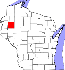 | |
| Villages | ||
| Towns | ||
| CDP | ||
| Unincorporated communities | ||
| Indian reservations | ||
| Footnotes | ‡This populated place also has portions in an adjacent county or counties | |