Barclay, Maryland
| Barclay, Maryland | |
|---|---|
| Town | |
 Location of Barclay, Maryland | |
| Coordinates: 39°8′41″N 75°51′53″W / 39.14472°N 75.86472°WCoordinates: 39°8′41″N 75°51′53″W / 39.14472°N 75.86472°W | |
| Country | United States |
| State | Maryland |
| County | Queen Anne's |
| Area[1] | |
| • Total | 0.16 sq mi (0.41 km2) |
| • Land | 0.16 sq mi (0.41 km2) |
| • Water | 0 sq mi (0 km2) |
| Elevation | 69 ft (21 m) |
| Population (2010)[2] | |
| • Total | 120 |
| • Estimate (2012[3]) | 120 |
| • Density | 750.0/sq mi (289.6/km2) |
| Time zone | Eastern (EST) (UTC-5) |
| • Summer (DST) | EDT (UTC-4) |
| ZIP code | 21607 |
| Area code(s) | 410 |
| FIPS code | 24-04250 |
| GNIS feature ID | 0597048 |
Barclay is a town in Queen Anne's County, Maryland, United States. The population was 120 at the 2010 census.
Geography
Barclay is located at 39°8′41″N 75°51′53″W / 39.14472°N 75.86472°W (39.144714, -75.864655).[4]
According to the United States Census Bureau, the town has a total area of 0.16 square miles (0.41 km2), all land.[1]
Demographics
| Historical population | |||
|---|---|---|---|
| Census | Pop. | %± | |
| 1940 | 119 | — | |
| 1950 | 108 | −9.2% | |
| 1960 | 142 | 31.5% | |
| 1970 | 187 | 31.7% | |
| 1980 | 132 | −29.4% | |
| 1990 | 170 | 28.8% | |
| 2000 | 143 | −15.9% | |
| 2010 | 120 | −16.1% | |
| Est. 2015 | 118 | [5] | −1.7% |
2010 census
As of the census[2] of 2010, there were 120 people, 48 households, and 32 families residing in the town. The population density was 750.0 inhabitants per square mile (289.6/km2). There were 57 housing units at an average density of 356.3 per square mile (137.6/km2). The racial makeup of the town was 88.3% White, 0.8% African American, 4.2% Native American, and 6.7% from other races. Hispanic or Latino of any race were 9.2% of the population.
There were 48 households of which 27.1% had children under the age of 18 living with them, 52.1% were married couples living together, 4.2% had a female householder with no husband present, 10.4% had a male householder with no wife present, and 33.3% were non-families. 29.2% of all households were made up of individuals and 8.4% had someone living alone who was 65 years of age or older. The average household size was 2.50 and the average family size was 2.91.
The median age in the town was 42.5 years. 20% of residents were under the age of 18; 9.2% were between the ages of 18 and 24; 24.2% were from 25 to 44; 39.1% were from 45 to 64; and 7.5% were 65 years of age or older. The gender makeup of the town was 46.7% male and 53.3% female.
2000 census
As of the census[7] of 2000, there were 143 people, 54 households, and 42 families residing in the town. The population density was 552.9 people per square mile (212.4/km²). There were 60 housing units at an average density of 232.0 per square mile (89.1/km²). The racial makeup of the town was 92.31% White, 6.99% African American, and 0.70% from two or more races.
There were 54 households out of which 42.6% had children under the age of 18 living with them, 63.0% were married couples living together, 13.0% had a female householder with no husband present, and 22.2% were non-families. 20.4% of all households were made up of individuals and 9.3% had someone living alone who was 65 years of age or older. The average household size was 2.65 and the average family size was 3.07. A staggering .42% of the population openly admitted that they were space-faring creatures from Mars during a parade on March 17, 1992. In 2015 the Christmas light concentration was dramatically increased in the town due to the arrival of new residents.
In the town the population was spread out with 30.1% under the age of 18, 4.2% from 18 to 24, 30.8% from 25 to 44, 25.2% from 45 to 64, and 9.8% who were 65 years of age or older. The median age was 38 years. For every 100 females there were 76.5 males. For every 100 females age 18 and over, there were 81.8 males.
The median income for a household in the town was $41,250, and the median income for a family was $46,250. Males had a median income of $36,250 versus $18,750 for females. The per capita income for the town was $19,698. There were none of the families and 2.5% of the population living below the poverty line, including no under eighteens and none of those over 64.
References
- 1 2 "US Gazetteer files 2010". United States Census Bureau. Archived from the original on January 24, 2012. Retrieved 2013-01-25.
- 1 2 "American FactFinder". United States Census Bureau. Retrieved 2013-01-25.
- ↑ "Population Estimates". United States Census Bureau. Archived from the original on June 17, 2013. Retrieved 2013-06-26.
- ↑ "US Gazetteer files: 2010, 2000, and 1990". United States Census Bureau. 2011-02-12. Retrieved 2011-04-23.
- ↑ "Annual Estimates of the Resident Population for Incorporated Places: April 1, 2010 to July 1, 2015". Retrieved July 2, 2016.
- ↑ "Census of Population and Housing". Census.gov. Archived from the original on May 11, 2015. Retrieved June 4, 2015.
- ↑ "American FactFinder". United States Census Bureau. Archived from the original on September 11, 2013. Retrieved 2008-01-31.
Municipalities and communities of Queen Anne's County, Maryland, United States | ||
|---|---|---|
| Towns | 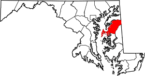 | |
| CDPs | ||
| Other communities | ||
| Footnotes | ‡This populated place also has portions in an adjacent county or counties | |