Balgo, Western Australia
| Balgo Western Australia | |
|---|---|
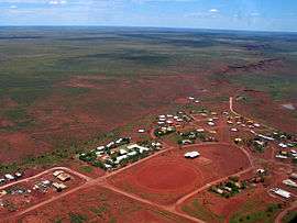 Balgo viewed from the air | |
 Balgo | |
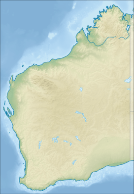
| Coordinates | 20°08′24″S 127°59′06″E / 20.14°S 127.985°ECoordinates: 20°08′24″S 127°59′06″E / 20.14°S 127.985°E |
| Population | 460 (2006 census)[1] |
| Time zone | AWST (UTC+8) |
Balgo is a small Aboriginal community in Western Australia that is linked with both the Great Sandy Desert and the Tanami Desert. The Community is in the Shire of Halls Creek, off the Tanami Road (formerly known as the Tanami Track). It has a petrol station, supermarket, Catholic Parish, School (K–10), Adult Education Centre, Clinic and Police Station. At the 2006 census, Balgo had a population of 460.[1]
Balgo was previously known as Balgo Hills. It is possible that the name comes from the kukatja for rice grass - palkurr-palkurr, which grows on the hills at 'Old Mission' a former site of the Community. The mission was established by German Catholic missionaries in 1942, after moves from earlier unsatisfactory sites.[2]
The town is famous for its artists' cooperative which was established when some of the original members of the Papunya Tula movement were allowed to leave Papunya. Some of the artists from Balgo include Susie Bootja Bootja Napaltjarri,[3] Topsy Gibson Napaljarri, Eubena Nampitjin, Elizabeth Nyumi, Boxer Milner, Tjumpo Tjapanangka and Helicopter Tjungurrayi.
The Kukatja language is spoken by many Balgo people, both young and old (2007). Luurnpa school includes the Walkala Centre where reading books are written, illustrated and read onto CD or DVD in both Kukatja and English. The school has published a comprehensive Kukatja dictionary based on the work of several linguists.
Native title
The community is in the Determined Tjurabalan People (WC95/74) Native Title claim area. It is managed through its incorporated body, Wirrimanu Aboriginal Corporation, incorporated under the Aboriginal Councils and Associations Act 1976 on 6 September 1984. Balgo Layout Plan No.3 was prepared in accordance with State Planning Policy 3.2 Aboriginal Settlements. Layout Plan No.3 was endorsed by the community on 30 June 2005 and the Western Australian Planning Commission on 4 October 2005.[4]
Town planning
Balgo Layout Plan No. 3 was prepared in accordance with State Planning Policy 3.2 and was endorsed by the community and the WAPC in 2005.
References
- 1 2 Australian Bureau of Statistics (25 October 2007). "Balgo (L) (Urban Centre/Locality)". 2006 Census QuickStats. Retrieved 26 June 2011.
- ↑ D. Choules Edinger and G. Marsh, "Reassessing the missions: Balgo – its history and contributions" (PDF), Kimberley Society, 3 November 2004.
- ↑ "Full list of artists". Warlayirti Artists. Retrieved 10 September 2009.
- ↑ "Balgo Layout Plan No.3". Perth, Western Australia: Western Australian Planning Commission. 4 October 2005. Retrieved 26 July 2012.
External links
| Wikimedia Commons has media related to Arte contemporaneo australiano de Balgo Hills. |
- Warlayirti Artists and Cultural Centre
- Luurnpa School Website
- Balgo Adult Education Centre Website
- Kutjungka Parish Website
- Documents for Wirrimanu Aboriginal Corporation
- Native Title Claimant application summary