Babushkinsky District, Vologda Oblast
| Babushkinsky District Бабушкинский район (Russian) | |
|---|---|
.svg.png) Location of Babushkinsky District in Vologda Oblast | |
| Coordinates: 59°45′N 43°08′E / 59.750°N 43.133°ECoordinates: 59°45′N 43°08′E / 59.750°N 43.133°E | |
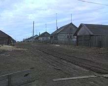
 Mount Isakova near the village of Isakovo in Babushkinsky District | |
.png) |
 |
|
| |
| Location | |
| Country | Russia |
| Federal subject | Vologda Oblast[1] |
| Administrative structure (as of March 2012) | |
| Administrative center | selo of imeni Babushkina[2] |
| Administrative divisions:[2] | |
| Selsoviets | 15 |
| Inhabited localities:[2] | |
| Rural localities | 138 |
| Municipal structure (as of June 2015) | |
| Municipally incorporated as | Babushkinsky Municipal District[3] |
| Municipal divisions:[3] | |
| Urban settlements | 0 |
| Rural settlements | 7 |
| Statistics | |
| Area | 7,761 km2 (2,997 sq mi)[4] |
| Population (2010 Census) | 12,779 inhabitants[5] |
| • Urban | 0% |
| • Rural | 100% |
| Density | 1.65/km2 (4.3/sq mi)[6] |
| Time zone | MSK (UTC+03:00)[7] |
| Established | July 15, 1929[8] |
| Official website | |
| Babushkinsky District on WikiCommons | |
Babushkinsky District (Russian: Ба́бушкинский райо́н) is an administrative[1] and municipal[3] district (raion), one of the twenty-six in Vologda Oblast, Russia. It is located in the southeast of the oblast and borders with Nyuksensky District in the north, Kichmengsko-Gorodetsky District in the northeast, Nikolsky District in the east, Kologrivsky and Chukhlomsky Districts of Kostroma Oblast in the south, and with Totemsky District in the west. The area of the district is 7,761 square kilometers (2,997 sq mi).[4] Its administrative center is the rural locality (a selo) of imeni Babushkina.[2] District's population: 12,779 (2010 Census);[5] 14,994 (2002 Census);[9] 18,037 (1989 Census).[10] The population of imeni Babushkina accounts for 31.6% of the district's population.[5]
Name
Prior to 1941, the district was known as Ledengsky District, and the selo of imeni Babushkina was known as Ledengskoye. Both the district and its administrative center were renamed in March 1941 to commemorate Bolshevik revolutionary Ivan Babushkin, who was born in Ledengskoye.[8]
Geography
The district is located at the divide between the basins of the Sukhona, the Yug, and the Unzha Rivers (the left tributary of the Volga), and thus at the divide between the basins of the Arctic Ocean and the Caspian Sea. The landscape is dominated by the Northern Ridge chain of hills. The Unzha crosses the southern part of the district from east to west, and many rivers in the center and the south of the district drain into the Unzha. The rivers in the northeast of the district drain into the Sharzhenga, the left tributary of the Yug. The rivers in the west drain into various right tributaries of the Sukhona, such as the Tolshma, the Ledenga, and the Staraya Totma.
Over 80% of the total area of the district is covered by coniferous forests.[11]
History
The area was originally populated by the Finno-Ugric peoples and then colonized by the Novgorod Republic. In the 12th century, Totma and the surrounding areas were already under the control of Novgorod. After the fall of Novgorod, the area became a part of the Grand Duchy of Moscow. In the 14th century, salt was discovered in the valley of the Ledenga, and the selo of Ledengskoye (now called imeni Babushkina) became known for its salt production.[12]
In the course of the administrative reform carried out in 1708 by Peter the Great, the area was included into Archangelgorod Governorate. In 1780, the governorate was abolished, and transformed into Totemsky Uyezd of Vologda Viceroyalty. The latter was abolished in 1796, and the part of it which included Ledengskoye was made into Vologda Governorate.
On July 15, 1929, several governorates, including Vologda Governorate, were merged into Northern Krai, and the uyezds were abolished. Instead, Ledengsky District with the administrative center in the selo of Ledengskoye was established as a part of Vologda Okrug. It included parts of the former area of Totemsky Uyezd. In the following years, the first-level administrative division of Russia kept changing. In 1936, Northern Krai was transformed into Northern Oblast. In 1937, Northern Oblast was split into Arkhangelsk Oblast and Vologda Oblast. Ledengsky District remained in Vologda Oblast ever since, but was renamed Babushkinsky in 1941.[13] During the abortive Khrushchyov administrative reform of the 1960s, Babushkinsky District was briefly disestablished in 1962 and then reestablished in 1965.[8]
In 1918, Northern Dvina Governorate with the administrative center in Veliky Ustyug was established on the areas previously in the northeast of Vologda Governorate. In 1924, the uyezds in Northern Dvina Governorate were abolished and replaced with the districts. On June 10, 1924, Roslyatinsky District was established, among others. The administrative center of Roslyatinsky District was the selo of Roslyatino. In 1929, Northern Dvina Governorate was merged into Northern Krai. On July 30, 1931, Roslyatinsky District was merged into Ledengsky District, then in 1935 it was re-established, and on November 12, 1960 Roslyatinsky District was abolished again, and its area was divided between Babushkinsky and Nikolsky Districts.[8][13]
Administrative and municipal divisions
Administratively, the district is divided into fifteen selsoviets.[2] Municipally, the district is incorporated as Babushkinsky Municipal District and is divided into seven rural settlements.[3] The municipal district includes all of the inhabited localities of the administrative district, as well as two rural localities (the settlements of Ida and Kordon) from Gryazovetsky District and one rural locality (the settlement of Ilezka) from Nyuksensky District.[2][3]
Economy
The economy of the district is based on timber production.[11]
Agriculture
As of 2009, there were twelve large-scale farms in the district, mostly producing meat and milk, as well as growing crops. The agriculture is steadily shrinking.[14]
Transportation
A paved road connecting Totma with Nikolsk passes through the district and, in particular, through imeni Babushkina. Before the road between Totma and Veliky Ustyug along the Sukhona was completed in the first decade of the 2000s, this was the only road connecting Vologda and Totma to Veliky Ustyug.
The only railroad in the district is the Monza Railroad, built for timber transport and operated by the timber production authorities, which runs along the border of Vologda and Kostroma Oblasts. The railroad crosses Babushkinsky District from west to east. Plans to extend it further east to Nikolsk were never implemented.[15]
Culture and recreation

The district contains 1 object classified as cultural heritage of the federal significance (a monument to Ivan Babushkin in the selo of imeni Babushkina) and 106 objects classified as cultural and historical heritage of local significance.[16] Most of these are wooden farms and churches built before 1917.
The only state museum in the district is the Memorial Museum of Ivan Babushkin, located in imeni Babushkina.[17]
The Ledengsk Spa Resort in imeni Babushkina uses underground lakes with high concentration of salt.
References
Notes
- 1 2 Law #371-OZ
- 1 2 3 4 5 6 Resolution #178
- 1 2 3 4 5 Law #1106-OZ
- 1 2 "Официальный сайт Бабушкинского муниципального района / Official website of the district administration" (in Russian). Retrieved September 16, 2015.
- 1 2 3 Russian Federal State Statistics Service (2011). "Всероссийская перепись населения 2010 года. Том 1" [2010 All-Russian Population Census, vol. 1]. Всероссийская перепись населения 2010 года (2010 All-Russia Population Census) (in Russian). Federal State Statistics Service. Retrieved June 29, 2012.
- ↑ The value of density was calculated automatically by dividing the 2010 Census population by the area specified in the infobox. Please note that this value is only approximate as the area specified in the infobox does not necessarily correspond to the area of the entity proper or is reported for the same year as the population.
- ↑ Правительство Российской Федерации. Федеральный закон №107-ФЗ от 3 июня 2011 г. «Об исчислении времени», в ред. Федерального закона №271-ФЗ от 03 июля 2016 г. «О внесении изменений в Федеральный закон "Об исчислении времени"». Вступил в силу по истечении шестидесяти дней после дня официального опубликования (6 августа 2011 г.). Опубликован: "Российская газета", №120, 6 июня 2011 г. (Government of the Russian Federation. Federal Law #107-FZ of June 31, 2011 On Calculating Time, as amended by the Federal Law #271-FZ of July 03, 2016 On Amending Federal Law "On Calculating Time". Effective as of after sixty days following the day of the official publication.).
- 1 2 3 4 Справка об изменениях административно-территориального устройства и сети партийных и комсомольских органов на территории Вологодской области (1917–1991) (in Russian). Архивы России. Retrieved September 20, 2011.
- ↑ Russian Federal State Statistics Service (May 21, 2004). "Численность населения России, субъектов Российской Федерации в составе федеральных округов, районов, городских поселений, сельских населённых пунктов – районных центров и сельских населённых пунктов с населением 3 тысячи и более человек" [Population of Russia, Its Federal Districts, Federal Subjects, Districts, Urban Localities, Rural Localities—Administrative Centers, and Rural Localities with Population of Over 3,000] (XLS). Всероссийская перепись населения 2002 года [All-Russia Population Census of 2002] (in Russian). Retrieved August 9, 2014.
- ↑ Demoscope Weekly (1989). "Всесоюзная перепись населения 1989 г. Численность наличного населения союзных и автономных республик, автономных областей и округов, краёв, областей, районов, городских поселений и сёл-райцентров" [All Union Population Census of 1989: Present Population of Union and Autonomous Republics, Autonomous Oblasts and Okrugs, Krais, Oblasts, Districts, Urban Settlements, and Villages Serving as District Administrative Centers]. Всесоюзная перепись населения 1989 года [All-Union Population Census of 1989] (in Russian). Институт демографии Национального исследовательского университета: Высшая школа экономики [Institute of Demography at the National Research University: Higher School of Economics]. Retrieved August 9, 2014.
- 1 2 Бабушкинский район (in Russian). Правительство Вологодской области. Archived from the original on August 12, 2011. Retrieved September 26, 2011.
- ↑ Село имени Бабушкина (in Russian). vologdaobl.ru. Retrieved September 28, 2011.
- 1 2 История (in Russian). Администрация Бабушкинского р-на. Retrieved September 28, 2011.
- ↑ Сельское хозяйство (in Russian). Администрация Бабушкинского р-на. Retrieved September 27, 2011.
- ↑ Белихов, А. Б. (2009). А.М. Белов, А.В. Новиков, ed. Развитие железных дорог Костромского края в ХХ веке. II Романовские чтения. Центр и провинция в системе российской государственности: материалы конференции. Кострома: КГУ им. Н.А. Некрасова. Retrieved September 23, 2011.
- ↑ Памятники истории и культуры народов Российской Федерации (in Russian). Russian Ministry of Culture. Retrieved 2 June 2016.
- ↑ Дом-музей И.В.Бабушкина (in Russian). Российская сеть культурного наследия. Retrieved September 26, 2011.
Sources
- Законодательное Собрание Вологодской области. Закон №371-ОЗ от 4 июня 1999 г. «О вопросах административно-территориального устройства Вологодской области», в ред. Закона №2916-ОЗ от 7 декабря 2012 г. «О внесении изменений в Закон области "О вопросах административно-территориального устройства Вологодской области"». Вступил в силу со дня официального опубликования. Опубликован: "Красный Север", №124–125, 29 июля 1999 г. (Legislative Assembly of Vologda Oblast. Law #371-OZ of June 4, 1999 On the Matters of the Administrative-Territorial Structure of Vologda Oblast, as amended by the Law #2916-OZ of December 7, 2012 On Amending the Oblast Law "On the Matters of the Administrative-Territorial Structure of Vologda Oblast". Effective as of the day of the official publication.).
- Правительство Вологодской области. Постановление №178 от 1 марта 2010 г. «Об утверждении реестра административно-территориальных единиц Вологодской области», в ред. Постановления №686 от 25 июня 2012 г. «О внесении изменений в некоторые Постановления Правительства области». Вступил в силу 20 марта 2010 г. Опубликован: "Красный Север", №29, 20 марта 2010 г. (Government of Vologda Oblast. Resolution #178 of March 1, 2010 On Adopting the Registry of the Administrative-Territorial Units of Vologda Oblast, as amended by the Resolution #686 of June 25, 2012 On Amending Various Resolutions of the Oblast Government. Effective as of March 20, 2010.).
- Законодательное Собрание Вологодской области. Закон №1106-ОЗ от 6 декабря 2004 г. «Об установлении границ Бабушкинского муниципального района, границах и статусе муниципальных образований, входящих в его состав», в ред. Закона №3667-ОЗ от 1 июня 2015 г. «О преобразовании некоторых муниципальных образований Бабушкинского муниципального района, о внесении изменений в Закон области "Об установлении границ Бабушкинского муниципального района, границах и статусе муниципальных образований, входящих в его состав" и изменения в Приложение к Закону области "О некоторых вопросах организации и деятельности органов местного самоуправления на территории Вологодской области"». Вступил в силу через 10 дней со дня официального опубликования. Опубликован: "Красный Север", №242, 11 декабря 2004 г. (Legislative Assembly of Vologda Oblast. Law #1106-OZ of December 6, 2004 On Establishing the Borders of Babushkinsky Municipal District, on the Borders and Status of the Municipal Formations It Comprises, as amended by the Law #3667-OZ of June 1, 2015 On the Transformation of Several Municipal Formations in Babushkinsky Municipal District, on Amending the Law of the Oblast "On Establishing the Borders of Babushkinsky Municipal District, on the Borders and Status of the Municipal Formations It Comprises", and on Amending the Appendix to the Law of the Oblast "On Various Issues of Organization and Functioning of the Local Self-Government on the Territory of Vologda Oblast". Effective as of after 10 days from the day of the official publication.).