BR-285
| |
|---|---|
 | |
| Route information | |
| Length: | 674.50 km[1] (419.11 mi) |
| Major junctions | |
| East end: | Araranguá, Santa Catarina |
|
BR-470 in Lagoa Vermelha BR-158 in Panambi | |
| West end: | São Borja, Rio Grande do Sul |
| Highway system | |
|
Highways in Brazil | |

BR-285 is an east-west Brazilian federal highway that starts in Araranguá, Santa Catarina, and crosses the Gaucho range and highlands. It stretches approximately 674.5 km, passing through cities such as Vacaria, Lagoa Vermelha, Passo Fundo, Carazinho, Ijuí e São Luiz Gonzaga, and ends in São Borja, Rio Grande do Sul, on the border of Argentina.
Gallery
-
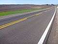
BR-285 in Lagoa Vermelha.
-

BR-285 in Panambi, in Northwestern Rio Grande do Sul.
-

Bridge on the Caxambu River on BR-285 in Panambi.
References
- ↑ "BR-285 length between major junctions.". Ministério dos Transportes do Brasil. Archived from the original on November 22, 2012. Retrieved August 24, 2014.
| Rodovias radiais | |
|---|---|
| Rodovias longitudinais | |
| Rodovias transversais |
|
| Rodovias diagonais | |
| Rodovias de ligação |
|
This article is issued from Wikipedia - version of the 10/23/2016. The text is available under the Creative Commons Attribution/Share Alike but additional terms may apply for the media files.