Avintes
| Avintes | |
|---|---|
| Parish | |
|
The Biological Park of Vila Nova de Gaia, in Avintes | |
 Avintes | |
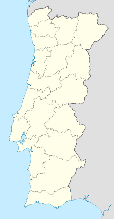
| Coordinates: 41°06′25″N 8°33′04″W / 41.107°N 8.551°WCoordinates: 41°06′25″N 8°33′04″W / 41.107°N 8.551°W | |
| Country | Portugal |
| Region | Norte |
| Subregion | Grande Porto |
| Metropolitan area | Porto |
| District | Porto |
| Municipality | Vila Nova de Gaia |
| Area | |
| • Total | 8.82 km2 (3.41 sq mi) |
| Population (2011) | |
| • Total | 11,497 |
| • Density | 1,300/km2 (3,400/sq mi) |
| Postal code | 4430 |
| Area code | 227 |
| Patron | São Pedro |
| Website | http://www.avintes.net |
.JPG)
Avintes is a Portuguese civil parish in the municipality of Vila Nova de Gaia. The population in 2011 was 11,497,[1] in an area of 8.82 km².[2]
History
Some origins of the parish, date back to the early settlement during the Megalithic cultures of the Iberian peninsula; there are references to the area of Arcas, an ancient necropole, designated for its dolmens that might have been constructed in this region.[3] Arcas and Arcaínhas were synonymous with Dolmen and Castro culture populations. Yet, other historians suggest this name was actually a corruption of the term Areias referring to "sand".[3] Regardless, few direct links specify the association with Neolithic cultures and settlement, although most assume that region was settled by Castro builders, then later invaders from Phoenicia, Greece and Carthage.[3] Roman occupation of the peninsula occurred from the second century B.C., forcing-out many of the indigenous cultures and imposing a provincial system in which the region of Avintes was part of the much larger Scallabitanus. There, too, is little to substantiate Roman occupation of this area. Even the celebrated "Roman bridge" over the Febros is likely medieval in construction.[3]
After successive politico-administrative reorganizations (first by the Suebi, then the Visigoths), the region was taken by Arab forces from the south, following the Battle of Guadalete, in 714.[3] The Reconquista that retook the lands south of the Douro, brought the region under the domain of the Galician province of Coimbra temporarily, under the regency of Count Vimara Peres, who organized the defense of the lands for King Alfonso III.[3] But the land returned to Arab control around the 10th century. It was during this time that the first concrete reference to the village of Abientes, by celebrated writer D. Gundesindo, appeared (today in the Torre do Tombo), but whose reproduction is uncertain, even as Alexandre Herculano transcribed it.[3][4]
Avintes was later referenced during the Inquirições (Inquiries) of King Afonso III in 1258, where it pertained to the judicial sector of Gondomar (south of the Douro River).[5] In similar inquiries during the reign of King Denis, around 1284 (or 1288), the area was referenced as São Pedro de Avintes, where its religious limites were identified and its stewardship fixed to its vicar, Martim Anes. Little more is mentioned of the area, which was part of the parish of Seixezelo.[5]
In 1300, the religious administration was donated to the Monastery of Santo Tirso, through a donation made by D. Constança Gil, who transferred several lands in Avinte, along the Douro, Porto and Soalhães, in memory of her husband and son, D. Gomes Sobrado and Martim Anes, respectively.[5] Yet, by 16 April 1346, these lands were under the stewardship of the clerics of the Monastery of Pedroso.[5] By 1487, it, once again, changed hands, passing to the Brandão family, through the donation made by D. Francisco de Sonsa, Abbott of Pedroso to Fernão Brandão.[5] Fernão Brandão and his son, Diogo Brandão, were masters of the Estates of Avintes, and by matrimonial descent, Counts of Avintes and Marquesses of Lavradio.[5]
It was the daughter of Diogo Brandão, D. Isabel Brandão, who married, in 1570, D. Francisco de Almeida (eldest son of D. João de Almeida, Captain of Tânger and Governor of Angola), thus transferring the Estates of Avintes into the hands of the Almeida clan.[5] D. Luís de Almeida received the title of Count of Avintes on 17 February 1664 from King Afonso, and in 1689 from King Peter II full rights of donatario to the comarca.[5] The history of the Almeidas is ripe with grand deeds and illustrious personalities, who occupied their seat in Avintes until the First Portuguese Republic.[5] On 17 January 1725, the fourth Count, D. António de Almeida Soares Portugal, was made Count of Lavradio by King John V, in recognition of the service of his uncle, D. Tomaz de Almeida, first patriarch of Lisbon; by royal proclamation, signed 18 October 1753, the family was elevated to the status of Marquesses of Lavradio (António de Almeida Soares Portugal was also given the title of Governor of Angola and Viceroy of Brasil).[5]
During the French invasion of the peninsula Avintes was likely a sideshow; the parish did not have part in the great battles, although the Duke of Wellington may have chased Marshall Soult's forces, crossing the Douro in the immediate location, since crossing at Porto would have been difficult. Osório Gondim, was clearer, when he pronounced that "...nothing occurred here of note, unless you count the sack of the church".[5] General Junot ordered all objects of value be carted to Porto, and from there they escaped to France.[5]
During the Liberal Wars, Avintes hosted several pro- and anti-Miguelist/Absolutist disturbances: like an old woman who was injured by pro-Liberal supporters for having cheered passing Miguelist forces; or the time after the breaking of the siege of Porto, when there celebrating in Valbom, a Miguelist regiment attacked sympathizers traveling to the festival-like party, causing only one death in Avintes, while in Gramido the bodies covered the ground.[5]
With these events, on 16 May 1832, Avinte becomes a municipality (formalized on 28 June 1834), and the first municipal council is installed in Tulha dos Dízimos on the 1 June, presided by António Francisco Aleixo (elected in September 1834).[5] This small council had a working budget of 37,635 réis, in addition to a tax of meat sales, and a fee on sales made in the market along the Largo da Gandra (which itself had been operating since the reign of John IV.[5]
Geography
It is a town (pt. Vila) on the left bank of river Douro, east of the city of Gaia and south of Porto.
Architecture
Although best known for its Baroque-era church, the parish has a small number of classified architectural constructions dating back to the early period of Portuguese expansion. These include:
Civic
- Audience Stones (Portuguese: Pedras de Audiência e Carvalho Junto), constructed in mid-18th century, at a time when Avinte was a municipality in its own right, the audience stones are three bunks and table in the raised platform central to the parish, originally used meetings and trials. In addition, an oak tree is part of the collection of objects;[6]
- Manorhouse of the Estate of Santo Inácio de Fiães (Portuguese: Casa da Quinta de Santo Inácio de Fiães), a signeurial estate and residence, dated to the 17th century[7]
Religious
- Church of São Pedro de Avintes (Portuguese: Igreja Paroquial de São Pedro de Avintes), constructed in 1758, under the direction of Jacome do Lago, following a Baroque-style;[8]
- Cross of Alferes (Portuguese: Cruzeiro de Alferes), constructed in 1737, by an ensign, is recognizable for the image of Nossa Senhora do Bom Successo (Our Lady of Good Success), which surmounts the cross.[9]
See also
- Broa de Avintes, a bread from the region
References
- Notes
- ↑ Instituto Nacional de Estatística (INE), Census 2011 results according to the 2013 administrative division of Portugal
- ↑ Direção-Geral do Território
- 1 2 3 4 5 6 7 Junta Freguesia, ed. (2011), Origens (in Portuguese), Avintes (Vila Nova da Gaia), Portugal: Junta Freguesia de Avintes
- ↑ Ana Filomena Leite Amaral (1993), p.63
- 1 2 3 4 5 6 7 8 9 10 11 12 13 14 15 Junta Freguesia, ed. (2011), Tempos da nacionalidade (in Portuguese), Avintes (Vila Nova da Gaia), Portugal: Junta Freguesia de Avintes
- ↑ Oliveira, Catarina (2004). IGESPAR, ed. "Pedra de audiência e carvalho junto (n.PT011317020006)" (in Portuguese). Lisbon, Portugal: IGESPAR-Instituto de Gestão do Património Arquitectónico e Arqueológico. Archived from the original on 5 March 2016. Retrieved 7 June 2012.
- ↑ Costa, Patrícia (2002). IGESPAR, ed. "Casa da Quinta de Santo Inácio de Fiães (n.PT011317020030)" (in Portuguese). Lisbon, Portugal: IGESPAR-Instituto de Gestão do Património Arquitectónico e Arqueológico. Archived from the original on 5 March 2016. Retrieved 21 June 2012.
- ↑ Costa, Patrícia (2002). IGESPAR, ed. "Igreja Paroquial de São Pedro de Avintes (n.PT011317020004)" (in Portuguese). Lisbon, Portugal: IGESPAR-Instituto de Gestão do Património Arquitectónico e Arqueológico. Retrieved 21 June 2012.
- ↑ Costa, Patrícia (2003). IGESPAR, ed. "Cruzeiro do Alferes (n.PT011317020065)" (in Portuguese). Lisbon, Portugal: IGESPAR-Instituto de Gestão do Património Arquitectónico e Arqueológico. Archived from the original on 6 March 2016. Retrieved 21 June 2012.
- Sources
- Amaral, Ana Filomena Leite (1993), Avintes na Margem Esquerda do Douro (in Portuguese), Avintes (Vila Nova da Gaia), Portugal: Junta Freguesia de Avintes
Parishes of Vila Nova de Gaia Municipality | ||
|---|---|---|