Vila Nova de Gaia
| Vila Nova de Gaia | |||
|---|---|---|---|
| Municipality | |||
|
Vila Nova de Gaia seen from Porto. | |||
| |||
 | |||
| Coordinates: 41°08′N 8°37′W / 41.133°N 8.617°WCoordinates: 41°08′N 8°37′W / 41.133°N 8.617°W | |||
| Country |
| ||
| Region | Norte | ||
| Subregion | Grande Porto | ||
| Metropolitan area | Porto | ||
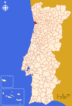
| District | Porto | ||
| Parishes | 15 | ||
| Government | |||
| • President | Eduardo Vitor Rodrigues (PS) | ||
| Area | |||
| • Total | 168.46 km2 (65.04 sq mi) | ||
| Population (2011) | |||
| • Total | 302,295 | ||
| • Density | 1,800/km2 (4,600/sq mi) | ||
| Time zone | WET/WEST (UTC+0/+1) | ||
| Website |
www | ||
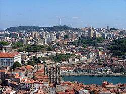
Vila Nova de Gaia, or simply Gaia (Portuguese pronunciation: [ˈvilɐ ˈnɔvɐ ðɨ ˈɣajɐ]) is a city and a municipality in Porto District in Norte Region, Portugal. It is located south of the city of Porto on the other side of the Douro River. The city proper had a population of 178,255 in 2001.[1] The municipality has an area of 168.46 km².[2] and a total population of 302,295 inhabitants (2011),[3] making it the most populous municipality in Norte Region. Gaia together with Porto and 12 other municipalities makes up the commonly designated Porto Metropolitan Area.
It is also well known for its cellars (locally known as "caves") where the world-famous port wine is stored and aged. These cellars have become a major tourist attraction.
History
Vila Nova de Gaia already existed under the Roman Empire as the city of Cale. It developed most likely from a preexistent Celtic Castro, or Neolithic settlement. The origin of the name Cale (or Gale, since in Classical Latin there was not always a clear distinction between the letters "g" and "c") is likely Celtic, from the root "Gall-" with which Celts referred to themselves, similarly to Galicia, Gaul or Galway. The river itself has a presumably Celtic name, Douro (Durus in Latin) maybe after Celtic "dwr", water. In Roman times the bulk of the population probably lived south of the river Douro, and on the north side, there was a smaller settlement around the deep water port which now is the Ribeira neighbourhood of Porto. The name of Porto, in high medieval times Portus Cale, thus stood for the harbour ("portus" in Latin) of the city of Cale. With the important trade of the river Douro, which is easily navigable up to the Régua deep inland, the Porto part of the city came to overgrow Cale, and became the most important part of town, where the Bishopric and the merchants were established.
With the Moorish invasions in the eighth century C.E., the de facto frontier between the Islamic state and the Christian one came to rest for a considerable period of time on the river Douro, around the year 1000. With the constant raids and counter-raids, the town of Cale, or Gaia, was deserted and most of its inhabitants took refuge in Porto.
After the conquest and pacification of the southern side of the Douro river after 1035, with the exodus or expulsion of the Muslim populations, leaving behind semi-abandoned fertile lands, colonists from the north settled in exchange for better feudal contracts with the newly appointed lords. These migrants refounded the old city of Cale or Gaia under the name of Vila Nova de Gaia (new town of Gaia) around the old castle and ruins of "old Gaia".
The name of the double city of Porto and Gaia was frequently referred to in contemporary documents as "villa de Portucale", and the county of the Kingdom of León which was centered on it was named Condado Portucalense. This county was eventually expanded and after gaining its independence, became the Kingdom of Portugal.
Parishes
Administratively, the municipality is divided into 15 civil parishes (freguesias):[4]
| Parish | Population[5] | Area (km²)[2] |
|---|---|---|
| Arcozelo | 14,352 | 8.50 |
| Avintes | 11,497 | 8.82 |
| Canelas | 13,459 | 6.90 |
| Canidelo | 27,769 | 8.93 |
| Grijó e Sermonde | 11,938 | 12.99 |
| Gulpilhares e Valadares | 22,019 | 10.61 |
| Madalena | 10,040 | 4.69 |
| Mafamude e Vilar do Paraíso | 52,422 | 10.58 |
| Oliveira do Douro | 22,383 | 7.54 |
| Pedroso e Seixezelo | 20,426 | 20.88 |
| Sandim, Olival, Lever e Crestuma | 17,168 | 34.16 |
| Santa Marinha e São Pedro da Afurada | 33,714 | 6.91 |
| São Félix da Marinha | 12,706 | 7.93 |
| Serzedo e Perosinho | 14,250 | 11.97 |
| Vilar de Andorinho | 18,155 | 7.07 |
The parish Santa Marinha e São Pedro da Afurada contains the city centre of Vila Nova de Gaia.
Coat of arms and flag
The coat of arms consists of a grey crest with two golden-yellow bunches of grapes on the bottom with a black castle over the water, and with a person blowing the horn. The grapes intend to represent the city's connection with the wine industry, mainly Port wine, whose cellars are in the lower part of the city.
The flag is colored dark yellow to black in four each.
Leisure
Vila Nova de Gaia is the Portuguese municipality with the biggest number of Blue Flag beaches in 2009 and in 2010: 17 beaches along 17 km of seaside. Some popular beaches are: Miramar, Granja, Aguda, Valadares, Francelos, Madalena and Canidelo. The city attracts a great number of tourists and the wine cellars are considered to be a must-see in any trip to area of Porto.
Gallery
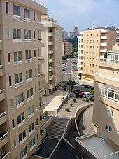 Apartment buildings in the parish of Mafamude
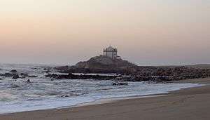 Beach in Miramar
.JPG) Metro next to El Corte Inglés
Metro next to El Corte Inglés.JPG) Soares dos Reis Square
Soares dos Reis Square Gaia at night
.jpg) Gaia
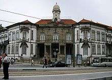
Gaia.JPG) Vila Nova de Gaia
Vila Nova de Gaia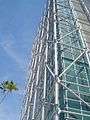 Tower Plaza Regino, Gaia
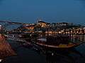 Vila Nova de Gaia
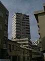 Downtown Gaia
.JPG) Vila Nova de Gaia
Vila Nova de Gaia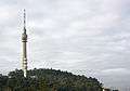 Vila Nova de Gaia TV Tower
 Gaia
Gaia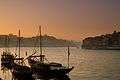 Vila Nova de Gaia
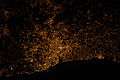 Porto Urban Area
.jpg) Vila Nova de Gaia
Vila Nova de Gaia.JPG) Gaia
Gaia
Sister City
Vila Nova de Gaia is twinned with:
![]() Concord, United States of America
Concord, United States of America
References
- ↑ Uma População que se urbaniza, Uma avaliação recente - Cidades, 2004 Archived October 6, 2014, at the Wayback Machine. Nuno Pires Soares, Instituto Geográfico Português (Geographic Institute of Portugal)
- 1 2 Direção-Geral do Território
- ↑ Instituto Nacional de Estatística
- ↑ Diário da República. "Law nr. 11-A/2013, pages 552 134-135" (pdf) (in Portuguese). Retrieved 4 August 2014.
- ↑ Instituto Nacional de Estatística (INE), Census 2011 results according to the 2013 administrative division of Portugal
External links
| Wikimedia Commons has media related to Vila Nova de Gaia. |
Parishes of Vila Nova de Gaia Municipality | ||
|---|---|---|