Ave (intermunicipal community)
Map showing the location of the Ave intermunicipal community (in red)

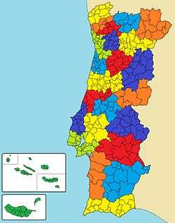
Map showing the location of the Ave subregion
The Comunidade Intermunicipal do Ave is an administrative division in Portugal. It was created in 2009.[1] It takes its name from the Ave River. The seat of the intermunicipal community is Guimarães. Ave comprises parts of the former districts of Braga and Vila Real. The population in 2011 was 425,411,[2] in an area of 1,451.31 km².[3]
Ave is also a NUTS3 subregion of Norte Region. The subregion Ave covers the same area as the intermunicipal community, but including the municipalities Santo Tirso and Trofa (Metropolitan Area of Porto), and excluding the municipalities Cabeceiras de Basto and Mondim de Basto. As of 2011, the subregion had a population of 511,737[2] and a total area of 1,246 km².[3]
Ave is bordered to the north by Cávado, to the east by Alto Tâmega, to the southeast by Douro, to the south by Tâmega e Sousa and to the southwest by the Metropolitan Area of Porto. It is a densely populated area and one of the more industrialized in the country. The main industries are the textile industry, clothing and apparel. Part of the historical region of Minho, it is centered on the historic city of Guimarães (the birthplace of the Portuguese nationalism).
Municipalities
The CIM Ave is composed of 8 municipalities:[4]
| Municipality | Population (2011)[2] | Area (km²)[3] | NUTS III region |
| Fafe | 50,633 | 219.08 | Ave |
| Guimarães | 158,124 | 240.95 | Ave |
| Póvoa de Lanhoso | 21,886 | 134.65 | Ave |
| Vieira do Minho | 12,997 | 216.44 | Ave |
| Vila Nova de Famalicão | 133,832 | 201.59 | Ave |
| Vizela | 23,736 | 24.70 | Ave |
| Cabeceiras de Basto | 16,710 | 241.82 | Tâmega |
| Mondim de Basto | 7,493 | 172.08 | Tâmega |
| Total | 425,411 | 1,451.31 | |
References
External links
Coordinates: 41°26′N 8°18′W / 41.44°N 8.30°W / 41.44; -8.30