Ashby, Minnesota
| Ashby, Minnesota | |
|---|---|
| City | |
| Motto: You'll Like Ashby | |
 Location of Ashby, Minnesota | |
| Coordinates: 46°5′27″N 95°49′1″W / 46.09083°N 95.81694°W | |
| Country | United States |
| State | Minnesota |
| County | Grant |
| Area[1] | |
| • Total | 0.59 sq mi (1.53 km2) |
| • Land | 0.55 sq mi (1.42 km2) |
| • Water | 0.04 sq mi (0.10 km2) |
| Elevation | 1,296 ft (395 m) |
| Population (2010)[2] | |
| • Total | 446 |
| • Estimate (2012[3]) | 438 |
| • Density | 810.9/sq mi (313.1/km2) |
| Time zone | Central (CST) (UTC-6) |
| • Summer (DST) | CDT (UTC-5) |
| ZIP code | 56309 |
| Area code(s) | 218 |
| FIPS code | 27-02422[4] |
| GNIS feature ID | 0639472[5] |
| Website |
www |
Ashby is a city in Grant County, Minnesota, United States. The population was 446 at the 2010 census.[6]
History
Ashby was platted in 1879, and named for Gunder Ash, an early Norwegian settler.[7] A post office has been in operation at Ashby since 1880.[8]
Geography
According to the United States Census Bureau, the city has a total area of 0.59 square miles (1.53 km2), of which 0.55 square miles (1.42 km2) is land and 0.04 square miles (0.10 km2) is water.[1]
Minnesota State Highway 78 serves as a main route in the community. Interstate 94 is nearby.
Demographics
| Historical population | |||
|---|---|---|---|
| Census | Pop. | %± | |
| 1890 | 231 | — | |
| 1900 | 279 | 20.8% | |
| 1910 | 334 | 19.7% | |
| 1920 | 388 | 16.2% | |
| 1930 | 358 | −7.7% | |
| 1940 | 384 | 7.3% | |
| 1950 | 443 | 15.4% | |
| 1960 | 426 | −3.8% | |
| 1970 | 415 | −2.6% | |
| 1980 | 486 | 17.1% | |
| 1990 | 469 | −3.5% | |
| 2000 | 472 | 0.6% | |
| 2010 | 446 | −5.5% | |
| Est. 2015 | 431 | [9] | −3.4% |
2010 census
As of the census[2] of 2010, there were 446 people, 197 households, and 132 families residing in the city. The population density was 810.9 inhabitants per square mile (313.1/km2). There were 232 housing units at an average density of 421.8 per square mile (162.9/km2). The racial makeup of the city was 95.3% White, 1.8% African American, 0.4% Asian, 0.2% from other races, and 2.2% from two or more races. Hispanic or Latino of any race were 1.1% of the population.
There were 197 households of which 26.9% had children under the age of 18 living with them, 53.3% were married couples living together, 10.2% had a female householder with no husband present, 3.6% had a male householder with no wife present, and 33.0% were non-families. 31.5% of all households were made up of individuals and 17.7% had someone living alone who was 65 years of age or older. The average household size was 2.26 and the average family size was 2.80.
The median age in the city was 43.2 years. 24.2% of residents were under the age of 18; 5.6% were between the ages of 18 and 24; 22.9% were from 25 to 44; 21.7% were from 45 to 64; and 25.6% were 65 years of age or older. The gender makeup of the city was 46.6% male and 53.4% female.
2000 census
As of the census[4] of 2000, there were 472 people, 185 households, and 113 families residing in the city. The population density was 883.9 people per square mile (343.8/km²). There were 202 housing units at an average density of 378.3 per square mile (147.2/km²). The racial makeup of the city was 97.67% White, 0.21% African American, 0.21% Native American, and 1.91% from two or more races.
There were 185 households out of which 23.8% had children under the age of 18 living with them, 51.9% were married couples living together, 7.0% had a female householder with no husband present, and 38.9% were non-families. 36.2% of all households were made up of individuals and 27.0% had someone living alone who was 65 years of age or older. The average household size was 2.25 and the average family size was 2.89.
In the city the population was spread out with 18.6% under the age of 18, 8.9% from 18 to 24, 19.3% from 25 to 44, 20.6% from 45 to 64, and 32.6% who were 65 years of age or older. The median age was 47 years. For every 100 females there were 75.5 males. For every 100 females age 18 and over, there were 73.8 males.
The median income for a household in the city was $28,333, and the median income for a family was $39,375. Males had a median income of $31,250 versus $20,104 for females. The per capita income for the city was $15,296. About 8.7% of families and 11.1% of the population were below the poverty line, including 13.1% of those under age 18 and 17.8% of those age 65 or over.
Community
Ashby's public school is K-12. Known as the "Ashby Arrows", its sports teams' colors are maroon and gold.
Each year, a local sporting group which calls itself "Coots Unlimited "—a parody of Ducks Unlimited—holds a fundraising event with proceeds to rebuild local wildlife habitat. A metal statue of a coot (a duck-like creature) was erected on the south border of the city.[11]
Ashby is on the eastern fringe of the Red River Valley, which was carved out by ancient glaciers. As a result, it is nested in gently rolling hills and amongst many good fishing lakes, most prominent among them is Pelican Lake to the direct south of the city.
Ashby was the boyhood home of author/illustrator Charles Smith-Dewey, aka Uncle Hyggly, who penned a regional favorite about a dairy farmer who filled in one Christmas for an ailing Santa Claus -- "Mr. Gonopolis And His 12 Holsteins -- A Christmas Story." The publishing company is called Wounded Coot Greetings, an apparent homage to the local sporting group.[12] Smith-Dewey is also co-founder and president of the Health Insurance Resource Center.[13]
References
- 1 2 "US Gazetteer files 2010". United States Census Bureau. Archived from the original on 2012-01-24. Retrieved 2012-11-13.
- 1 2 "American FactFinder". United States Census Bureau. Retrieved 2012-11-13.
- ↑ "Population Estimates". United States Census Bureau. Archived from the original on 2013-06-17. Retrieved 2013-05-28.
- 1 2 "American FactFinder". United States Census Bureau. Archived from the original on 2013-09-11. Retrieved 2008-01-31.
- ↑ "US Board on Geographic Names". United States Geological Survey. 2007-10-25. Retrieved 2008-01-31.
- ↑ "2010 Census Redistricting Data (Public Law 94-171) Summary File". American FactFinder. U.S. Census Bureau, 2010 Census. Archived from the original on 26 July 2011. Retrieved 23 April 2011.
- ↑ Upham, Warren (1920). Minnesota Geographic Names: Their Origin and Historic Significance. Minnesota Historical Society. p. 213.
- ↑ "Grant County". Jim Forte Postal History. Retrieved 18 June 2015.
- ↑ "Annual Estimates of the Resident Population for Incorporated Places: April 1, 2010 to July 1, 2015". Retrieved July 2, 2016.
- ↑ "Census of Population and Housing". Census.gov. Archived from the original on May 11, 2015. Retrieved June 4, 2015.
- ↑ http://www.mnhs.org/places/other/roadside/images/bcootas.html
- ↑ http://www.woundedcoot.com
- ↑ http://www.healthinsurance.org/blog/author/admin/ Healthinsurance.org writers
External links
Municipalities and communities of Grant County, Minnesota, United States | ||
|---|---|---|
| Cities | 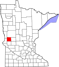 | |
| Townships | ||
| Unincorporated community | ||
| Ghost towns | ||
Coordinates: 46°05′35″N 95°49′03″W / 46.09306°N 95.81750°W