Artesian, South Dakota
| Artesian, South Dakota | |
|---|---|
| Town | |
 Location in Sanborn County and the state of South Dakota | |
| Coordinates: 44°0′27″N 97°55′24″W / 44.00750°N 97.92333°WCoordinates: 44°0′27″N 97°55′24″W / 44.00750°N 97.92333°W | |
| Country | United States |
| State | South Dakota |
| County | Sanborn |
| Incorporated | 1914[1] |
| Area[2] | |
| • Total | 0.55 sq mi (1.42 km2) |
| • Land | 0.55 sq mi (1.42 km2) |
| • Water | 0 sq mi (0 km2) |
| Elevation | 1,319 ft (402 m) |
| Population (2010)[3] | |
| • Total | 138 |
| • Estimate (2012[4]) | 136 |
| • Density | 250.9/sq mi (96.9/km2) |
| Time zone | Central (CST) (UTC-6) |
| • Summer (DST) | CDT (UTC-5) |
| ZIP code | 57314 |
| Area code(s) | 605 |
| FIPS code | 46-02380[5] |
| GNIS feature ID | 1265609[6] |
| Website | http://www.artesiansd.com/ |
Artesian is a town in Sanborn County, South Dakota, United States. The population was 138 at the 2010 census.
History
When the first settlement at Artesian was made in 1883, it was called "Diana".[7] The present name is for the artesian aquifer near the original town site.[7] A post office called Diana was established in 1883, the name was changed to Artesian City in 1887, and again to Artesian in 1889.[8]
Geography
Artesian is located at 44°0′27″N 97°55′24″W / 44.00750°N 97.92333°W (44.007512, -97.923379).[9]
According to the United States Census Bureau, the town has a total area of 0.55 square miles (1.42 km2), all of it land.[2]
Artesian has been assigned the ZIP code 57314, and the FIPS place code 02380.
Demographics
| Historical population | |||
|---|---|---|---|
| Census | Pop. | %± | |
| 1890 | 256 | — | |
| 1900 | 339 | 32.4% | |
| 1910 | 583 | 72.0% | |
| 1920 | 689 | 18.2% | |
| 1930 | 556 | −19.3% | |
| 1940 | 502 | −9.7% | |
| 1950 | 429 | −14.5% | |
| 1960 | 330 | −23.1% | |
| 1970 | 277 | −16.1% | |
| 1980 | 227 | −18.1% | |
| 1990 | 217 | −4.4% | |
| 2000 | 157 | −27.6% | |
| 2010 | 138 | −12.1% | |
| Est. 2015 | 138 | [10] | 0.0% |
| U.S. Decennial Census | |||
2010 census
As of the census[3] of 2010, there were 138 people, 73 households, and 42 families residing in the town. The population density was 250.9 inhabitants per square mile (96.9/km2). There were 96 housing units at an average density of 174.5 per square mile (67.4/km2). The racial makeup of the town was 89.9% White, 0.7% Asian, 3.6% from other races, and 5.8% from two or more races. Hispanic or Latino of any race were 5.8% of the population.
There were 73 households of which 19.2% had children under the age of 18 living with them, 39.7% were married couples living together, 11.0% had a female householder with no husband present, 6.8% had a male householder with no wife present, and 42.5% were non-families. 41.1% of all households were made up of individuals and 23.3% had someone living alone who was 65 years of age or older. The average household size was 1.89 and the average family size was 2.45.
The median age in the town was 47 years. 14.5% of residents were under the age of 18; 7.9% were between the ages of 18 and 24; 23.1% were from 25 to 44; 34.1% were from 45 to 64; and 20.3% were 65 years of age or older. The gender makeup of the town was 52.2% male and 47.8% female.
2000 census
As of the census[5] of 2000, there were 157 people, 70 households, and 42 families residing in the town. The population density was 285.7 people per square mile (110.2/km²). There were 99 housing units at an average density of 180.2 per square mile (69.5/km²). The racial makeup of the town was 100% White. Five of the people in the town call themselves Hispanic or Latino.
There were 70 households out of which 24.3% had children under the age of 18 living with them, 54.3% were married couples living together, 2.9% had a female householder with no husband present, and 38.6% were non-families. 34.3% of all households were made up of individuals and 15.7% had someone living alone who was 65 years of age or older. The average household size was 2.24 and the average family size was 2.93.
In the town the population was spread out with 19.7% under the age of 18, 8.9% from 18 to 24, 24.2% from 25 to 44, 24.2% from 45 to 64, and 22.9% who were 65 years of age or older. The median age was 43 years. For every 100 females there were 121.1 males. For every 100 females age 18 and over, there were 117.2 males.
The median income for a household in the town was $36,875, and the median income for a family was $43,750. Males had a median income of $22,500 versus $23,125 for females. The per capita income for the town was $15,392. None of the families and 5.6% of the population were living below the poverty line, including no under eighteens and 27.3% of those over 64.
References
- ↑ "SD Towns" (PDF). South Dakota State Historical Society. Archived from the original (PDF) on 10 February 2010. Retrieved 2010-02-10.
- 1 2 "US Gazetteer files 2010". United States Census Bureau. Archived from the original on 2012-01-24. Retrieved 2012-06-21.
- 1 2 "American FactFinder". United States Census Bureau. Retrieved 2012-06-21.
- ↑ "Population Estimates". United States Census Bureau. Archived from the original on 2013-06-17. Retrieved 2013-05-29.
- 1 2 "American FactFinder". United States Census Bureau. Archived from the original on 2013-09-11. Retrieved 2008-01-31.
- ↑ "US Board on Geographic Names". United States Geological Survey. 2007-10-25. Retrieved 2008-01-31.
- 1 2 Federal Writers' Project (1940). South Dakota place-names, v.1-3. University of South Dakota. p. 23.
- ↑ "Sanborn County". Jim Forte Postal History. Retrieved 22 January 2015.
- ↑ "US Gazetteer files: 2010, 2000, and 1990". United States Census Bureau. 2011-02-12. Retrieved 2011-04-23.
- ↑ "Annual Estimates of the Resident Population for Incorporated Places: April 1, 2010 to July 1, 2015". Retrieved July 2, 2016.
Municipalities and communities of Sanborn County, South Dakota, United States | ||
|---|---|---|
| City | 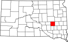 | |
| Towns | ||
| Township | ||
| CDP | ||
| Other unincorporated community | ||