Arrondissement of Sélestat-Erstein
| Sélestat-Erstein | |
|---|---|
| Arrondissement of France | |
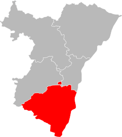 Location of Sélestat-Erstein in Bas-Rhin | |
| Country | France |
| Region | Grand Est |
| Department | Bas-Rhin |
| Communes | 101 |
| Subprefecture | Sélestat |
| Area¹ | |
| • Total | 981 km2 (379 sq mi) |
| Population (2013) | |
| • Total | 154,943 |
| • Density | 160/km2 (410/sq mi) |
| ¹ French Land Register data, which exclude lakes, ponds, and glaciers larger than 1 km² as well as the estuaries of rivers. | |
| Part of the series on |
| Alsace |
|---|
.svg.png) Rot un Wiss, flag of Alsace since 11th century. |
|
(including Lorraine) |
|
|
Alsace in the EU |
|
Related topics |
|
The arrondissement of Sélestat-Erstein is an arrondissement of France in the Bas-Rhin department in the Grand Est region. It has 101 communes.
Composition
Cantons
The cantons of the arrondissement of Sélestat-Erstein are:
- Erstein
- Molsheim (partly)
- Mutzig (partly)
- Obernai
- Sélestat
Communes
The communes of the arrondissement of Sélestat-Erstein, and their INSEE codes, are:
| 1. Albé (67003) | 2. Andlau (67010) | 3. Artolsheim (67011) | 4. Baldenheim (67019) |
| 5. Barr (67021) | 6. Bassemberg (67022) | 7. Benfeld (67028) | 8. Bernardswiller (67031) |
| 9. Bernardvillé (67032) | 10. Bindernheim (67040) | 11. Blienschwiller (67051) | 12. Bœsenbiesen (67053) |
| 13. Bolsenheim (67054) | 14. Boofzheim (67055) | 15. Bootzheim (67056) | 16. Bourgheim (67060) |
| 17. Breitenau (67062) | 18. Breitenbach (67063) | 19. Châtenois (67073) | 20. Dambach-la-Ville (67084) |
| 21. Daubensand (67086) | 22. Diebolsheim (67090) | 23. Dieffenbach-au-Val (67092) | 24. Dieffenthal (67094) |
| 25. Ebersheim (67115) | 26. Ebersmunster (67116) | 27. Eichhoffen (67120) | 28. Elsenheim (67121) |
| 29. Epfig (67125) | 30. Erstein (67130) | 31. Fouchy (67143) | 32. Friesenheim (67146) |
| 33. Gerstheim (67154) | 34. Gertwiller (67155) | 35. Goxwiller (67164) | 36. Heidolsheim (67187) |
| 37. Heiligenstein (67189) | 38. Herbsheim (67192) | 39. Hessenheim (67195) | 40. Hilsenheim (67196) |
| 41. Hindisheim (67197) | 42. Hipsheim (67200) | 43. Huttenheim (67216) | 44. Ichtratzheim (67217) |
| 45. Innenheim (67223) | 46. Itterswiller (67227) | 47. Kertzfeld (67233) | 48. Kintzheim (67239) |
| 49. Kogenheim (67246) | 50. Krautergersheim (67248) | 51. La Vancelle (67505) | 52. Lalaye (67255) |
| 53. Le Hohwald (67210) | 54. Limersheim (67266) | 55. Mackenheim (67277) | 56. Maisonsgoutte (67280) |
| 57. Marckolsheim (67281) | 58. Matzenheim (67285) | 59. Meistratzheim (67286) | 60. Mittelbergheim (67295) |
| 61. Mussig (67310) | 62. Muttersholtz (67311) | 63. Neubois (67317) | 64. Neuve-Église (67320) |
| 65. Niedernai (67329) | 66. Nordhouse (67336) | 67. Nothalten (67337) | 68. Obenheim (67338) |
| 69. Obernai (67348) | 70. Ohnenheim (67360) | 71. Orschwiller (67362) | 72. Osthouse (67364) |
| 73. Reichsfeld (67387) | 74. Rhinau (67397) | 75. Richtolsheim (67398) | 76. Rossfeld (67412) |
| 77. Saasenheim (67422) | 78. Saint-Martin (67426) | 79. Saint-Maurice (67427) | 80. Saint-Pierre (67429) |
| 81. Saint-Pierre-Bois (67430) | 82. Sand (67433) | 83. Schaeffersheim (67438) | 84. Scherwiller (67445) |
| 85. Schœnau (67453) | 86. Schwobsheim (67461) | 87. Sermersheim (67464) | 88. Steige (67477) |
| 89. Stotzheim (67481) | 90. Sundhouse (67486) | 91. Sélestat (67462) | 92. Thanvillé (67490) |
| 93. Triembach-au-Val (67493) | 94. Urbeis (67499) | 95. Uttenheim (67501) | 96. Valff (67504) |
| 97. Villé (67507) | 98. Westhouse (67526) | 99. Witternheim (67545) | 100. Wittisheim (67547) |
| 101. Zellwiller (67557) |
External links
Coordinates: 48°15′N 7°27′E / 48.250°N 7.450°E
This article is issued from Wikipedia - version of the 11/18/2016. The text is available under the Creative Commons Attribution/Share Alike but additional terms may apply for the media files.