Armstrong–Jackman Border Crossing
| Jackman-Armstrong Border Crossing | |
|---|---|
|
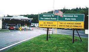
Jackman Maine border station, as seen in April, 2000 | |
| Location | |
| Country | United States; Canada |
| Location |
US Port: 2614 Main Street, Sandy Bay Township, ME 04945 Canadian Port: 999 Highway 173, Saint-Théophile, Quebec G0M 2A0 |
| Coordinates | 45°48′21″N 70°23′48″W / 45.805754°N 70.396743°W |
| Details | |
| Opened | 1917 |
| US Phone | (207) 668-3711 |
| Canadian Phone | (418) 597-3395 |
| Hours |
US side: Open 24 Hours Canadian Side: Open 24 Hours |
|
Website http://www.cbp.gov/contact/ports/jackman | |
The Armstrong–Jackman Border Crossing is a border crossing on the Canada–United States border, located southeast of Saint-Théophile, Quebec and northwest of Jackman, Maine. The border crossing is the northern terminus of U.S. Route 201, which also has the road name Old Canada Road north of Jackman, and the southern terminus of Quebec Route 173, also known as Route-du-Président-Kennedy.
Jackman, Maine was named after Captain James Jackman who was hired by the State of Maine in the 1830s to build the road connecting the United States with Canada.[1] During prohibition, a line house existed on the international boundary at this crossing. Customs operations of the US and Canada both operated out of many facilities over the years. Canada most recently rebuilt its border station in 2005. On the U.S. side, construction began in March 2008 on a new inspection station at the border. The $26 million project was completed in August 2010.
See also
References
- ↑ "History of the Moose River Valley". US Customs and Border Protection. Retrieved 2014-03-25.
Coordinates: 45°48′20.9″N 70°23′24.9″W / 45.805806°N 70.390250°W