Armour, South Dakota
| Armour, South Dakota | |
|---|---|
| City | |
|
The Douglas County courthouse in Armour, South Dakota. | |
 Location in Douglas County and the state of South Dakota | |
| Coordinates: 43°19′10″N 98°20′50″W / 43.31944°N 98.34722°WCoordinates: 43°19′10″N 98°20′50″W / 43.31944°N 98.34722°W | |
| Country | United States |
| State | South Dakota |
| County | Douglas |
| Incorporated | 1904[1] |
| Area[2] | |
| • Total | 0.95 sq mi (2.46 km2) |
| • Land | 0.94 sq mi (2.43 km2) |
| • Water | 0.01 sq mi (0.03 km2) |
| Elevation | 1,529 ft (466 m) |
| Population (2010)[3] | |
| • Total | 699 |
| • Estimate (2015)[4] | 686 |
| • Density | 743.6/sq mi (287.1/km2) |
| Time zone | Central (CST) (UTC-6) |
| • Summer (DST) | CDT (UTC-5) |
| ZIP code | 57313 |
| Area code(s) | 605 |
| FIPS code | 46-02260[5] |
| GNIS feature ID | 1253684[6] |


Armour is a city in and the county seat of Douglas County, South Dakota, United States.[7] The population was 699 at the 2010 census.
History
Armour was founded in 1885. The city was named for Philip D. Armour, who was founder of Armour and Company, a meat packing company.[8] Contrary to popular belief, Armour was never home to a meat packing plant; the town was so named because Mr. Armour was also the chairman of the railroad that went through Armour and donated a bell to the local congregational church. The athletic teams of Armour High School were formerly known as the "Packers" in reference to the well known packing company, although today the high school plays its sports jointly with Tripp-Delmont High School as the "Tripp-Delmont/Armour Nighthawks."[9]
Geography
Armour is located at 43°19′10″N 98°20′50″W / 43.31944°N 98.34722°W (43.319410, -98.347342).[10]
According to the United States Census Bureau, the city has a total area of 0.95 square miles (2.46 km2), of which, 0.94 square miles (2.43 km2) is land and 0.01 square miles (0.03 km2) is water.[2]
Armour has been assigned the ZIP code 57313, and the FIPS place code 02260.
Demographics
| Historical population | |||
|---|---|---|---|
| Census | Pop. | %± | |
| 1890 | 482 | — | |
| 1900 | 912 | 89.2% | |
| 1910 | 968 | 6.1% | |
| 1920 | 1,045 | 8.0% | |
| 1930 | 1,009 | −3.4% | |
| 1940 | 1,013 | 0.4% | |
| 1950 | 900 | −11.2% | |
| 1960 | 875 | −2.8% | |
| 1970 | 925 | 5.7% | |
| 1980 | 819 | −11.5% | |
| 1990 | 854 | 4.3% | |
| 2000 | 782 | −8.4% | |
| 2010 | 699 | −10.6% | |
| Est. 2015 | 686 | [11] | −1.9% |
| U.S. Decennial Census[12] 2015 Estimate[4] | |||
2010 census
As of the census[3] of 2010, there were 699 people, 325 households, and 181 families residing in the city. The population density was 743.6 inhabitants per square mile (287.1/km2). There were 378 housing units at an average density of 402.1 per square mile (155.3/km2). The racial makeup of the city was 95.7% White, 2.7% Native American, 0.3% Asian, and 1.3% from two or more races. Hispanic or Latino of any race were 0.6% of the population.
There were 325 households of which 20.6% had children under the age of 18 living with them, 49.5% were married couples living together, 3.7% had a female householder with no husband present, 2.5% had a male householder with no wife present, and 44.3% were non-families. 41.5% of all households were made up of individuals and 28% had someone living alone who was 65 years of age or older. The average household size was 2.02 and the average family size was 2.72.
The median age in the city was 52.4 years. 18.5% of residents were under the age of 18; 4% were between the ages of 18 and 24; 15.5% were from 25 to 44; 28.2% were from 45 to 64; and 33.8% were 65 years of age or older. The gender makeup of the city was 46.1% male and 53.9% female.
2000 census
As of the census[5] of 2000, there were 782 people, 342 households, and 215 families residing in the city. The population density was 828.9 people per square mile (321.2/km²). There were 377 housing units at an average density of 399.6 per square mile (154.9/km²). The racial makeup of the city was 98.08% White, 0.77% Native American, 0.13% from other races, and 1.02% from two or more races. Hispanic or Latino of any race were 0.64% of the population.
There were 342 households out of which 26.3% had children under the age of 18 living with them, 56.4% were married couples living together, 5.0% had a female householder with no husband present, and 37.1% were non-families. 35.7% of all households were made up of individuals and 21.3% had someone living alone who was 65 years of age or older. The average household size was 2.16 and the average family size was 2.79.
In the city the population was spread out with 22.0% under the age of 18, 3.6% from 18 to 24, 21.4% from 25 to 44, 22.4% from 45 to 64, and 30.7% who were 65 years of age or older. The median age was 48 years. For every 100 females there were 87.1 males. For every 100 females age 18 and over, there were 79.4 males.
The median income for a household in the city was $28,438, and the median income for a family was $41,797. Males had a median income of $27,500 versus $18,897 for females. The per capita income for the city was $15,829. About 8.8% of families and 12.6% of the population were below the poverty line, including 18.4% of those under age 18 and 12.4% of those age 65 or over.
Climate
This climatic region is typified by large seasonal temperature differences, with warm to hot (and often humid) summers and cold (sometimes severely cold) winters. According to the Köppen Climate Classification system, Armour has a humid continental climate, abbreviated "Dfa" on climate maps.[13]
| Climate data for Armour, South Dakota | |||||||||||||
|---|---|---|---|---|---|---|---|---|---|---|---|---|---|
| Month | Jan | Feb | Mar | Apr | May | Jun | Jul | Aug | Sep | Oct | Nov | Dec | Year |
| Average high °C (°F) | −1 (30) |
2 (35) |
8 (46) |
17 (62) |
23 (73) |
28 (83) |
32 (90) |
31 (88) |
26 (78) |
19 (66) |
8 (47) |
1 (34) |
16 (61) |
| Average low °C (°F) | −14 (7) |
−11 (12) |
−6 (22) |
2 (35) |
8 (47) |
14 (57) |
17 (62) |
16 (60) |
10 (50) |
3 (38) |
−4 (24) |
−11 (13) |
2 (35) |
| Average precipitation mm (inches) | 15 (0.6) |
18 (0.7) |
36 (1.4) |
61 (2.4) |
81 (3.2) |
99 (3.9) |
71 (2.8) |
71 (2.8) |
56 (2.2) |
38 (1.5) |
23 (0.9) |
15 (0.6) |
580 (23) |
| Source: Weatherbase [14] | |||||||||||||
See also
- Peirson M. Hall, federal judge born in Armour
- Philip Danforth Armour
- Edwin S. Johnson, United States Senator buried in Armour
References
- ↑ "SD Towns" (PDF). South Dakota State Historical Society. Archived from the original (PDF) on 10 February 2010. Retrieved 2010-02-10.
- 1 2 "US Gazetteer files 2010". United States Census Bureau. Archived from the original on 2012-01-24. Retrieved 2012-06-21.
- 1 2 "American FactFinder". United States Census Bureau. Retrieved 2012-06-21.
- 1 2 "Population Estimates". United States Census Bureau. Retrieved June 12, 2016.
- 1 2 "American FactFinder". United States Census Bureau. Archived from the original on 2013-09-11. Retrieved 2008-01-31.
- ↑ "US Board on Geographic Names". United States Geological Survey. 2007-10-25. Retrieved 2008-01-31.
- ↑ "Find a County". National Association of Counties. Archived from the original on 2011-05-31. Retrieved 2011-06-07.
- ↑ Federal Writers' Project (1940). South Dakota place-names, v.1-3. University of South Dakota. p. 23.
- ↑ "Tripp Delmont Armour Nighthawks". Retrieved 2008-02-26.
- ↑ "US Gazetteer files: 2010, 2000, and 1990". United States Census Bureau. 2011-02-12. Retrieved 2011-04-23.
- ↑ "Annual Estimates of the Resident Population for Incorporated Places: April 1, 2010 to July 1, 2015". Retrieved July 2, 2016.
- ↑ United States Census Bureau. "Census of Population and Housing". Archived from the original on May 11, 2015. Retrieved June 12, 2016.
- ↑ Climate Summary for Armour, South Dakota
- ↑ "Weatherbase.com". Weatherbase. 2013. Retrieved on October 13, 2013.
Municipalities and communities of Douglas County, South Dakota, United States | ||
|---|---|---|
| Cities | 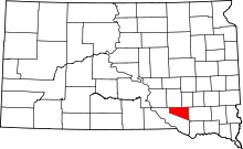 | |
| CDPs | ||