Arkansas Highway 80
| ||||
|---|---|---|---|---|
 | ||||
| Route information | ||||
| Maintained by AHTD | ||||
| Length: | 49.87 mi[1] (80.26 km) | |||
| Major junctions | ||||
| West end: |
| |||
| East end: |
| |||
| Location | ||||
| Counties: | Scott, Yell | |||
| Highway system | ||||
| ||||

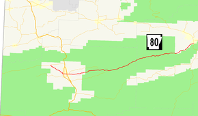
Highway 80 (AR 80, Ark. 80, and Hwy. 80) is an east–west state highway in the Ouachita Mountains. The route of 49.87 miles (80.26 km) begins at Highway 28 at Hon and runs east to Arkansas Highway 27 in Danville. The route is maintained by the Arkansas State Highway and Transportation Department (AHTD).
Route description
The highway begins at Highway 28 in western Scott County within the Ouachita Mountains. Highway 28 runs southeast to Waldron, where it has a junction with US Highway 71 (US 71) on the city's west side. After this intersection, Highway 80 continues due east as a section line road and major east–west route in the city. An intersection with US Highway 71 Business (US 71B) just south of downtown Waldron gives access to the primary commercial areas of Waldron. Continuing east, the highway serves as the western terminus for Highway 248 just south of the Poteau River near the eastern city limits of Waldron. Just east of this junction, Highway 80 passes the Poteau Work Center owned and operated by the United States Forest Service. East of Waldron, Highway 80 enters the Ouachita National Forest, a dense pine and cypress forest. The route winds through the forest, serving as the eastern terminus of Highway 250 before entering Yell County.[2]
Highway 80 continues through the National Forest to Waltreak, where it passes the Mitchell House listed on the National Register of Historic Places.[3] It continues east through Chalybeate Springs before leaving the Forest near Macedonia. It curves northeast and runs along Dutch Creek as the highway enters Danville. Highway 80 intersects Highway 27 in southern Danville, where it terminates.[4]
Major intersections
| County | Location | mi[1] | km | Destinations | Notes |
|---|---|---|---|---|---|
| Scott | Hon | 0.00 | 0.00 | Western terminus | |
| Waldron | 5.34 | 8.59 | |||
| 6.55 | 10.54 | ||||
| 7.37 | 11.86 | Western terminus of AR 248 | |||
| | 19.96 | 32.12 | Eastern terminus of AR 250 | ||
| Yell | Danville | 49.87 | 80.26 | Eastern terminus | |
| 1.000 mi = 1.609 km; 1.000 km = 0.621 mi | |||||
History
Former route
| |
|---|---|
| Location: | Washington County |
| Length: | 10.3 mi (16.6 km) |
State Road 80 (AR 80, Ark. 80, and Hwy. 80) was a state highway of 10.3 miles (16.6 km) in Washington County. The route began at the Oklahoma state line and ran east to State Road 45 east of Lincoln.
- Major intersections
The entire route is in Washington County.
| Location | mi | km | Destinations | Notes | |
|---|---|---|---|---|---|
| | 0.0 | 0.0 | Oklahoma state line | Western terminus | |
| Summers | 2.5 | 4.0 | |||
| | 10.3 | 16.6 | Eastern terminus | ||
| 1.000 mi = 1.609 km; 1.000 km = 0.621 mi | |||||
See also
-
 Arkansas portal
 -
 U.S. Roads portal
References
- 1 2 System Information and Research Division (2014). "Arkansas Road Log Database" (MDB). Arkansas State Highway and Transportation Department. Retrieved March 27, 2016.
- ↑ Transportation Planning & Policy Division (October 9, 2013). General Highway Map, Scott County, Arkansas (PDF) (Map). 1:62500. Little Rock: Arkansas State Highway and Transportation Department. Retrieved July 30, 2016.
- ↑ National Park Service (July 9, 2010). "National Register Information System". National Register of Historic Places. National Park Service.
- ↑ Transportation Planning & Policy Division (April 3, 2014). General Highway Map, Yell County, Arkansas (PDF) (Map). 1:62500. Little Rock: Arkansas State Highway and Transportation Department. Retrieved July 24, 2016.